Changeset: 34285022
Cavite boundary
Closed by Gero
Tags
| created_by | JOSM/1.5 (5990 de) |
|---|
Discussion
-
Comment from seav
It seems you placed Carabao Island and Limbones Island in Maragondon, and El Fraile Island in Ternate. But these are part of the Corregidor group and are therefore part of Cavite City.
-
Comment from Gero
There seem to be different opinions.
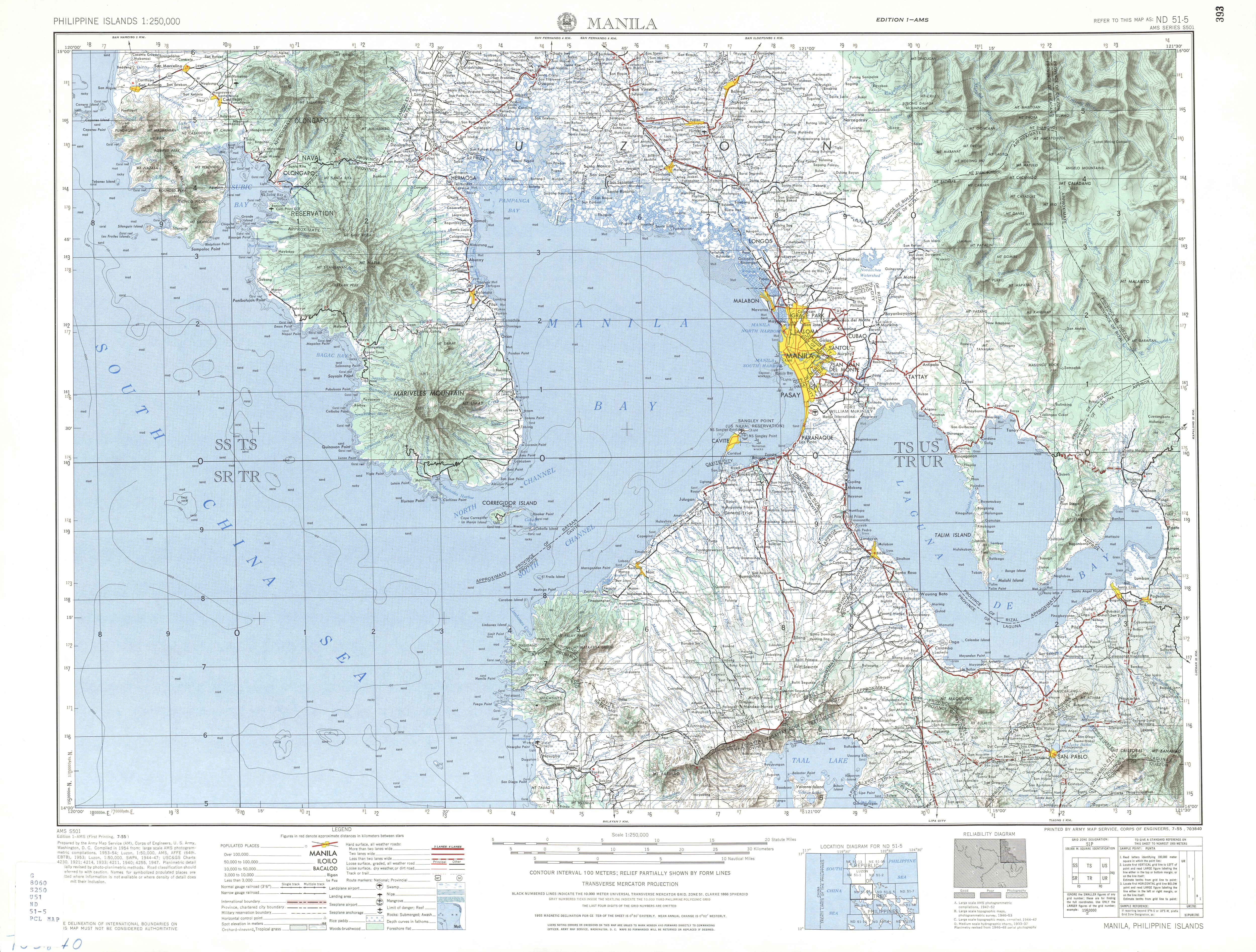
At least this map of the Cavite government (http://www.cavite.gov.ph/home/images/cavite%20maps/legis%20dist.jpg) claims Carabao in District VII, but has no claim for Limbones.
The older AMS map (http://www.lib.utexas.edu/maps/ams/philippines/txu-oclc-6539351-nd51-5-450.jpg) even has Corregidor and Caballo in the province of Bataan, wich inicates there is no administrative connection of all the islands.
But, if you have definitive proof otherwise, feel free to change the municipal borders. -
Comment from seav
I'll try to do some research but I agree that there's conflicting information. (Bataan *did* have jurisdiction over Corregidor at some point in the past.) However, I can't easily do the buffer thing you're doing as well as the equidistant lines.
- 372597858, v1
- 372597861, v1
- 372597862, v1
- 372597865, v1
- 372597866, v1
- 372597868, v1
- 372597870, v1
- 372597871, v1
- 372597873, v1
- 372597874, v1
- 372597875, v1
- 372597876, v1
- 372597877, v1
- 372597878, v1
- 372597879, v1
- 372597880, v1
- 372597881, v1
- 372597882, v1
- 372597883, v1
- 372597884, v1
Relations (15)
- Calabarzon (1552120), v89
- Central Luzon (1552195), v105
- Bataan (1504680), v34
- Batangas (1504427), v41
- Cavite (1503544), v58
- Bacoor (122139), v88
- Cavite City (122129), v31
- Kawit (1485548), v20
- Maragondon (1491420), v11
- Naic (1491193), v12
- Noveleta (1486524), v21
- Rosario (1486321), v15
- Tanza (1491111), v12
- Ternate (1491333), v18
- Luzon Island (4250623), v33
Welcome to OpenStreetMap!
OpenStreetMap is a map of the world, created by people like you and free to use under an open license.
Hosting is supported by Fastly, OSMF corporate members, and other partners.
| https://openstreetmap.org/copyright | https://openstreetmap.org |
| Copyright OpenStreetMap and contributors, under an open license | |