Loading...
Node History: עינת (278477062)
Version #11
remove nonsense tag (accuracy=minutes)
- Edited by traveleditor
- Changeset #134664911
- Location: 32.0827765, 34.9394305
Tags
| alt_name:en | Einat |
|---|---|
| description | עֵינַת הוא קיבוץ באזור השרון השייך למועצה אזורית דרום השרון. |
| description:he | עֵינַת הוא קיבוץ באזור השרון השייך למועצה אזורית דרום השרון. |
| gns_ref | -779678 |
| image | https://upload.wikimedia.org/wikipedia/he/1/1f/%D7%A2%D7%99%D7%A0%D7%AA_1390.JPG |
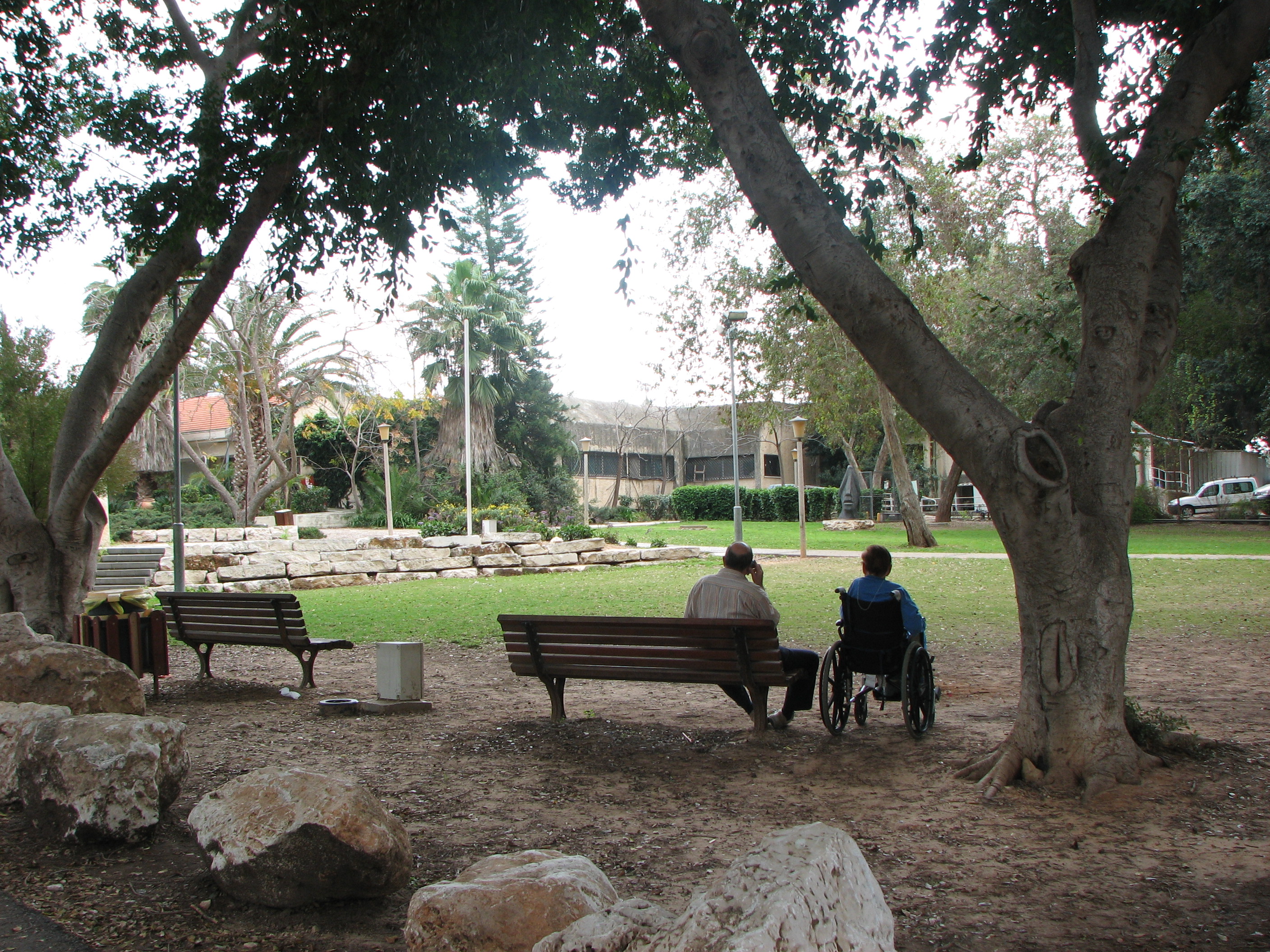
| image1 | https://upload.wikimedia.org/wikipedia/commons/1/10/Einat_inside_the_Kibutz.jpg |
| name | עינת |
| name:ar | عينات |
| name:en | Einat |
| name:fr | Einat |
| name:he | עינת |
| name:ru | Эйнат |
| name:ur | عینت |
| place | village |
| source | GEOnet Names Server (gns) |
| wikidata | Q2920136 |
| wikipedia | he:עינת |
| wikipedia:en | Einat |
| wikipedia:he | עינת |
Version #10
add name:ru to villages in IL
- Edited by woodwayfarer
- Changeset #133481922
- Location: 32.0827765, 34.9394305
Tags
| accuracy | minutes |
|---|---|
| alt_name:en | Einat |
| description | עֵינַת הוא קיבוץ באזור השרון השייך למועצה אזורית דרום השרון. |
| description:he | עֵינַת הוא קיבוץ באזור השרון השייך למועצה אזורית דרום השרון. |
| gns_ref | -779678 |
| image | https://upload.wikimedia.org/wikipedia/he/1/1f/%D7%A2%D7%99%D7%A0%D7%AA_1390.JPG |
| image1 | https://upload.wikimedia.org/wikipedia/commons/1/10/Einat_inside_the_Kibutz.jpg |
| name | עינת |
| name:ar | عينات |
| name:en | Einat |
| name:fr | Einat |
| name:he | עינת |
| name:ru | Эйнат |
| name:ur | عینت |
| place | village |
| source | GEOnet Names Server (gns) |
| wikidata | Q2920136 |
| wikipedia | he:עינת |
| wikipedia:en | Einat |
| wikipedia:he | עינת |
Version #9
Localised name into Urdu
- Edited by Jacksonville
- Changeset #118516758
- Location: 32.0827765, 34.9394305
Tags
| accuracy | minutes |
|---|---|
| alt_name:en | Einat |
| description | עֵינַת הוא קיבוץ באזור השרון השייך למועצה אזורית דרום השרון. |
| description:he | עֵינַת הוא קיבוץ באזור השרון השייך למועצה אזורית דרום השרון. |
| gns_ref | -779678 |
| image | https://upload.wikimedia.org/wikipedia/he/1/1f/%D7%A2%D7%99%D7%A0%D7%AA_1390.JPG |
| image1 | https://upload.wikimedia.org/wikipedia/commons/1/10/Einat_inside_the_Kibutz.jpg |
| name | עינת |
| name:ar | عينات |
| name:en | Einat |
| name:fr | Einat |
| name:he | עינת |
| name:ur | عینت |
| place | village |
| source | GEOnet Names Server (gns) |
| wikidata | Q2920136 |
| wikipedia | he:עינת |
| wikipedia:en | Einat |
| wikipedia:he | עינת |
Version #8
Villages - OSM Israel
- Edited by deleted
- Changeset #101524452
- Location: 32.0827765, 34.9394305
Tags
| accuracy | minutes |
|---|---|
| alt_name:en | Einat |
| description | עֵינַת הוא קיבוץ באזור השרון השייך למועצה אזורית דרום השרון. |
| description:he | עֵינַת הוא קיבוץ באזור השרון השייך למועצה אזורית דרום השרון. |
| gns_ref | -779678 |
| image | https://upload.wikimedia.org/wikipedia/he/1/1f/%D7%A2%D7%99%D7%A0%D7%AA_1390.JPG |
| image1 | https://upload.wikimedia.org/wikipedia/commons/1/10/Einat_inside_the_Kibutz.jpg |
| name | עינת |
| name:ar | عينات |
| name:en | Einat |
| name:fr | Einat |
| name:he | עינת |
| place | village |
| source | GEOnet Names Server (gns) |
| wikidata | Q2920136 |
| wikipedia | he:עינת |
| wikipedia:en | Einat |
| wikipedia:he | עינת |
Version #7
tag updates, minor edits, Arabic name updates of villages and localities
- Edited by NFZANMNIM
- Changeset #96559757
- Location: 32.0827765, 34.9394305
Tags
| accuracy | minutes |
|---|---|
| alt_name:en | Einat |
| description | עֵינַת הוא קיבוץ באזור השרון השייך למועצה אזורית דרום השרון. |
| description:he | עֵינַת הוא קיבוץ באזור השרון השייך למועצה אזורית דרום השרון. |
| gns_ref | -779678 |
| image | https://upload.wikimedia.org/wikipedia/he/1/1f/%D7%A2%D7%99%D7%A0%D7%AA_1390.JPG |
| image1 | https://upload.wikimedia.org/wikipedia/commons/1/10/Einat_inside_the_Kibutz.jpg |
| name | עינת |
| name:ar | عينات |
| name:en | Einat |
| name:he | עינת |
| place | village |
| source | GEOnet Names Server (gns) |
| wikidata | Q2920136 |
| wikipedia | he:עינת |
| wikipedia:en | Einat |
| wikipedia:he | עינת |
Version #6
קישור לויקינתונים
- Edited by Guy A
- Changeset #91376461
- Location: 32.0827765, 34.9394305
Tags
| accuracy | minutes |
|---|---|
| description | עֵינַת הוא קיבוץ באזור השרון השייך למועצה אזורית דרום השרון. |
| description:he | עֵינַת הוא קיבוץ באזור השרון השייך למועצה אזורית דרום השרון. |
| gns_ref | -779678 |
| image | https://upload.wikimedia.org/wikipedia/he/1/1f/%D7%A2%D7%99%D7%A0%D7%AA_1390.JPG |
| image1 | https://upload.wikimedia.org/wikipedia/commons/1/10/Einat_inside_the_Kibutz.jpg |
| name | עינת |
| name:en | Einat |
| name:en1 | Einat |
| name:he | עינת |
| place | village |
| source | GEOnet Names Server (gns) |
| wikidata | Q2920136 |
| wikipedia | he:עינת |
| wikipedia:en | Einat |
| wikipedia:he | עינת |
Version #5
Updated עינת using IsraelHiking.osm.org.il
- Edited by avi mazor
- Changeset #87994658
- Location: 32.0827765, 34.9394305
Tags
| accuracy | minutes |
|---|---|
| description | עֵינַת הוא קיבוץ באזור השרון השייך למועצה אזורית דרום השרון. |
| description:he | עֵינַת הוא קיבוץ באזור השרון השייך למועצה אזורית דרום השרון. |
| gns_ref | -779678 |
| image | https://upload.wikimedia.org/wikipedia/he/1/1f/%D7%A2%D7%99%D7%A0%D7%AA_1390.JPG |
| image1 | https://upload.wikimedia.org/wikipedia/commons/1/10/Einat_inside_the_Kibutz.jpg |
| name | עינת |
| name:en | Einat |
| name:en1 | Einat |
| name:he | עינת |
| place | village |
| source | GEOnet Names Server (gns) |
| wikipedia | he:עינת |
| wikipedia:en | Einat |
| wikipedia:he | עינת |
Welcome to OpenStreetMap!
OpenStreetMap is a map of the world, created by people like you and free to use under an open license.
Hosting is supported by Fastly, OSMF corporate members, and other partners.
| https://openstreetmap.org/copyright | https://openstreetmap.org |
| Copyright OpenStreetMap and contributors, under an open license | |