OpenStreetMap

Abbe98's Diary

Recent diary entries

CLC06 Import Cleanup Part Two

Posted by Abbe98 on 6 September 2015 in English.

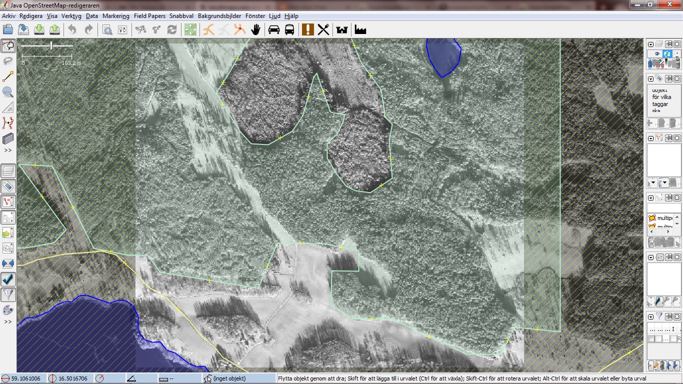
In January I proposed cleaning up a lot of imported CLC06 data manually to preserve the OSM ecosystem. Mappers had a hard time working with the large multipolygons and tools such as Tilemill/Mapbox Studio/iD all had rendering issues. Because of those issues the multipolygons become even more broken by mappers trying to handle them.

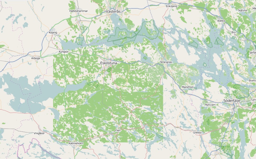
The two main multipolygons had areas about 80x120KM. Overpass image over the multipolygons.

Removed

Today I removed the last major imported multipolygon(the east one). The first one I removed all way back in January, then I spend about a month mapping all the forest back from scratch. I moved on to the next multipolygon and ran into ±5.0 × 10−324 to ±1.7 × 10308 errors and moved on to do other things.

I learned some more powerful Overpass queries and earlier this Sunday morning I pulled the trigger on the second multipolygon, done in less then five minutes. I brutally smashed some “smaller” low quality CLC06 multipolygons into nothing.

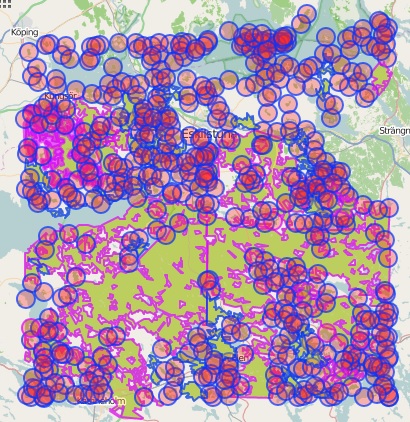
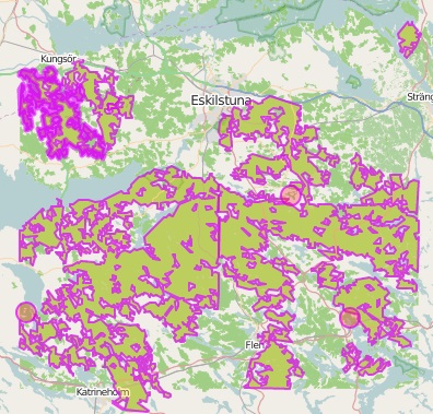
Imported CLC06 multipolygons, currently:

overpass screenshot

Ahead

OpenStreetMap lost tons of data as a result of my work, still I believe that the lose of bad data allow OSM to faster gain high quality data. I mentioned earlier I mapped most of the forest from the first multipolygon back in smaller pieces and with higher quality. Mapping it all back will take time but the forest data will end up being usable.

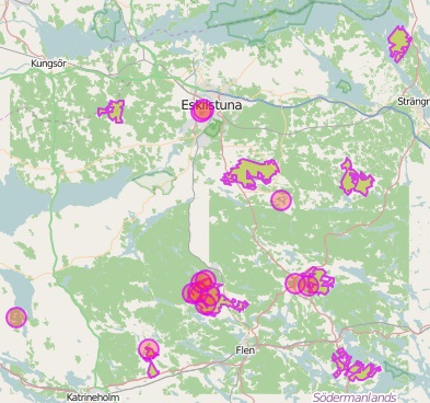
All the CLC06 relations and ways:

overpass screenshot

As shown in the image above all easy edible such as small not broken multipolygons and areas is still in there, progressive updates of those objects will eventually make the underlying low quality import obsolete.

Location: Hillersta, Katrineholms kommun, Södermanland County, Sweden

CLC06 Import Cleanup

Posted by Abbe98 on 5 January 2015 in English.

When I first got involved in OpenStreetMap all my mapping was done in the iD editor, a great user experience for new users easy to work with and tagging made easy. My first experience with iD and OSM was terrible. It was because of a old low quality forest import that covers a huge area, shown below.

OSM screenshot

Most of the import is two massive multipolygons with tons of relations. In iD it was impossible to merge other areas into the multipolygons and the forests had to be heavily remapped. The result of other mappers ways to deal deal with this has lead to two massive multipolygons with broken relations, resulting in rendering issues. First image below shows the quality of the import, the second shows a rendering issue in iD as a result of broken relations(Not related to the reverse inner bug).

JSOM screenshot.

rendering issue in iD.

Below is two screenshots from Overpass Turbo, showing how the imported data looks like in the OSM database. The first image shows both ways and relations, the second just shows relations(multipolygons).

Ways and relations.

Relations

The imported multipolygons has become a issue to the OSM ecosystem. It makes it hard for developers and designers to use the data because applications such as Tilemill and Mapbox Studio having rendering issues with the data. It becomes a issue for new mappers that has to remap major areas(in iD this means dragging nodes), that can’t merge smaller areas such as lakes and has to deal with relations.

I’m looking into solutions for splitting the two major multipolygons into pieces along major roads(they should be it anyway) or in a worst case scenario delete them. If anyone has a idea about how we should deal with this please share your knowledge.

There is other imports like this one in Sweden some of them also from EEA Corine Land Cover 06(Link to latest version of the dataset) but I haven’t looked into them as much. I think that we need forest imports at least here but we need to be able to work with them from or usual tools such as JSOM and iD.

Any thoughts?

Link to related changesets

Location: Hillersta, Katrineholms kommun, Södermanland County, Sweden

Nyköping status completed!

Posted by Abbe98 on 7 December 2014 in English.

This post was first published 26th October 2014 at my blog.

Untill today Nyköping has been having the status of “decent”. The list of cities in Sweden and their status can be found on the Wiki(WikiProject Sweden/Cities). After many hours of mapping yesterday, I changed the status to “completed”(for car navigation). The description of the completed status states “All public roads should be mapped. Roads should be tagged with name and driving restrictions should be fully mapped.”.

I decided when I saw the status table at the wiki yesterday that the task for the weekend should be to make sure that Nyköping could be given the status completed. I saw it as a easy task as we have been spending a loot of time on mapping buildings downtown but I did knew that some roads was missing names so I used the “QA” tool to check for roads without names. I think I added about 70 missing names, much more then I had thought of. I also discovered that in the eastern part of Nyköping there was black areas where roads were missing. The areas had no aerial imagery. I went to sleep late that night, mapping about 30 new roads without aerial imagery. I think the result become as good as it can be anyway.

iD is our main editor and it's available under WTFPL.

Location: Marieberg, Nyköping, Nyköpings kommun, Södermanland County, 611 39, Sweden