DougPeterson's Diary Comments
Diary Comments added by DougPeterson
| Post | When | Comment |
|---|---|---|
| Update on Using Benchmarks for Imagery Offsets | Thanks for the help. I have created a user wiki page along with an imagery shifts page. I have then added a link to my profile so it is not any less convenient than getting to My Diary entries. |
|
| Update on Using Benchmarks for Imagery Offsets | I am not sure what a My Diary entry would be used for then. Maybe it is not a good title if that is the case. In this context it was adding a little more commentary on a prior personal entry and prior comment, granted it was mostly the rewritten comment made more convenient for me to find. As well, I am not sure what is being referred to as personal OSM wiki page. |
|
| Using Benchmarks for Imagery Offsets | I thought I would document the information I used in creating the survey point and offsets for my future reference. Add Node using coordinates from NGS Datasheet: man_made=survey_point name=Benchmark PID AA6770 Designation 120 20 note=Used for creating offsets on Bing and USGS. N 42° 24’ 48.14568” W 83° 18’ 55.41223” Add imagery bookmarks: Bing - Benchmark PID AA6770 Designation 120 20 USGS - Benchmark PID AA6770 Designation 120 20 Upload imagery offsets: Bing imagery offset based on Benchmark PID AA6770 Designation 120 20 located at Six Mile Road and Inkster road USGS imagery offset based on Benchmark PID AA6770 Designation 120 20 located at Six Mile Road and Inkster road Comment: Added survey point for Benchmark PID AA6770 Designation 120 20 to use with creating imagery offsets on Bing and USGS. Sources: USGS Large Scale Imagery; Bing; NGS Datasheet |
|
| Documenting Process for Creating GPS Traces | I have looked at OSMand and other free OSM based navigation tools such as Navfree, MapFactor Navigator or Be-On-Road. I thought OSMand had the most features and had better features for contributing to OSM. There were some others that were nicer to look at. OsmAnd seems like a good choice for a single tool, depending on what you are trying to record. It might avoid having a second tool like OSMTracker. The navigation tools are going to be more focused on navigating and may not include things that would contribute to screen clutter and confusion. I think that is appropriate to their purpose. One thing about the free version of OSMand is that it limits you to ten free file downloads, which I think includes updates to map files you may have already downloaded. If someone is interested in OSMand then it would seem worthwhile to buy the full version OsmAnd+. For me, the issue is that all the navigation tools use their own map files. I want to see all the items I am mapping on my phone or tablet. That includes seeing things that I have already mapped. That is why I use my own tagging file with Osmosis and my own theme in Locus. I can make my phone’s map look a lot more like OSM on-line. In some cases I am displaying things that are not displayed on-line, such as survey marks. |
|
| Using Benchmarks for Imagery Offsets | Some adjustments I have seen are related to gravity and altitude or height. NGS may do similar sorts of calculations regardless of the original method of calculating the coordinates. I had tried to find information but I could not find much. |
|
| improper tags | I know I have been guilty of this, particularly to make things render “properly” in off-line maps on my phone. I had not understood differences in renderers and issues with individual ones. In general, my issues were due to ordering of elements to render within the theme, which was noted in Mapsforge documentation I had not read. The solution was then to change the order in the theme and then go back and remove those “tags for the renderer”. As I type this I realize I have one more type to go look for. I had tagged some buildings as layer=2. This was because some roofs I extended over roads were having the road rendered on top of the roof. Layer=1 did not seem to solve it so I put it as layer=2. Nonetheless, this is still tagging for the renderer and I should fix it. |
|
| Using Benchmarks for Imagery Offsets | As I read about creating offsets I realized I need to be sure my driving traces had angles to them so that I could create better offsets. I continue to do driving traces. Eventually they may be of use to me or someone else. There are some areas in the broader area I map that I have not been able to find suitable benchmarks for. The driving traces may be needed there. I have been uploaded the imagery offsets through JOSM. I checked the site and saw my offset uploads listed there. |
|
| First Contribution to HOT - Iraq Missing Maps | …and additionally
|
|
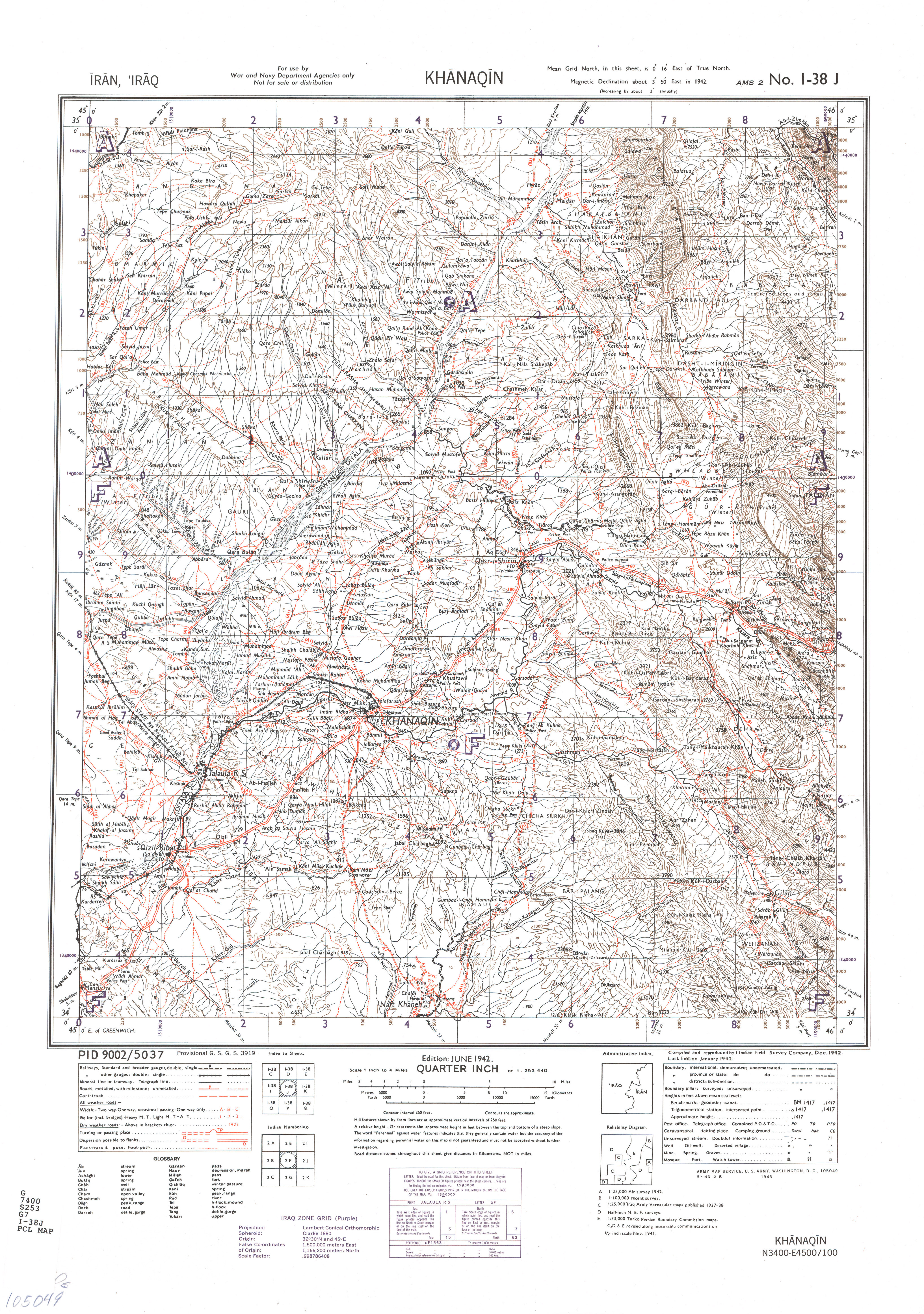
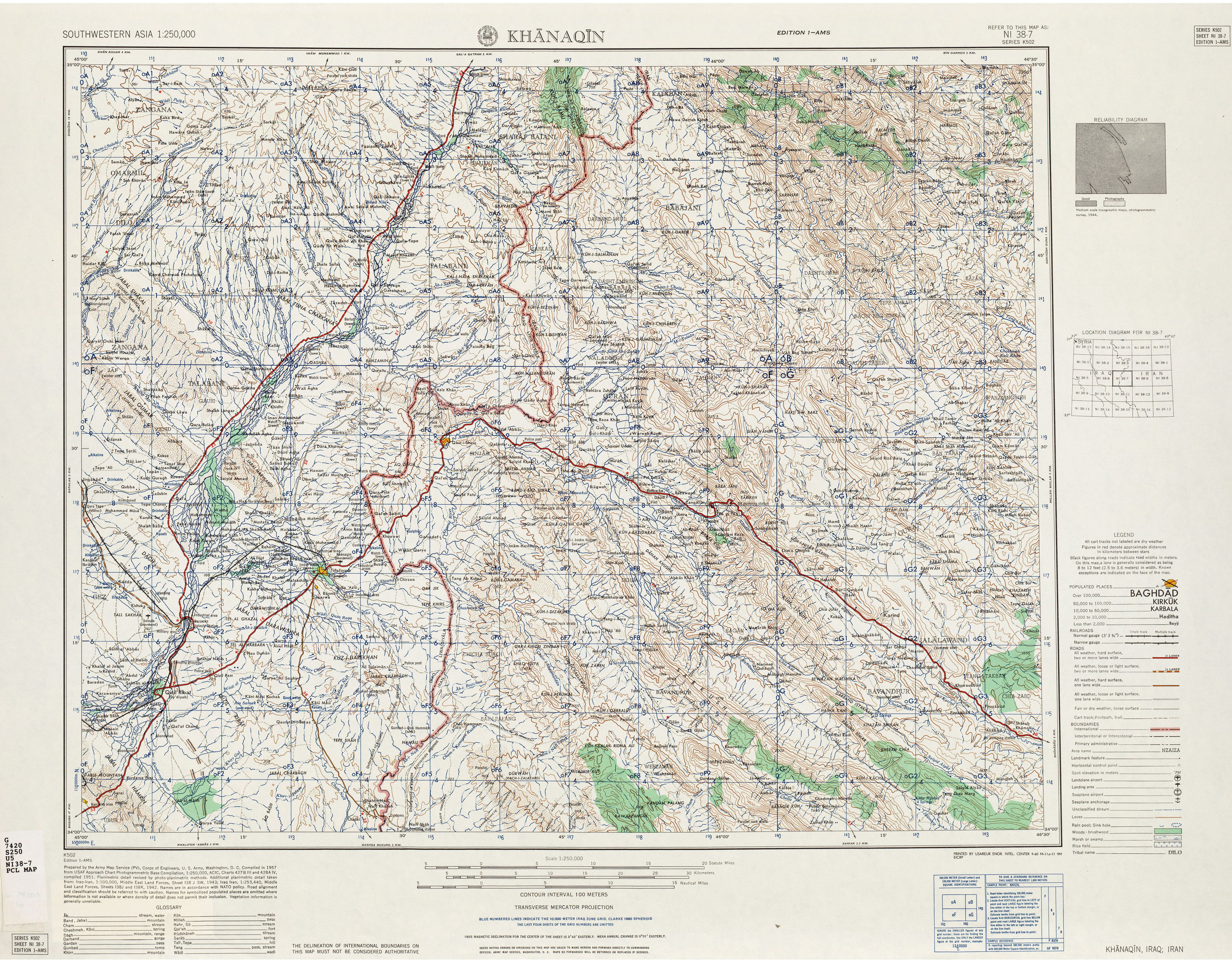
| First Contribution to HOT - Iraq Missing Maps | Thanks for your comments. They were helpful. I had tried looking at other tiles but had seen some inconsistencies in what looked like similar roads, meaning what they looked like physically and where they went. In some cases roads I was mapping did not seem to go anywhere, or at least I could no longer see evidence of the road beyond a certain point. That was behind my comment behind some roads that might be better classified as tracks. I was thinking those might be agricultural roads referred to. The comment about broader view is definitely valid. Some roads go on without seeming to come to another town. There may very well be another town at the other end and possibly be secondary or tertiary. I can see that the right classification might not be seen until the end of that road is reached. I was thinking they might be better classified as tertiary or unclassified until better connected. I did look for US army topo maps. Unfortunately the only source I found any was at the University of Texas. In the case of Iraq only maps that Iraq bordered another country on where included. Part of the the area I was working in is included in one map. The data is 1940s and 1950s era. I will see if it is of value.
|
|
| Android OSM apps | This is a rather late comment. I like Locus. It was one of the first apps I paid for. I was using Locus Pro long before doing OSM mapping so I have continued to use it as my primary mapping tool, including tracing and recording of waypoints / pois. I started using in particular for off-line maps. It does have integration with numerous on-line maps (> 100?). You can attach photos, audio or video to waypoints. https://play.google.com/store/apps/details?id=menion.android.locus.pro https://play.google.com/store/apps/details?id=menion.android.locus Depending on your perspective the main strength or weakness is the large number of features it has. |