OpenStreetMap

Popolon's Diary

Recent diary entries

The current usage of tags in OSM for junctions between motorways is really dangerous in high density areas.

  • There is currently a tag for the junction that is put at the point where the driver can’t change anymore way but at great risk.
  • Author of the current situation say that it’s fine as there is some tags on main lane say there is a junction and mode lane during the split of main road and junction.

I tried it around Paris with Organic Maps in navigation mode. An oral announce is made few hundred meters that driver should at left or right in few hundred meters, then when the change is no more possible, that the change should be made.

In high density areas, junctions can be on the left or on the right, two or three exits can follow from few tens of meters, making it more confusing, especially if there in not any announce of the name or number of the exit (as in case of Organics Maps), and on often overloaded traffic in these areas.

A good solution could be the announce of the exit direction, number or road name/number to follow, that could be verified on traffic signs, this imply that traffic signs nodes contains these informations. In France, on A6, exit numbers are given (ref field), but not the exit direction/name (name field).

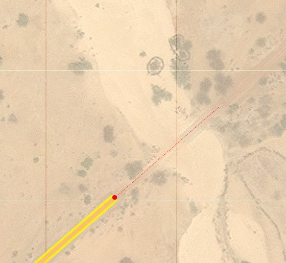
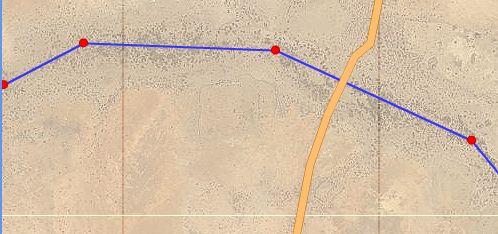
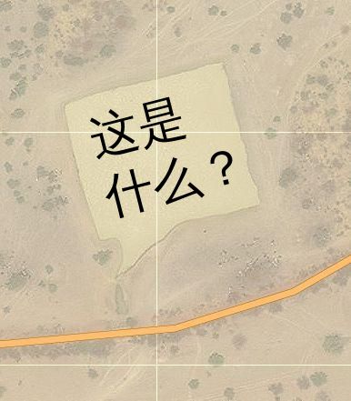
Around Ris-Orangis in about 1000m (~40s at 90km/h) there are lot of changes at left/right between A6a, a6b and A10 The current representation doesn’t display at all the parallel lanes, but only start at the last moment the change can be done, from few tens of meters to several km after the start.

The driving rules, say to go as soon as possible on the exit and THEN to slow down quickly, not to slow down on the main lane, nor to wait for last time to change to exit lane.

OSM & FlighGear Flight Simulator

Posted by Popolon on 3 August 2013 in English.

FlightGear Flight Simulator is a free & open source flight simulator, it cover the whole planet with open data that covers the whole planet. Base of the airport come from the X-Plane airport database, as it’s diffused in an open and free format. Planet earth datas come from various datas with open licenses. There are third party custom scenery that use satellite pictures too, like European Corinne one.

Since, at least one year, there is a process of integrating OSM data into the flight simulator main scenerary, at the same time, new open dataset of the terrain elevation, with freely available data are far more precise than before. Some improvement have also be made in scenery corner (like model animation on road or river streams. Everything will be available autogenerated with OSM data in next main scenery release (not sync and independant with next FlightGear release), but don’t know exactly when, as only few people are actually working on developpement and testing.

There are already some custom scenery available using OSM data, and you can rebuilt it by yourself using tools freely available. Well you need some technical knowledge, some GB of RAM, HDD and lot of computing power during several days or weeks to render the whole planet scenery.

Some cities, are really well populated. Paris is probably the best populated with custom buildings, Shanghai, Tokyo or London have lot of custom buildings too, Hong kong a little les. San francisco or New York has only some custom building, most of building are modelized by standard parallepipded buildings with accurate highness. Lor of other big cities have one to few custom buildings. populated, with still lot of work needed, and some airport too. In the other side lots of airports are still missing (see it in China, where I edit a lot in OSM). There are several object in various place (electic pylons, castles, church, power plant, windturbine in place with standard objects too.

Some areas have regional textures, like Madagascar, Europe, mountains areas, etc…

For OSM features in FlightGear : http://wiki.flightgear.org/OSM

This is an answer to OSM & X-Plane.

I was on wikipedia uploading a picture taken in Xiamen about a wagang (瓦缸, a big jar) restaurant, I then searched appropriated category on commons for french term “jarre”, and found it was about english term “jar” that is today translated by “bocal” in french. In french jarre is more about big container like chinese wagang or greek phitos, searching to sort and categorize some commons pictures, and found a picture about women trading jarres in Gorom-Gorom market. Gorom-Gorom is a Burkina Faso trade city for nomads of South Sahel (in Burkina Sahel Region. I immediatly think about geotag the picture, using OSM url => {{Location dec}}/{{Object location dec}} wikipedia commons tags.

Wagang / 瓦缸

You can simply do this by taking Openstreetmap url in two step : 1. Click on the place you want the geoposition. 2. Click on permalink, you will get an URL like :

  1. Extract lat=$lat and lon=$lon values and paste it in : * {{Location dec|$lat|$lon}}, here : {{Location dec|14.445|-0.2326}} for camera position, and : * {{Object location dec|$lat|$lon}}, here : {{Object location dec|14.445|-0.2326}} for object position.

Well, this was not really precise, no aerial photography of the place, only satellite one. But I moved a little and seen, that now, big parts of Burkina Faso have aerial photography on Bing Imagery layer for Potalatch (the web OSM editor).

I then started to route some roads, street and water pieces. This is unusual to draw tracks in desert for me, that mostly drawn, the 22 to 25 lanes (+2 sides lanes and footway and bikeways) asphalted streets in China. In this countries all road are one lane for two ways.

Here are some information I noticed, that could help other OSMers to draw thoses areas (Sahel in some poor sub-saharian countries) :

In most of the Burkina Faso, the tag higwhay=track should be avoided, as most road but perhaps 10 national roads are not in asphalt. They should be classified by distance and function. Perhaps trunk for national (only one asphalted), primary for biggest intercity roads, secondary for smaller cities intercity roads, etc…

  • In the Sahel region (North East of the Burkina Faso), most roads are only tracks slightly browner or marked by stones along the sides of the road. There is bush areas and pure sand areas.

Sahel road in Burkina Faso

  • In the Sahel region, water of the rivers are rarely seen from sky, only a slightly more green area indicate there is water underground.

Sahel rivers in Burkina Faso

  • Markoye, in the far North of the Burkina Sahel Region, as most Burkina small cities in this region, that’s not easy to trace. I question myself to know if that’s better to draw roads on lighter parts of the streets (because of sand moved by feets ?), or to only draw houses, walls and trees, possible ways then appear by themselves. Is there any local code about what is in the family house, and what is outside ? I will probably ask soon to Burkinabe friends.

Markaye streets

Sahel rivers in Burkina Faso

I after that moved in Ouagadougou, the capital, in Centre Region, and its green tropical area, the roads are often destroy by water here, there is big ponds in the middle of the raod, but this is generally more easy to trace :

Roads in Central Region

After few month of work, most roads, streets, forest, airports, golfs and football pitch are done, still lot of tennis/basket pitch, farm fields, service road, and residential roads to do. There are also lot of street and bus stop to name. Only few buildings are drawed among ten of thousands. About Six month ago, there was only about ten roads, mostly not really well placed due to GPS errors. http://osm.org/go/41XJPhb-

This is another chinese city I mostlycartographied big part, after :

  • Weihai municipality, Shandong province (山东省威海市) http://osm.org/go/5zmnH1a–

  • Jingzhou municipality, Hubei province (湖北省荆州市) http://osm.org/go/5O_krIm

  • big part of Huzhou municipality,Zhejiang province(浙江省湖州市), and most of it’s famous chinese brush manufacturer village,Shanlian (善琏镇) http://osm.org/go/5mfE4uQW

  • Big part of Qingdao and most of the actual drawing of Yantai, Penglai, Wendeng, Zhaoyuan and some other city of Shandong province (山东省青岛市,烟台市,蓬莱市,文登市,招远市。。。) http://osm.org/go/5zkCAH–

I trace street and road using statellites and planes pictures as Yahoo or Bing, GPS trace are really often very bad, because car has to stop, cross other cars, and are really less precise than actual plane pictures.

Perhaps need to document how to cartography China, with it’s special roads sign, as bus stop, road parrallel paths, mostly used by bikes, bicycle of for going inside residential roads, turn back path. The road signs for highways, street roads, bicycle way are is moslty like in France, so it should not be too hard to cartography for European OSMers.

I tried to work as good as possible on Airports runways, taxiways, aprons and building, in the hope to use them in Flightgear flight simulator free and opensource software. In this software, there are only few airport in for China, and mostly represented by only a runway (where there are several runway) and sometime wrongly placed taxiway, like Shanghai Hongqiao airport (I don’t worked on it on OSM) (ICAO:ZSSS) http://osm.org/go/5ngxf~p

http://yosmhm.neis-one.org/?Popolon

Location: 夏村, Zhuhai, Guangdong Province, 519000, China