
Mapping cycleways in Melbourne
Posted by Quite Frankly on 8 January 2023 in English. Last updated on 22 September 2023.I am embarking on a project documenting and updating bike lanes throughout Melbourne, and eventually Victoria, in as much detail as possible. This work draws on a range of sources including aerial imagery, street-level imagery, local surveys, other OSM users, and input from councils. I am drawing on global tagging conventions, and other tagging schemes developed specifically for detailed documentation of cycling infrastructure such as here and here.
In the first iteration I will capture the most basic attributes, such as whether a lane exists and if so, what basic category, e.g. exclusive, advisory, shared, separated, etc. If a survey reveals no lane, I mark the way explicitly as cycleway:side=no. Otherwise, the type of lane is captured using cycleway:side=? and cycleway:side:lane=? (side = both/left/right, depending on the way). See this tagging guide for specifics.
This step in itself is quite a large undertaking, and I’m finding even this basic categorisation can be somewhat subjective in cases where cycle lanes haven’t been properly maintained or markings are particularly sparse or unclear. I will post some examples of these edge cases in due course.
Note that where a cycleway tag already exists on a way, but I cannot validate its accuracy, I will not remove the tag. I will only update existing tags if I can confirm the tagging is incorrect, outdated, or could benefit from more detail (such as specifying :side and/or :lane).
Following this, I intend to add additional attributes such as lane width, buffers, separation type, traffic calming, etc. as well as updating the off-road network. This work aims to support better city planning, journey planning and cycle route suggestions across the state.
I have nearly completed the first sweep of City of Melbourne, City of Darebin, and City of Casey and am currently in the process of validating this with these councils.
I am primarily using StreetComplete as an interface to capture basic cycleway attributes, as it provides one of the most simple and efficient interfaces for this kind of work, and conforms to global standards for cycleway tagging. I also use the OSM iD editor, JOSM and Vespucci for more complex mapping needs.
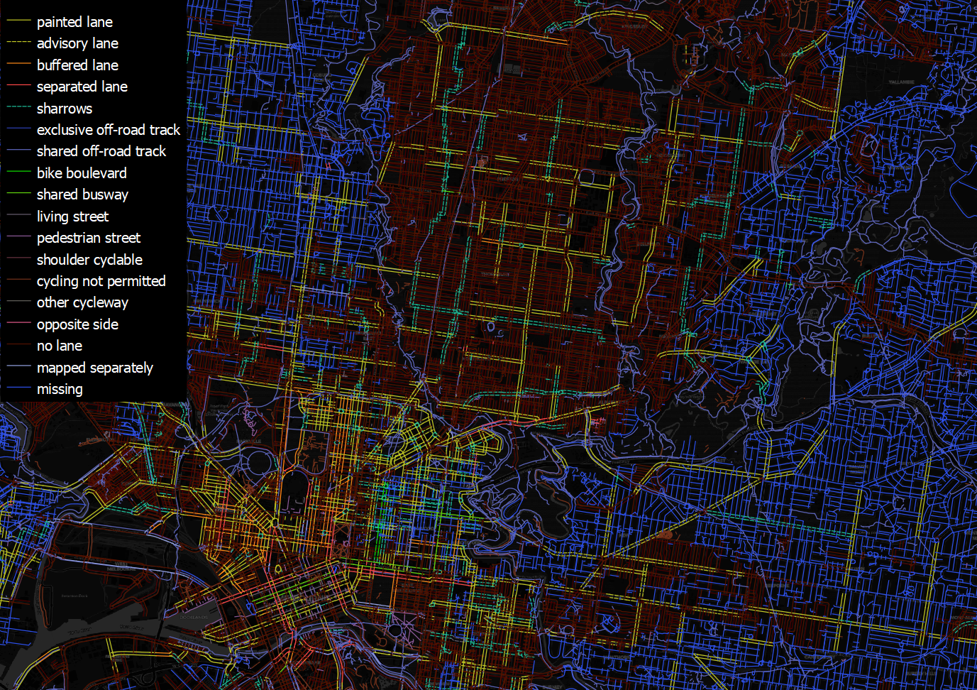
I maintain a local version of the OSM network of Victoria in PostgreSQL/Postgis, which I refresh daily. I use QGIS to connect to this database, track my progress, validate and check for tagging mistakes, and to understand changes that have been made by other users. See below for an example of how I visualise the network and some of its various attributes:
Any questions or comments are welcome. Very happy to discuss with fellow mappers.