
landscapemapper
- Mapper since:
- January 17, 2010
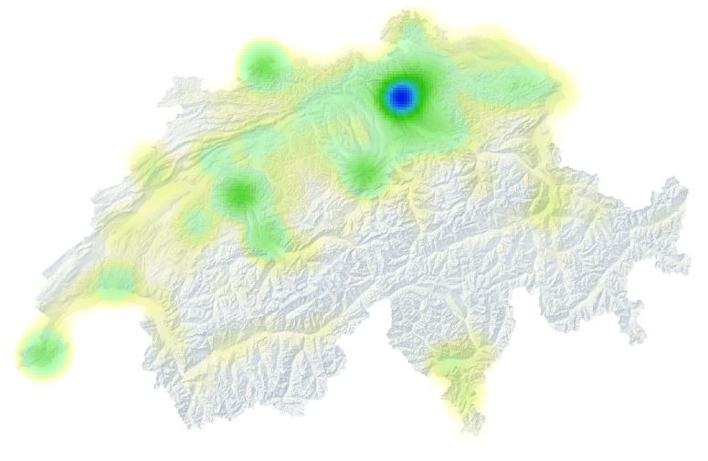
Here is my heatmap And my contribution profile
Landscape mapping
I love trail-running (with a map at hand) and thus try to improve the osm mostly in regard of path network and terrain representation.
Topics: mostly natural tags (fell, scree, bare_rock, cliff, ridge, peak, saddle, heath, shingle, scrub)
Subtopics: wild protection areas, marked trails, bus stops
-
How to make proper=licence according use of Open LiDAR and DEM data. Solved
-
For the trail network we are allowed to use Strava heatmaps <3! To get a high resolution image you have an own account or to work around with https://anygis.ru/api/v1/Tracks_Strava_Run_Bluered_HD/{x}/{y}/{z}
?? Cliff is a line feature, bare_rock is area but does not say anything about steepness. I thus miss an area symbol to represent steep areas, which would correspond to the traditional Swiss Hatchure.
?? Do the marked trails really have to be mapped as routes between two nodes? The hiking trail network is as dense that you regularly have a single path between two nodes.
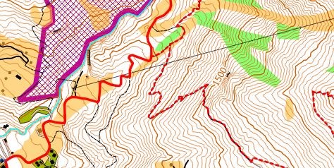
-> Here is my preliminary result (OSM & DEM Kt.GR ->QGIS for Symbology)
Trailrunning maps Sweden/Schweiz
-
Swiss Hiking Trail network, Zürich Green Marathon, Helsanatrails, Mora outdoor
Orienteering maps
The orienteering community has several projects related to osm.
-
MapAnt.no features an osm path overlay
-
MapAnt.es includes the OSM path network.
-
oomap.co.uk is fully based on osm (own tiles)
-
o-map.ch Combines Mapbox vector tiles with live rendering (??) of osm data
Table Tennis tables
- I also map Table Tennis Tables
- TagInfo
- you can add TTTs with mapcomplete
- 19.3.2021: 1699 sites mapped in Switzerland
- 22.3.2021: 2216 sites mapped in Switzerland
- 24.03.2021: 2443 sites mapped. in Switzerland
- 26.03.2021: 2744 sites
- 13.04.2021: 3300 sites
- 16.04.2021: 3950 sites
- 26.04.2021: 4515 sites
- 23.09.2021: 5025 sites
- 09.11.2021: 6089 sites