OpenStreetMap

mapmeld's Diary

Recent diary entries

Odds & Ends July 2023

Posted by mapmeld on 23 July 2023 in English.

Last fall I posted about “Living Streets of OpenStreetMap US”. In Las Vegas, I encountered two pedestrian streets (tagged with highway=pedestrian), and they’re in an outdoor mall.

The next aisle over, by the Panera, is a walkable area tagged with benches but doesn’t have highway=pedestrian. I mapped a bike rack.
There’s also a splash pad on the map, which isn’t in any of the standard OSM renderers.

While visiting Moab, I corrected the new Utah Raptor state park to “Utahraptor”, and added two sculptures downtown (“Get Your Mind Rolling” was memorable).

I added some local businesses, parking access roads, residential access roads in a new development, etc. There are a good number of bike racks in national parks which ought to be mapped.

Shortly after I posted about bikes in northern Wisconsin / Lake Superior area, I found BicycleBenefits.org through the local co-op. Get discounts!

While browsing the map east of Borneo, Sebatik Island is divided between Malaysia and Indonesia. Local attractions include a pool and house which cross the border! But there seems to be limited cross-border traffic and development.

Location: Moab, Grand County, Utah, 84532, United States

Continuing last week’s trip from Duluth, MN to Ashland, WI with a loop around Bayfield County.

Now that I’m on the lake shore, I started seeing a bunch of bikes around, even where there isn’t much bike infrastructure.

Ashland, WI

Around 1900, Ashland was the third-largest Great Lakes port after Chicago and Buffalo. In recent years they have reclaimed the waterfront ore dock and brownfields for parks. A paved trail connects beaches to downtown and the Wal-Mart.

When I arrived in Ashland, I locked the bike at the library. Semi-recently (after the 2015 StreetView), the city got Lake Superior-themed bike racks along Main Street. There could be more of these. The local high school is making these and Lake Superior-themed trash cans.

There was a bike rack and repair-tools pole in Bayview Park. On the trail and ore dock there weren’t other places to leave a bike.
Around a pedestrian access tunnel (Howard Pearson Plaza) there are some poles for holding a bike, but they are so out-of-place that they include an instructional sticker.

Bayfield County

Superior Vistas Bike Tour

This weekend, the local cycling and business associations hosted a bike tour. I don’t know how organized this was, but they did put several color-coded wayfinding signs on the roads.

More info: https://washburnchamber.com/svbt/

Wisconsin Highway 13

I traveled north on WI-13 to Washburn, county road to Cornucopia, and from Bayfield back to Ashland. The state highway has a wide shoulder. On the trip south, it’s hard to figure out getting onto US-2 without entering a terrifying highway roundabout? I walked the bike and crossed the highway a couple of times to avoid it.

Closer to Bayfield, and going onto county roads here, I noticed “share the road” signage.

Washburn

The local hardware store does bike repairs.
Found bike racks at the library, the rec center, and this café; another take on Lake Superior theme bike rack:

Cornucopia

Smaller town on the South Shore with a historical marker and artesian well. Good place to find a small, isolated beach and wade in Lake Superior. Added the fish fry place to OSM.

Bayfield (city)

Many people bring or rent bikes here, and take them on the ferry across to Madeline Island. Bike racks at the marina, library, and across the street on the Iron Bridge trail. Weirdly no bike infrastructure around the ferry terminal.

Local bike shop is Howl Adventure Center; they have a clothing shop downtown and a bike shop closer to County Road J.

Location: Bayfield Historic District, Bayfield, Bayfield County, Wisconsin, 54814, United States

Notes from Lake Superior Bike + Map

Posted by mapmeld on 23 June 2023 in English.

Originally posted on https://blog.georeactor.com

I had the idea to go bike touring on the western tip of Lake Superior. There’s a lot to say, but I wanted to have an OpenStreetMap mapper + bike travelogue perspective first.

The Route

I started in Duluth, Minnesota and crossed the bridge into Wisconsin. The next day I started biking along the Tri-County Trail, through a forested area, toward Ashland, Wisconsin.

The Twin Ports

Duluth, MN and Superior, WI (combined population: 113k) are a center for rail and Great Lakes shipping. They were built up during lumber and copper booms around 1900. I arrived on the weekend of their biggest summer event (Grandma’s Marathon).

The Duluth Airport is served by a regional transit bus. On weekdays it’s Route 1 to a transit center, but on the weekend it was Route 5 to a more southwestern neighborhood. I updated the bus stop and surrounding waiting area on OSM.

Duluth has a couple of bike shops - major props to Ski Hut for their help :)

A good stretch of Superior Street has a protected bi-directional bike lane:

Part of the city is on a steep hill, so it could be difficult to navigate just by pedaling. Probably the nicest bike routes would be Minnesota Point and the Lakewalk going northeast. I was unable to explore during the marathon.

A grocery co-op named Whole Foods and a Kwik Trip had bike racks out front, but these are not so common. Whenever I see a bike rack, I try to mark them on MapsME and remember to fully add them later.

You can cross to Superior, WI over the 2.5 mile Richard I. Bong Memorial Bridge. There is a chute with its own onramp. Though this was Saturday of a busy holiday weekend, I didn’t see other bikers or walkers (there was maybe one guy in Superior).

In Superior there were a few ring-shaped bike racks installed on the sidewalk on Tower Ave (sort of the major commercial drive). Houses often had bikes out in their front or side yard. One annoying thing is biking over so many train tracks.

Barker’s Island was a quiet waterfront spot to park my bike (racks at the beach and U. Wisconsin building). They also had a former Zagster bike-share dock (should this be removed or renamed on OSM?)

The hotels, Veterans Center, Dollar Tree, etc. in this area did not have bike parking.

Superior has the 5-mile Osaugie Trail. A great part of this was beautiful waterfront or forest, but in the middle as you leave town, you get directed between two unsignaled railroad tracks. This looked kinda wild (look for the “Osaugie Trail” arch here).

Tri-County Corridor

The Tri-County Corridor is a 62-mile rail trail roughly following US Highway 2 from Superior to Ashland. It’s typically used by ATVs in summer and snowmobiles in winter. Despite researching this a bit, I only found a few reviews, warnings about gravel or puddles, and a recent embezzlement case.

CC-BY OpenStreetMap contributors; Relation on OSM

The paved Osaugie trail quickly became stretches of packed sand and loose sand. Even though it was Sunday of a holiday weekend, I saw maybe three ATVs and one hiker with walking sticks (he asked me if cars were allowed).

On a mountain bike, there were several sections where I was slipping in sand before reaching Amnicon Falls State Park (13 miles in) and I was alternating between riding on ATV tracks or walking the bike, swarmed by mosquitos. Maybe I approached this with the wrong tire pressure / weight distribution / posture etc. If you cycle this trail, please post, because there is no info online. I decided to abandon the trail about 20 miles in, at Maple.

I rejoined the trail two days later from Ino to Ashland. This section was gravel and lightly downhill. Maybe this part would be an enjoyable day / weekend trip from Ashland. There were a few sand traps around Moquah though, and I didn’t notice another bike track until I was almost entering Ashland.

tl;dr It’s cool that the counties maintain this rail trail, but they only seriously consider use by ATVs and snowmobiles. When I did a bike tour before in Hokkaido, it was easy to stop at a convenience store for water and snacks. Here you’re never far from the highway, but you can’t expect to find a bathroom, store, restaurant, or hotel room around the corner.

Amnicon Falls State Park was a refreshing place to stop, but they had no bike rack and warned me not to take a bike on the trail system there (they suggested Brule).

County Roads

When I left the Tri-County Trail, I was on County Road “F”. Compared to busy US Highway 2, these county roads are less-traveled roads, often straight north/south or east/west, with one lane each way. There isn’t much of a shoulder, so I stuck close to the white line while the occasional car passed by. In state forests it felt like there were no cars at all.

Google Maps would suggest even smaller roads which looked more direct, but they often are gravel or sand. MapsME was generally better on routing and accurately long travel time.

There are risks to traveling on isolated roads and roads with limited space. I was also really lucky re: weather / visibility.

I followed these 20 miles down to Solon Springs for a last-minute hotel room. If I were re-doing the route, I would stick to county roads north of the trail until Iron River / Ino.

Preview

I’m planning a Part 2 about Ashland, Washburn, and potentially other bike experiences.

Ending with a fun Lake Superior-themed bike rack on Ashland’s Main Street (please add more on the new bike trails! And at laundromats!)

Location: Iron River, Town of Iron River, Bayfield County, Wisconsin, 54847, United States

A visit to Baarle-Hertog/Nassau

Posted by mapmeld on 6 May 2023 in English.

Sharing from my post on https://blog.georeactor.com

Belgium’s Baarle-Hertog and the Dutch Baarle-Nassau overlap in one town riddled with border crossings and enclaves. Let’s take a look at OpenStreetMap:

Map of Baarle-Hertog/Nassau full of border lines
Wow, it looks complicated!

Legend depicts Baarle as a Kafkaesque theme park where buildings swap countries and laws are fluid. Sample anecdote:

There was a time when according to Dutch laws restaurants had to close earlier. For some restaurants on the border it meant that the clients simply had to change their tables to the Belgian side.

I likely learned about this town from the Google Sightseeing Blog a long time ago. As a maps nerd, I knew that I had to see it for myself one day.

Getting there

In April 2023, I took a train from Brussels to Antwerp, checked out the award-winning Port Authority Building, then another train onward to Turnhout, then a bus to Baarle-Hertog.

Sign showing times until buses arrive, including Baarle-Hertog
If you’re coming from the Dutch side, there’s a bus from the Breda train station (these bus systems have stops a few meters apart at a commuter parking lot on Sint-Janstraat).

History

When I read books about enclaves last summer, the authors explained that this situation was once not so unique. As fiefdoms and city-states got aggregated into kingdoms and counties and nations, irregular borders would go away or get simplified by the higher-level government. In the 1840s, the UK eliminated most of its chaotic county enclaves, though some remained into the 1970s. Traditional boundaries surfaced at odd times in the 20th century, such as areas of West Berlin inside of East Berlin.

After India and Bangladesh swapped territory in 2015, the only remaining ‘double enclaves’ are here and between UAE/Oman [I was thinking about Cypriot villages within Dhekelia (UK) on the island of Cyprus, but Dhekelia has access to the sea and that gets into enclave/exclave terminology].

The borders of Baarle have been set since 1995. They had previously been somewhat defined in 1974, with descriptive borders such as [translated]

[the border] is formed by the middle of a ditch in an approximately northwesterly direction up to a stone crossing the old road from Baarle-Nassau to Hoogstraten. Thereafter the boundary runs in an approximately westerly direction, approximately parallel to said track, and is formed by an approximately straight line through the center of several ditches and ditches over a post called “afgevild paard” [skinned horse] to a point 1.8m south of a stone. The border then follows a line marked by pickets in an approximately westerly direction to the northeast side of a ditch, crossing the Hoogstraten…

Speculation

Some uninformed theories for the longevity of Baarle: - A sign hinted that swaps happened when buying, selling, and inherited land. This could help explain odd blocks of borders in fields. - The road connecting Baarle-Hertog to the rest of Belgium passes through possibly valuable territory that the Dutch would not give to Belgium. - Conceding Baarle-Hertog to the Dutch could trigger Flemish areas to leave Belgium - By the time of the 20th-century definition of the border the tourism, Schengen, and EU rules made it less urgent.

How wild is the border in 2023?

I stayed at Den Engel, which has a nice restaurant and fry counter, with ~10 rooms above. Their outdoor seating comes up to the border, but clearly stays within the Netherlands:

Outdoor dining with a border shown with tiles on the sidewalk

There was some care taken either when building or when drawing borders. Despite a twisty border at this corner, buildings tend to fall into one country or the other:

OpenStreetMap screenshot with buildings having non-square shapes to fit inside the border

Though the historical Baarle could have been more criss-crossed by borders, it seemed to have been simplified. I decided to search the map to find which buildings currently sit in both countries. Only a few are open to the public:

  • Drankenhandel Hoefnagels - a beer store embracing its border status. This is part of the world’s smallest counter-enclave. Before both countries adopted the Euro, they had two prices and two cash registers. The border goes right through where the beer bottles meet above the door. It’s closed on Mondays.

A beer store and parking lot with a mural showing Dutch and Belgian beers meeting

  • Goossens wonen en slapen - this is an ordinary furniture store. Google gives its address as a service entrance in the Netherlands, but the parking and customer entrance are totally in Belgium. The Dutch side had this odd siding which looks like filled (or slideable?) doorways.

A blank wall

  • Zeeman (clothing store with cleaning and kitchen sections; think TJ Maxx). On Sunday night there were kids doing bicycle tricks over the border on the sidewalk. Inside there was a cute yet understated border marker. I bought slippers and Q-tips.

An aisle of a department store with a stripe of color and two flags representing the border.

  • The space around the corner from Zeeman was recently an art gallery. During 2020 the owner was interviewed about differing mask restrictions. That gallery has relocated to a Belgian storefront. The new tenant is Clinias, a pleasantly self-aware dentist’s office.

A border marked on the sidewalk and a sign about smiles without borders

  • a shared library / community center (I walked through the first hallway, didn’t see anything out of the ordinary or overtly divided)
  • shared town hall (a sign outside explains that the Council room on the upper floor is split, and Belgian weddings must be performed entirely on the Belgian side)

I’m not going to walk into a warehouse or an apartment to bother people about the border, so… that’s all that I have!
These residential neighborhoods were built with seemingly little concern for the border. No cross-border Airbnbs are available =(

A border on top of a neighborhood map with no regard for streets and housing

There are multiple streets where a border goes down the middle. I wondered if that was the meaning of the brick in this neighborhood, but it could easily be European traffic calming and parking:

An ordinary residential street with red brick on the left and right edges

In the southwest, outside of town, there are farms with buildings in both countries. I found two mailboxes with dueling house numbers.


Here’s a look at OpenStreetMap to explain the situation:


Some Tourism Notes

Rooms at Den Engel were cozy. I should note though that they are not accessible for elderly or disabled.

An ordinary hotel bedroom with a photo showing the historical border crossing

Residents have a monument for smugglers (particularly around butter I think?) and today there is a cluster of firework stores in Belgian territory. There was a small reconstruction of a radio tower set up by the Belgian resistance inside an enclave during WW1.

Bakkerij Adams was not on the border, but it was tasty. There’s a window into the kitchen. The cashier (and an elderly customer) answered my questions about their pastry.

Several bike paths pass through Baarle and connect to nearby towns in both countries. A sign recommended an Enclaveroute.

Final thoughts

Just as the Euro and Schengen can (in their better moments) give a feeling that we live in a special peaceful era, walking to the bakery and discovering you’ve crossed the border 3 or 4 times, including by crossing the street, gives a warm fuzzy feeling. Is being Dutch about flying the flag and eating pancakes and Tony’s chocolate in the supermarket? Is it about who sends you a tax bill?

By the Clinias dentist office, a sign reads [abridged / translated]:

the lion of the Netherlands on the pole, with crown and sword…
On the other side the Belgian Lion. no crown can oppress him
This couple doesn’t fight each other in Hertog en Nassauwe:
but whoever besieges their Twin Village.
two pairs of claws strike him

I’ll leave you with this road sign showing drivers that they have stopped crossing from one town to the other, and have now left both behind.

Location: Loveren, Baarle-Nassau, North Brabant, Netherlands, 5111 TA, Netherlands

Mapping Early 2023

Posted by mapmeld on 11 March 2023 in English.

Waymo

I used the driverless ride-share from Waymo to go from the Phoenix airport to downtown. The airport pickup location was a bit out of the way, so I added a taxi stand point on OSM.

Many neighborhoods had building footprints added in Phoenix in just the past 2 years. I was able to add some details to trails or new construction.

Wisconsin and the U.P.

I’m planning a summer bicycle trip from Duluth, east through Wisconsin and Michigan’s Upper Peninsula. There are gravel trails along highways (likely old rail lines) which are commonly used by ATVs and snowmobiles. OSM coverage of these is good. What surprised me on Google Maps is that huge swathes of this area have one low-res StreetView from 2008-09? This might be an entry point for Mapillary and others. I’d like to use this and/or tagging to find bike racks.

Durbin Feeling Language Center

I recently listened to a talk by Chris Skillern (New Leaves: The Cherokee Syllabary in the 21st Century). The Cherokee Nation opened this new language center building in Nov. ‘22, but none of the stories gave its address, and it wasn’t a point on Google Maps. Looking up older news articles from when the building was selected, I found it nearby. Then I saw that the Bing imagery included new construction which was not present on Maxar. Typically I had thought Bing was older? But maybe that’s getting a refresh.

Mapping recap for EOY 2022

Posted by mapmeld on 1 January 2023 in English.

This is the fifth in a series of posts which I’m doing inspired by other users’ monthly updates. This is only around a month later, so it’s brief

Catalina Island

In the beginning of December, I did day hikes on Catalina Island, southwest of Los Angeles. The Trans-Catalina Trail is already well-mapped on my route from the airport to Avalon, but I was able to map a few picnic table + shelters, and a one-way drive loop. On the Lone Tree trail, there are several steep points (I was surprised that a Jeep can drive these); one had an unmapped footpath detour (with official signage) around the steepest point. Another point has ~half of a trail. I included it for completeness, and to show that it doesn’t lead anywhere.

Lincoln Park

On the sidewalk I saw a sculpture “Gourd Man” which was missing from OSM. Articles about it typically say that it is in Village Green, but here it is (was it moved? is it a copy?). Anyway I added it.

Mapping recap for Fall 2022

Posted by mapmeld on 27 November 2022 in English.

This is the fourth in a series of posts which I’m doing this year inspired by another user’s monthly updates. In the two months since my last update, I visited Palos Verdes (a bit south of Los Angeles) and mapped a few other places remotely.

Also there is a geo-focused Mastodon server; you can find me there: @mapmeld@mapstodon.space

Palos Verdes / Los Angeles

There are a few fancy neighborhoods segmented by dirt paths which are either for utility access, bridle paths, or fire control. For example one road had horse stables on it, and another served as the boundary between two cities. There are a few access points which are barricaded with a reflector or guard rail, but you can still walk onto the path and onward into the next neighborhood. I talked to a resident who said that his car GPS considers these thru-ways, so it’s possible that they were more connected in the past? I would say OSM coverage of these was good but not great (particularly: linking entrances and exits to the road way, or missing shorter paths and alleys).

A local park was named “Los Arboles Rocketship Park” on Google. I visited and confirmed there is an actual sign with Rocketship in the name (based on a sculpture there).

Central Asia research

I’m considering a hiking trip to Tash Rabat, a Silk Road era landmark in Kyrgyzstan. OSM has the dirt road from the highway, and an additional trail north to Баетов which is missing from Google.

I was also looking at locations with Islamic architecture. Turkistan, Kazakhstan has parcel data (labeled building=yes) and then addresses added by Toyota. So that data is on a bit of a journey. A large area in the city center recently got redeveloped into a park, which I updated on the map. Google reviews dispute how often the park is fully open to the public, whether boats are working, etc.

Grand Canyon

After an announcement that the parks service was renaming Indian Garden to Havasupai Gardens, I renamed the area but kept the alt_name tag.

OSMBuildings

My changes to building height (a tower section separate from the base) weren’t showing up on the 3D view provided by OSM Buildings, so I investigated. I think the problem was an existing building relation where the building:levels tag was on the relation level. I had to add and remove a few tags so the building outline and address is consistent but the building:levels is different for the two parts. It looks great now!

Location: Palos Verdes Estates, California, United States

Mapping in Summer 2022

Posted by mapmeld on 21 September 2022 in English.

I had planned to do monthly updates, but instead after a Europe trip, I returned home to a mostly-mapped Chicago and stopped editing so much.

Chicago

  • A local news article covered the Winthrop Family Historical Garden - a park marking the only block where Black Americans could live in Uptown in the 1920s. I added this to OpenStreetMap.

  • Following a Reddit comment, I added the pull-off area and path for a Schiller Woods water pump which attracts the superstitious. Google StreetView shows the area had cars going back many years.

  • My local park recently replaced a ‘desire path’ with a paved sidewalk, so I finally could add it to the map.

Las Vegas

I removed some OSM paths which made it look like you could enter the MGM Grand monorail station from the street level (you need to walk through the casino).

The new Caesar’s Forum conference center was well-marked with indoor mapping (restrooms , exits, etc. ) but the building did not appear shaded in on OSM. It’s unclear what was wrong, but I checked today and finally it’s appearing.

Border edits

I was inspired to resume editing areas along the Myanmar-Laos-China border. A lot of times there are marked residential areas or some little bubbles of roads which should be connected to the larger road network. Other times, as previously discussed, there are large tracts of new construction in part due to the Belt and Road Initiative. I found myself making a lot more edits, and occasionally stumbling on roads which I previously edited in summer 2020.

Map of southeast Asia with overlay showing edits

Location: Near North Side, Chicago, Cook County, Illinois, United States

Mapping in April-June 2022

Posted by mapmeld on 14 June 2022 in English.

Cyprus

In May I visited Cyprus and crossed into the UN Green Zone, Northern Cyprus, and Dhekelia (the UK Sovereign Base Area). This is a rare case where the Mapnik style is the one which best shows the true boundaries and situation on the ground. Here it is in between screenshots from Google and my MapsME app.

Side-by-side maps from OpenStreetMap, Google, and Maps ME

Businesses were under-mapped in the capital (Nicosia) and a Cypriot enclave inside of the UK base area (Ormidhia). Only roads and bus stops were well-mapped. There were similar problems on Google. As I walked along the main street in Ormidhia, I added a bunch of grocery stores and hairdressers.

Estonia

I visited Tallinn. At the Estonian History Museum I spent several minutes near closing time, walking around a park trying to find the old Soviet statues described in a Google Maps review. In retrospect I should have looked at OpenStreetMap, where they are all mapped and labeled!

Maldives

Sadly I am not physically in the Maldives, but last week was following up on a story that the island of Gulhifalhu is being expanded to make a new industrial zone. On Maxar imagery the new landfill is visible. I changed the reef into a donut-shaped relation and added a coastline tag, but it takes an unsatisfying long time for new coastline to be rendered. I am a little worried about having done it incorrectly.

Location: Kumpula, Central major district, Helsinki, Helsinki sub-region, Uusimaa, Southern Finland, Mainland Finland, Finland

My 2022 in OSM so far

Posted by mapmeld on 27 April 2022 in English.

Summary of mapping in Alameda, Petaluma, Elfland, and some code in iD.

I saw an OpenStreetMap diary recently “What I did in OpenStreetMap in March 2022”, and Amanda is on the right track. This is such a good idea to post about OpenStreetMap on a regular basis - I know that a monthly book blog has helped me read more often. I don’t know how to borrow this idea without outright stealing. For now I can maybe post a quarterly update?

Petaluma, CA

The map has building footprints, but almost none are labeled. I added restaurants, gas stations, a Whole Foods, and sculptures at the train station.

Alameda, CA

I walked from the ferry dock to my place, and looking back added some crosswalks (or converting footpath to crosswalk). A school in the neighborhood added a one-way pick-up/drop-off area and rearranged their sports fields to fit the remaining space, so that was a more complex edit.

Elfland, Somerville, MA

A colleague looked up Alameda on Google Maps and we started talking about which businesses and parks show up. She told me about “Elfland”, a collection of tiny buildings which appeared on a vacant lot in late 2021. After looking on Twitter to confirm some details, I removed the old gas station from OSM and added a sculpture marker.

Code in iD

In 2016 I added some code to iD for right-to-left language layout. In 2017 we discussed a notable weirdness to how street labels in many scripts showed up in Chrome. SVG textPath is really obscure so the Webkit bug goes back a long way. I was able to use Unicode presentation forms and JS to improve how Arabic and Hebrew appear in Chrome. Unfortunately other South Asian languages have multiple combining characters which can’t be faked like this.

In October 2021, a fix to the Webkit bug landed in Chromium v96. I made a PR to turn off my changes, and promised to return and clear out my patch 6 months later. Here’s the problem - Safari Webkit still has this issue. A small % of people still use Safari, including every iOS user (other iOS browsers are a wrapper around Webkit). New and non-English-speaking users may be more likely to be on Safari. So I think this code ought to stay in. I’d like to make my alif-toolkit module a bit lighter and a bit better, but that’s what it is for now.

Location: East End, Alameda, Alameda County, California, 94502, United States

OpenStreetMap on the Chinese Border

Posted by mapmeld on 12 June 2020 in English.

Something funny happens when Google Maps meets the Chinese border. Commercial data providers follow China’s coordinate system (GCJ-02). Their illusion comes to a crashing halt when you reach a border with Hong Kong, Macau, or any other country.

In Móng Cái, Vietnam, something is noticeably off:

The OpenStreetMap version, traced from satellite imagery, tells a different story

This isn’t a politically disputed border problem. Google and Bing push the two cities together while following Chinese data rules and invented new geography to try and reconcile the problem. This issue has surfaced before, but it rarely enters promotion of OpenStreetMap.

Why bring this up now? As part of the Belt and Road Initiative, new buildings and roads are being constructed on both sides of the border:

This new highway link to Myanmar is completely missing from both Google and OSM. We have unmapped, under-mapped, and outdated coverage across Southeast Asia. And no other major web map provider will show these border cities accurately.

With rapid economic development come other changes. An extreme case is Mong La, which a BBC report called “Myanmar’s lawless region where anything goes”. We should have OSM data to support NGOs and monitoring groups which work in these areas.

I did a little editing to start, but here’s my plan going forward:

I hope you’ll join a Twitch stream (or video chat?). I will post the link in comments to my diary post on the day of, or you can follow me on Twitter: https://twitter.com/mapmeld

Location: Pangkham, Matman District, North Shan State, Shan State, Wa State, Myanmar

I’ve long wanted to see a true map of the world’s languages. We know where languages are supposed to be spoken, but where are the real borders, where are the little enclaves? Recently I finally got the server space to download the global OSM data and look for myself!

For this project, I take the primary ‘name’ tag of any points, and using Jan Lelis’s unicode-blocks Ruby gem, determine where its characters fall in the Unicode block system. This blog post is in English speakers’ familiar “Basic Latin”, “Latin-1 Supplement”, and “General Punctuation”, which are common enough that I’ve filtered them out from this map.

Explore

You can view the map at mapmeld.com/osm-unicode-coverage/ and data and source code are on GitHub. I think Europe and Asia, being the largest files, may have been undercounted or only partially read by my script, but it still shows all of the expected language coverage.

Local Language Hotspots

Tifinagh (ⵜⵉⴼⵉⵏⴰⵖ) is used alongside Arabic across North Africa. In the past five years, OpenStreetMap users started labeling all Moroccan cities in Latin, Arabic, and Tifinagh script. You can see a handful of other locations in Algeria and Libya.

Morocco and Algeria

The letters in “Latin Extended-B” and “IPA Extensions” are common on a small section of the Guyana-Brazil border. This seems to overlap with a local language known as Wayampi. There is another cluster in the Tizi Ouzou region of Algeria. That doesn’t mean that these languages are related at all — just when new sounds and/or symbols were added to the Unicode standard, both were included in the same batch of updates.

rainforest collection

Similarly, “Latin Extended-D” appears only on Easter Island. There is a small cluster of N’Ko labeled cities and rivers in Guinea.

Canadian Aboriginal Syllabics are used over a wide area, but don’t appear to ‘cluster’ as much. I’d like to see some initiatives to get this used more often. Canada

Outliers

Seeing a solitary marker for the “Latin Extended Additional” block, we find that Australia’s Uluṟu includes the letter ṟ.

Uluru map

I found India’s Antarctic base because it’s labeled in Devanagari script.

Antarctica

A Greek hostel in Vila Velha, Brazil? A Chinese bank in the Bahamas? There were other unusual outliers which I couldn’t fully identify or verify on Google Street View.

Vandals

A “Canadian Aboriginal Syllabics” point in Colombia caught my attention. This user stylized the shop name as ᗰI ᑕᗩᔕᗩ, but Mapnik had some issues rendering it.

Mi Casa

A seemingly harmless extra bus stop named in Lao script in a neighborhood outside of Adelaide, Australia, got scraped into the content generator OpeningHoursAU.com

bus stop

I found attempts to add ‘flag emojis’ and a handful of points in Tenerife which had Glagolitic (unused old Croatian script). The reason for this type of vandalism is unclear, but they should be removed.

Caveats

  • OpenStreetMap data is © OpenStreetMap and contributors, and was downloaded from https://download.geofabrik.de/
  • By using the Unicode script, I miss distinction between several language sets, such as Russian, Ukrainian, Abkhazian, and Mongolian using different parts of the Cyrillic alphabet.
  • By using node names, I missed names used on ways, particularly roads, rivers, and buildings where I’ve seen local languages used in the past.
  • I haven’t checked if Guyana and Easter Island have the ‘correct’ Latin extended letters for their names, just noting a common pattern.
  • I checked only the primary name=__ tag, and not the alternate names (name:en=, name:es=), I’m leaving a lot of multilingual names. This was OK with me because cities often have dozens of alternate WikiData names, and the main name tag is the primary, most-seen one.

Finding gaps in local language coverage

There are many areas which aren’t highlighted by the map because they were Anglicized by map editors. As an example, places in the Marshall Islands aren’t labeled in their Marshallese names (e.g. Mājro, Arņo). Unicode may not be done adding new codepoints for Marshallese (ņ here is repurposed from the Latvian alphabet).

It would be interesting to reach out to editors who have added ~5 places in N’Ko alphabet in Guinea, or similar local scripts, to expand the number of local scripts used on OSM.

Adapted from my Medium post for non-OSM audiences

Location: Ward 8, Washington, District of Columbia, United States

Since I’m on a right-to-left-languages-and-mapping kick, I recently asked a language school in Malé to translate OpenStreetMap.org into Divehi, the local language of the Maldives. After a promising start and an initial quoted price, we had a month without communication. After determining it wasn’t just a Ramadan break, I texted a phone numbers on an ad on Ewity, a Maldivian Craigslist. Almost immediately I had the first translations:

OSM About Screenshot

OpenStreetMap About page — green text is a possible transliteration of “OpenStreetMap”

Font issues aside, bringing OSM Divehi coverage from zero to a few hundred words was a milestone. I’ve decided to pay for another 1,101 words to be translated — this covers most of what you’d see browsing OpenStreetMap, signing up, logging in, leaving a note on the map, and making your first edit.

Why translate Divehi?

This is a good question — even in the right-to-left languages theme, there are more speakers of Arabic, Persian, and Urdu who could use a completed translation of OpenStreetMap and the iD Editor.

Disappearing Islands

The Maldives are sinking. Long before they disappear, storms will damage crops, buildings, and local landmarks, and drive people to more protected cities or even out of the country. I believe that there’s value in mapping and documenting the Maldives and Maldivian way of life as it exists today, especially on more remote islands, and using community reports to monitor areas that are changing.

photo map

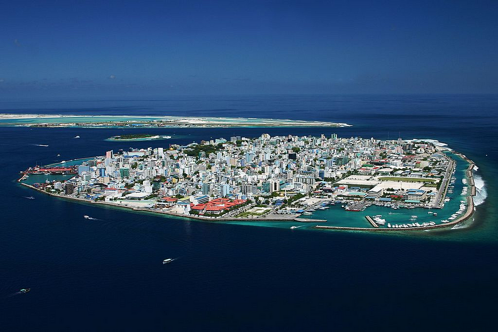
Malé, Maldives, by Shahee Ilyas, via Wikipedia

Don’t Ignore Existing Volunteers

When I started working on Arabic i18n I felt out of place, as I had limited knowledge and OpenStreetMap clearly has volunteer mappers who speak Arabic fluently. Eventually I realized that fixing these issues in the source code required knowledge of CSS, Unicode, and git, too. A mapper from the Middle East, North Africa, Iran, or Pakistan might not be available to fix these issues, but translations are much more accessible.

Volunteer translators are already doing great work — for iD Editor, Persian is 79% complete, and Arabic 60% complete.

Considering how few people speak Divehi, and how little the language is visible on OpenStreetMap today, it would be less likely that native speakers would be editing, and then that one of these editors would volunteer to translate the site from scratch. Providing the first chunk of translations for the site gives us a starting point to recruit mappers, translators, and organizing NGOs.

Local Language Content

Places in the Maldives ought to have a local-language name tag, combined Divehi-English name tag, or some other system, as seen in other countries. If the map is going to include local people, places, and knowledge, English-speaking tourists can’t be the only mapmakers.

person speaking

A participant in the annual Divehi Oratory competition

Comparable Open Source Translation Efforts

Arabic, Persian, and Urdu have open content on the web. They also appear on Google Translate, though translation on this level requires a human touch.

I have seen precious few websites with open source translations into Divehi. Clearly there was work on Wikimedia and Wordpress, but opening OpenStreetMap translations with a Creative Commons Zero license could be useful to new developers.

How’s it going?

Up until I got an invoice from the translator, I was pessimistic. Now that translation is happening, I feel much better about it.

The OpenStreetMap website project uses TranslateWiki and the iD Editor uses Transifex. Neither site allows me to import translations directly.

  • TranslateWiki tested me with random translations before I could join an OSM team. After some confusion, I decided to ‘translate’ five statements in Spanish to their existing translations, with little or no modification. About 24 hours later a mod approved my account, and I was able to add the first Divehi translations for the About page.

  • Transifex made me request to add Divehi to the iD project, which was approved. There are separate repos for the ‘presets’ and the main editor. I submitted a few translations which are not yet reviewed, so I’m not sure if they will be added or if I need to nudge them through the process.

Context and Legalese

I made a spreadsheet on Google Drive with one column of translations and one column of ‘context’, explaining when I need Edit (verb) and Edits (noun, a list of changes). Or explaining map-editing terms like “circularize” and “shape is not square-ish”.

Another example is finding a translation for ‘Agree’, for the OpenStreetMap Contributor Terms. OpenStreetMap asserts that the English version of the agreement has the final legal standing, and I can’t be sure that a translation would represent that accurately. I decided not to include the Contributor Terms in my translation, though I do plan to include the title of the page, the option buttons, and the public domain checkbox.

Template Content

I had many options on how to represent template phrases such as “{user}’s Profile” or “{user} posted about {topic} at {date}”. Should I include them in my word count? I asked the translator to do 50–100 words and then report back. He translated “number” in “{number} km” yesterday, so I tried to explain this better.

Quality Control and new NPM module

When I received my first translations, the translator asked how I would check the results. I didn’t really think about it until I was confronted with text.

  • Words such as ސިނަމާ and ބޭންކު I can Google and/or Image Search and see that movie theaters and banks come up. I also check if ‘homepage’, ‘next’, ‘previous’ appear in similar places on other websites.

  • I compared similar sentences for structure and subject-object-verb order.

  • I found a GPL transliteration library in PHP, converted it to JS/Node, and published it on NPM with a command-line interface. Source code. This allowed me to find proper names such as ‘OpenStreetMap’ and loan words such as ‘GPS’.

To be continued…

I’m going to continue to work on both translation pages to make sure that it starts appearing on the map, then show it to the USDP office and other NGOs in the Maldives.

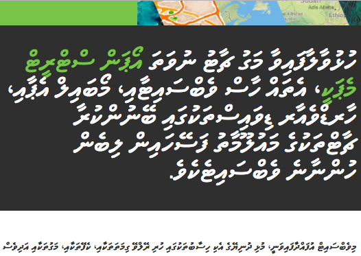
I know some Arabic, so I’m hopeful that I could read. Each letter contains a consonant and vowel sign. ބޭންކު is beynku. Going from right to left, ބ is b, ޭ _ is ey, ނ is n, ް_ is no-vowel, and so on.

In October I’ll be discussing right-to-left support in OpenStreetMap at the Unicode Conference. I hope to visit the Maldives sometime this year!

Location: Galolhu, Malé, Maldives

Translating places with CityNamer + Bots

Posted by mapmeld on 8 September 2016 in English.

Last month, I wrote to the HOT list about transliterating placenames around the world, with an open source crowdsourcing tool called CityNamer. This project uses OSM data and account details, but does not save edits yet.

The goal is to set local language names for areas which have been mapped by foreigners, and to add alternative (likely English) names for areas using local writing systems. One of the top suggestions was Nepal (some places are labeled in English, others are only in Nepali Devanagari text, which isn’t readable to many users).

For OpenStreetMap users

screenshot

  • Sign in with OpenStreetMap
  • Set the languages which you can read and write
  • Select or create a new project (similar to OSM Task Manager)
  • Fill in missing placenames (starting with states, counties, and cities)

For Facebook Messenger

screenshot

  • Have Facebook and Messenger installed on your phone or set up on your computer
  • Follow this Messenger link or send a message to this Facebook Page
  • Send “hello” or another message
  • Choose one of the current language projects
  • Submit names until you are done

Again this does not save edits and I am working on crowdsourcing / comparing multiple users’ responses before saving.

The project is open source on GitHub

Location: Old Church Bell, Manhattan, New York County, New York, 10044, United States

How to Map your Trek in Nepal

Posted by mapmeld on 17 May 2014 in English.

Langtang National Park map

I recently returned from a week trekking in Nepal’s Langtang National Park. I did my best to collect data on the whole trip for OpenStreetMap. Here’s how you can do it, too.

Do it for fun

On a week-long trek you will spend a lot of time hiking, talking with your friends, and looking at scenery. You should also probably bring some books and things for downtime and rainy days.

Mapping can be fun, too! Think of it as a scavenger hunt where the goal is to find everything.

beautiful mountains

Difficulty

Langtang is easier than other treks in the country, and much easier than any IMAX film you’ve seen where people were climbing ice walls. That said - seasons matter, weather matters, your personal health and fitness matters. Research. I biked daily and got altitude sickness medication from a travel clinic to prepare myself. I felt under-prepared and wish I’d done some high-altitude hiking beforehand.

There are only a couple of well-defined trails, so it’s difficult to get lost. Every hour or so there are guest houses where you can get food or stay overnight.

Travel with a group so someone will know if you fall or get sick. This could be the most important advice you ever read. Travel with a group.

Things to bring

A towel, a thin blanket or sleeping bag, sunscreen, a light raincoat, a sweatshirt, a winter jacket and gloves, binoculars, Nepali currency (especially bills less than 1000 Rs), long paperback book or Kindle. Water purification tablets or UV wand, hand sanitizer, toilet paper and other countermeasures.

Bring multiple passport-sized photos so you can enter the country and get a TIMS card

For mapping: smartphone with standard US or UK charger, plus a backup battery that can recharge your phone multiple times. On my Android phone, I use the My Tracks app.

What you can get on the trail

Every guesthouse has roughly the same items. If you see a unique item it’s in your best interest to order it; not because it’s a specialty, but because it’s something different.

Guest houses offer vegetarian meals including eggs, pancakes, naan, pasta, pizza, fried rice, mo:mo: dumplings, cake, tea, coffee, beer, soda, and Nepali specialties. Dal bhat is the best Nepali food because you get rice, vegetables, and soup with infinite refills for all three. Dal bhat is also slightly different at each place you go.

You can buy more toilet paper, bottled water, and a recharge from most places, but it’s always good to bring your own TP, water purification, and backup battery.

How to map

Review existing maps

About half of the area is covered by good-resolution satellite photos from Bing. The other half is a nondescript blur. A couple of in-person mappers had already uploaded decent GPS traces, points of interest, and village names to OpenStreetMap. On Google Maps, satellite coverage is more complete, but the trails and other details are not mapped.

In your pocket

Whether you’re the bus and on foot, recording and uploading a GPS trace makes it easier to figure out where the road is. Even in a satellite-covered area, your trace can help answer questions like: is the imagery aligned correctly? Were changes made to the road? Where does the road go in this tree-covered area?

Recording what you see

The My Tracks app has a pushpin button which allows you to insert a short note about your location. Some of my notes include “shrine”, “Dorje Bakery”, and “Pilgrim Guest House closer to river”. Use the space to record a name properly or remember a good location later.

The monasteries and also the towers called stupas are part of Tibetan Buddhism. There are several rock walls, also called stupa, where the road splits and you’re expected to go around on the left side. All should be tagged as amenity=place_of_worship with Buddhism as the religion. Some say a stupa should be tagged tower=stupa, but I don’t know if it’s true, and it looks like an electrical power pole on the map. Our guide also showed us a rock with a hole through it, covered in scarves and other offerings. He told us local folklore involving the Adam and Eve of yaks. This appeared to predate Buddhism or Hinduism, so I tagged it with a different religion.

There are a lot of guest houses. I don’t think anyone is going to map them all, so just get what you can. From a humanitarian perspective, it might be more helpful to map schools, health clinics, wells, and other places frequented by local people.

Not worth mapping

  • Military installations and checkpoints. They don’t like being mapped. Their stations move from time to time.
  • Streams. I added pushpins at a few crossings, but the stream is too small to see or care about it on the satellite picture. You shouldn’t follow a streambed in real life because your GPS is too inaccurate to know which side of the stream you’re on. Ravines are steep and will contain dangerous rocks. Don’t wander off the trail at all.

Things to remember

  • In another post I wrote “you are not National Geographic”. Avoid taking photos of people while they’re naked and in other personal settings. We wandered into a Buddhist monastery and everyone was ok with us being there, but we were asked not to use flash photography.
  • I’ll also add “you are not Jack Bauer”. If someone does not answer your question or says they don’t know, they don’t know and it does not help to ask again. People might not have a name for a local landmark or a mountain. It may be useless to ask “how do you spell {word}?” because Nepali words do not use English letters, and many people who you meet are illiterate in both languages.
  • If you have questions or requests, speak up. Your conversation partner may not understand right away. Talk through the situation and you may hit on the right word, tone, or pantomime that conveys your point. I thought back to a video I saw in driver’s ed where the driver talked through every situation. Real life example: “what is it? It’s meat? Okay I want to try it. You’re saying it’s chewy? Yes it is. Oh wow! It is spicy. I like it.”.
Location: Goljung, Parbati Kunda, Rasuwa, Bagmati Province, Nepal

How to Map an Atoll

Posted by mapmeld on 8 April 2013 in English.

My GPS trace

Me and my OSM Shirt

What did you map?

I collected a GPS trace between islands of Majuro Atoll, Marshall Islands. Majuro is a long string of islands at most a few city blocks wide, and sometimes smaller than a house. During low tide, you can walk across old, solidified reef from the main island out to Ejit, Kemman, and other tiny populated islands.

What are atolls?

Great question! Charles Darwin went on a ship called The Beagle hoping to sort this out. His measurements convinced the geologic community that atolls come from a coral reef around a volcanic island. After millions of years of inactivity the volcano sinks into the lagoon, leaving the ring of coral islands behind.

Today you can just look at this GIF:

animated atoll formation

How to Prepare

  • Look at OpenStreetMap. Figure out where you are and where you are going.
  • Talk to a local person about where you plan to map. Best case: they come with you!
  • My sneakers and flip-flops were not good ‘reef shoes’. I met a guy who’d been living on small islands for years, and he wore a cross between crocs and Batman. I believe they are called fisherman’s sandals. Get these before you go to the atoll.
  • If you’re using your phone’s GPS, try out an app such as My Tracks (Android) in airplane mode before you go the atoll.
  • Visit a site such as tide-forecast.com to see when the tide is lowest. To maximize your time, arrive before low tide. Find out when high tide is, so you can finish your trip before it comes. Don’t trust the timetable: see if others are crossing.
  • Don’t cross when tsunami waves or bad weather are expected. Even a small tsunami causes a fast current between islands.

What to Bring

  • Bottled water, crackers, first-aid kit, and sunscreen in backpack
  • Backup clothes (you will get wet)
  • Backup footwear (in case you lose a shoe)
  • Camera and GPS for mapping
  • Local phone (separate from GPS, so your battery doesn’t run out)

My Experience

Where to Go

I went mapping on Majuro Atoll about three times. Each time I started from the Djarrit / Rita end of the main island and walked west, once as far as the island marked Bwokwmeej. The tide came in while I was walking, and I ended up catching a boat ride back to shore. A smarter traveler would probably stop at Amiel.

The Taiwanese ambassador said that you could walk from the Laura end of the main island and go north, to Ajokwala. My boss explained that this is possible only during low tide, at certain times of the year, and you can’t cross back to the main island on the same day.

One day I went mapping on Arno Atoll, which is several miles to the east. I didn’t know the area well, and there was no cell phone service, so I only mapped on land.

Water Depth

I am short. Your experience may vary.

Water is counter-intuitively most shallow on the ocean side of the atoll. You will see people walking in a U-shape away from one island, toward the ocean, and then to the next island. See my GPS trace at the start of the post for an example.

The principal at Ejit warned me that small sharks are a real danger once the tide comes in, possibly even in knee-deep water. I saw several small fish, brittle stars, and a couple of fish which were about the size of my hand.

Once the tide starts coming in, it is fast. When water is nearly waist-deep, the current can easily make you lose your footing. There is a ferry at Ejit, so you can end your walking trip there if the tide is getting too deep.

Shoes and Clothes

I wore a T-shirt, knee-length shorts, and flip-flops. In the photo you can see I wore my State of the Map US 2012 “Map The World” T-shirt. Recommend.

After my first trip, a friend picked me up in his car. I brought a towel to keep the seat dry.

My flip-flops never protected my feet properly. You want to avoid having coral scraping at the toes and sides of your foot. You want the back of the foot to have a tight fit. You can’t have closed shoes because water and sand is flowing all of the time. Fishermen’s shoes appear to be the right thing to do.

A flip-flop slipped off between Amiel and Kemman islands. Fortunately it floated and I caught up to it. On another trip it broke and nearly stranded me. Walking barefoot on coral-rock is painful. I wish I brought sneakers or a backup pair of sandals.

Meeting Strangers

In the Marshall Islands, people say yokwe to greet each other. It is pronounced a little closer to yawk-way. Visitors do not typically walk very far between islands. People will be surprised to see you.

I’ve read The Most Dangerous Game. I was cautious at first.

Children on Ejit were friendly and curious. They have met many Americans through the Dartmouth volunteer program.

Beyond Ejit, you will see only a few people. On Amiel I felt completely alone, and was a little disappointed to see a sandal print in the sand. Islanders live on the lagoon side there. Islands to the west are so remote, that there is often only one house.

Respect for Property and Culture

Land is scarce in the Marshall Islands, so land rights are important. You cannot just camp on an island. You cannot just buy an island. If you are interested in renting an island or having a beach day, ask the RRE hotel about Eneko.

There is a small shipwreck and graveyard on the lagoon side of the island labeled ‘Pegerian’. I saw them many times while traveling by boat to Ejit, but I did not pry.

You are not National Geographic. Avoid photographing naked people.

Mapping your path

If you drop GPX, KML, GeoJSON, and CSV files in CrunchTime.heroku.com, you’ll get an animated timeline-map. Here’s mine.

The tiniest island

Location: Rita, Ejit, Majuro, 96960, Marshall Islands