OpenStreetMap

morb_au's Diary

Recent diary entries

In 2020, the Queensland Government Department of Natural Resources, Mines and Energy (DNRME) made a statement in regard to the CC:BY 4.0 datasets made available through their Queensland Spatial Catalogue (including their Digital Cadastral Database (DCDB)).

Nemanja Bracko posted the statement at https://github.com/microsoft/Open-Maps/issues/49

Can I highlight this passage from DNRME’s statement:

“data accessible from the Queensland Spatial Data Catalogue […] licensed under the […] CC:BY 4.0 licence […] permits OpenStreetMap to copy and redistribute the data, and remix, transform and build upon the data for any purpose”

This statement is expressing DNRME’s intent in respect of their CC BY 4.0 data. It essentially functions as the “explicit permission for use in OpenStreetMap from licensors of CC BY databases and data” contemplated in https://blog.openstreetmap.org/2017/03/17/use-of-cc-by-data/

Additionally, section 2.a.5.B of CC:BY 4.0 contemplates “Technological Effective Measures”, but the DNRME’s view is that Technological Effective Measures are no matter: DNRME also permits its CC:BY 4.0 data for any purpose.

Thank you, Nemanja, for making the enquiry and posting the DNRME’s response.
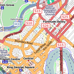
I took a well-earned break from stirring up licencing what-ifs to add in the new extension from Robina to Varsity Lakes station. A special shuttle train was running today (with me taking advantage), and revenue service commences in about 7 hours' time. So, time to flick the switch from "railway=construction" to "=rail"!

http://www.openstreetmap.org/browse/changeset/3362109

Location: Robina Dales, Robina, Gold Coast City, Queensland, 4230, Australia

as per http://nearmap.lefora.com/2009/11/12/edit-the-map-instructions/15826202/

If you're a NearMap (http://www.openstreetmap.org/user/JohnSmith/diary/8559) fan, you can now go to their website, have a cruise around their imagery with the "StreetMap" layer turned on, then when you see something not quite right, you can (now) click on their edit link and have a Potlatch screen (with the Nearmap imagery) come right up at the same spot. Genius!

Example URL: http://openstreetmap.org/edit?lat=-27.47223&lon=153.01384&zoom=19&tileurl=http%3A//www.nearmap.com/kh/zxy%3D%21%2C%21%2C%21

With any luck the quality of edits will snowball in the areas Nearmap have covered.

Location: 4101, West End, Greater Brisbane, Queensland, Australia

Vandalism on the Gold Coast

Posted by morb_au on 31 October 2009 in English.

Hmm ... first time I've seen obvious vandalism in "my" area... A little bit distressed that it's been there for most a year...

But hey, with the advent of the 0.6 API I can now go back over the contributor's history (e.g. http://www.openstreetmap.org/browse/changeset/115867, http://www.openstreetmap.org/browse/changeset/364929) and judge what, if anything, is legit.

Doesn't look good...

Location: Hope Island, Gold Coast City, Queensland, 4216, Australia

DCDB skew

Posted by morb_au on 8 October 2009 in English.

Those who've followed my conversations closely on talk-au will know that the DCDB geography is not always anchored to GPS - it's more concerned with the relationships between immediate parcels.

Anyway I've discovered another area - Kilcoy.

In my opinion the DCDB is about 8-10 metres south of where it "should" be given the GPS traces in the area. Fire up your copy of JOSM and see if you agree.

Note to self: Ask Queensland DERM how it wants to handle "bug reports" of this nature.

Location: Kilcoy, Somerset Regional, Queensland, Australia

Queensland DCDB - updated towns

Posted by morb_au on 5 October 2009 in English.

Now that we have access to the DCDB, I've had a crack at filling out some towns and railways.

Towns: Calliope, Nagoorin, Biloela, Moura, Theodore, Thangool.
Railways: Moura Short Line, Gladstone Monto Branch, Callide Valley Branch South, Dawson Valley Branch.

Up next: Emerald.

Yes there's a theme developing: Being interested in the railways since forever, in Queensland, coal haulage has been the peak activity, and I suppose the main economic base of the state as well. Looking at the Moura Mine (location of this diary entry), on the Yahoo Landsat imagery, I'd never realised for how long it stretched.

Location: Moura Mine, Kianga, Banana Shire, Queensland, Australia

As mentioned in recent talk-au mailing list posts, the mashup australia competition is now open and as a side effect we now have some lovely datasets available for the first time under CC-BY licencing.

I've converted and added the cadastre shapefile dataset to a WMS server. (Due to disk space constraints I've chosen to keep the geometry only, which is all you need if you want to trace medial lines for the basic route of highways, railways and waterways).

I've added the WMS connection and source details to this page:
http://wiki.openstreetmap.org/wiki/Australian_Data_Imports

Strictly speaking it's not a data import - I'm only using it to trace off. However if the OSM leadership would like to import 2.1 million property boundaries into the OSM database then please let me know.

For the impatient you can set a new WMS server entry in JOSM to the following address:
http://206.123.75.6/cgi/ms/mapserv?service=WMS&version=1.1.1&request=GetMap&layers=dcdb_lite_geometry&srs=EPSG:4326&format=image/png&map=../../mapserv/wms.osm.au.qld.map& (the last & is important!)
It will work up to about a 1:10000 scale, but at that point most street casements are only a handful of pixels wide.

Apparently my mapserver manual tells me it might also work as a WFS server as well, but I haven't had a chance to source a WFS client to verify.

I've been using it tonight to add in generic streets around Calliope (just inland from Gladstone), as per the location attached to this diary entry. It seems to have grown quite a bit since the effective-date of the ABS suburb import, especially towards the NE.

Other areas to benefit so far have been Springfield and North Lakes in the Brisbane metropolitan area.

Location: Calliope, Gladstone Regional, Queensland, Australia

I went for a drive along the Centenary Highway extension, opened not one week ago. Of course the GPX logger went along for a ride.

The approximate course of the highway was already plotted, but we could finally confirm things such as the "roundabout in the middle of nowhere". I understand it will eventually feed a future Swanbank industrial estate but right now it's not connected to anything. Think of it at a really expensive traffic calming measure for now.

Location: White Rock, Greater Brisbane, Queensland, Australia

Further to http://www.openstreetmap.org/user/morb_au/diary/5421

All the known QROTI positions have now been entered into OSM.

The merging took longer than I first estimated. Not simply because my neighbourhood mappers had already entered a lot of positions (not that I mind that), but also because the JOSM merging sometimes did not delete the "before" nodes. So there were a few duplicates around for a few days.

The next step is to backport some changes where the previous OSM position was clearly more up to date than the QROTI version. This is most obvious in the Waterworks Road and Lutwyche Road corridoors. i.e. it'll look like I've gone quiet for a while.

Next phase after that is to attach the QROTI routes to the stops just imported and/or complete the import of the rest of the QROTI stop metadata.

OSM Mapnik QROTI rendering preview (zoom level 14) OSM Mapnik QROTI rendering preview (zoom level 15) OSM Mapnik QROTI rendering preview (zoom level 15)

The above are preview tiles of an alternate Mapnik rendering that emphasises transport networks (including bus stop names). Just playing with it for now.

Location: 4152, Carina Heights, Greater Brisbane, Queensland, Australia

I've bitten the bullet and started importing the bus stops in earnest (search the wiki for the background of the QROTI import).

After a random smattering across Brisbane of the first 50 or so, now I'm uploading in a northerly direction. Therefore it's a bit like a glass filling up.

The southern suburbs of Brisbane were easy but now I'm running into previous contributors' work. The Merge Node action of JOSM is coming into heavy use now.

Currently the "tide mark" is in the Indooroopilly - Yeronga - Annerley region. I'm about 20% of the way through.

Keen observers will note that I haven't added all the attributes in yet. At the moment I've only added in just enough detail to make each stop unambiguous.

Location set to one of the more interesting areas of the network.

Location: 4122, Mount Gravatt East, Greater Brisbane, Queensland, Australia

Continuing from: http://www.openstreetmap.org/user/morb_au/diary/2012

(Was it really 7 months ago?)

I'm currently on the next tranche of feature alignment to local GPS traces. Areas covered this time are parts of Goodna, Richlands, Forest Lake. I'm sure itoworld's OSM Mapper will tally the exact cost in a day or so.

To recap, I'm realigning features from their apparent position in Yahoo imagery to their truer position compared to GPS traces in the area, an error of about 20 metres.

Location: 4078, The Peninsula, Forest Lake, Greater Brisbane, Queensland, Australia

re http://www.openstreetmap.org/user/morb_au/diary/2012

Earlier today I tracked through the suburbs of Mitchelton, Oxford Park, Everton Hills and Albany Creek, in particular the parts of the Yahoo imagery that are neither aligned "well enough" nor have a constant error (and would otherwise benefit from the space+drag hack in Potlatch). GPS traces are already uploaded. I was going to just drive around to record the GPS tracks, but I couldn't help but stop every once in a while to note down street names.

I uploaded the first batch on route using some new fangled mobile phone internet thingy (-: and osmarender had already refreshed the area by the time I got back home. That's pretty cool.

Not so cool will be the tedious task of shifting the ways that were aligned to the Yahoo imagery to the truer alignment of the GPS tracks. The area in question has a mix of yahoo- and gpx-traced roads so it's difficult to automate. This will take a bit longer to show up in the map. However as I bonus I discovered various little recent housing developments, so they'll show up too.

Finally I think I already covered most of slice 6 in the upcoming Albany Creek mapping party already. (-: Didn't notice the diary entry until I got back...

Location: 4053, Everton Park, Brisbane City, Queensland, Australia

Brisbane

Posted by morb_au on 29 December 2008 in English.

Hi diary, long time no write.

Over the weekend I was in the North Lakes area doing some "real" field mapping (as opposed to Yahoo armchair mapping). More recently I've done some mini-mapping* in the Sinnamon Park-Darra corridor as per the lat/lon of this diary entry.

Also recently took ownership of an Eee netbook + bluetooth + Haicom 408-BT. Much less cumbersome when out on the road but the Haicom doesn't quite have the sensitivity of the i-gotU. (MTK vs SirfStarIII chipsets respectively). Both are much more sensitive than my old Delorme Earthmate (SirfStar II) though.

* mini-mapping = addition of landuses, residental townhouse estates, etc.

Hi to awesm, David Dean, redsofa and AshKyd who I've been seeing adding quality edits to the Brisbane area recently (-:

Location: Jindalee Home, Jindalee, Greater Brisbane, Queensland, 4074, Australia

Boosting my OSM Geek Cred

Posted by morb_au on 16 August 2008 in English.

I went for a walk through downtown Brisbane last night, leaving a trail in OSM of newly-captured features through George Street, Charlotte Street and a little of Albert Street.

There's still some more of Charlotte Street, Edward Street and Adelaide Street left to enter into OSM. Let's hope the renderers don't choke on the newly dense crowds of POIs (-:

The capture method of choice was the voice memo recorder of my mobile phone. I think it blends in quite well in the crowd - simply pretend you're calling someone because you're "lost", and, well, you have to "describe" where you are to the phone!

Location: 4000, Brisbane City, Greater Brisbane, Queensland, Australia

High rise buildings in Potlatch

Posted by morb_au on 13 August 2008 in English.

Problem. You want to capture all those lovely high rise buildings in your city of your choice.

You know you need to take into account the parallax error (because the satellite photography is rarely straight down), but you can only see the roof of the building, not its position on the ground. What to do?

Well it may be obvious to some but I only worked it out today. Trace the top of the building anyway, and at the end just use Potlatch to slide the shape into place on the ground.

So much easier than estimating the offset in your head and kinda drawing with a tilt!

Location: 4000, Brisbane City, Greater Brisbane, Queensland, Australia

Hello,

I've started trying out mapping some bus routes in Brisbane from Chermside, through the Gympie Road corridor south through Kedron and Lutwyche.

The Potlatch support for relations worked very well except for one thing: It seems you can't display more than 16 attributes of a way at one time - including what relations it belongs to. This is a bit of a problem when a way has many bus routes!

Is there anything I'm missing? or should I just fire up JOSM for the tough bits?

Location: 4031, Kedron, Greater Brisbane, Queensland, Australia

Keen readers will know my battle against the Yahoo mis-georegistration in the western suburbs of Brisbane. Now I'm doing something about it.

Potlatch isn't up to do a man's job, so I've dusted off JOSM.

First suburb off the ranks is the Seventeen Mile Rocks area. So, if you're a Brisbanite and editing in that area, please line up the imagery to the existing street network rather than the other way around. In Potlatch you can drag the imagery around whilst holding the spacebar.

Location: 4075, Corinda, Greater Brisbane, Queensland, Australia

Springfield, Queensland is on the map

Posted by morb_au on 16 June 2008 in English.

Not the cartoon Springfield but a real masterplanned development south west of Brisbane. I wonder which name was dreamt up first - whilst the development of this Springfield CBD has only really occured in the last year or two, other parts of the Springfield development has been going on for maybe a decade.

Location: 4300, Brookwater, Greater Brisbane, Queensland, Australia

Brisbane Mappers,

I'm working on a hypothesis that there is a fairly consistent "landslip" in the high-resolution (zoom 17) Yahoo imagery in western Brisbane. If we can pin down the magnitude of the slip, we can then systematically apply a reverse correction whenever we map new areas from the imagery.

The hypothesis goes like this. If you look at the longitudes across western Brisbane, take the following values A, B1 and B2.

--- A --- ... --- B1 - B2 ---

Where
A = 152.866 E (west Redbank)
B1 = 152.965 E
B2 = 152.972 E (Inala, west Indooroopilly, Mitchelton, Strathpine)

West of A and east of B2, the imagery alignment seems fine (to within a handful of pixels, as compared to GPS trace logs).

Between A and B1 is the north-south "slip zone" of about one street width (fence to fence, maybe 20 metres) - i.e. the imagery is ~20m north of where it "should" be.

B1-B2 seems to be where the "fault line" lies - there seems to be a smooth graduation between the slip area to the west of B1 and the correct area to the east of B2.

I haven't worked out where the equivalent fault line area is through A, but we will probably find out where A1 and A2 is in due time.

More observations are of course desirable as I like to be proven right. (-:

Lat/Lon are of B1/B2 through Indooroopilly.

Location: 4068, Indooroopilly, Greater Brisbane, Queensland, Australia