My pandemic mapping project: Cheltenham addresses
Posted by nickjohnston on 31 May 2023 in English. Last updated on 14 February 2024.Cheltenham is a town of 116,000 people in south-west England. During the Covid-19 pandemic lockdowns, I spent lots of time collecting addresses in the town and adding them to the map.
Cheltenham is now better mapped than parts of London and many other cities and towns. If I can do it, you can do it too—and better still, you can learn from my experience and mistakes.
Why?
Address coverage in OpenStreetMap is still poor in many places. Good coverage is needed for better geocoding, which many users view as an integral part of a modern map.
During lockdown, many people relied on deliveries. Even now, a huge amount of time is wasted not so much in “last mile” delivery issues but “last few hundred metres” ones.
UK address data is not open, so addresses have to be surveyed or collected on the ground. This is tedious and repetitive, but there are some upsides. You’ll uncover mistakes in places which haven’t been touched on OpenStreetMap for years, and you’ll have the opportunity to improve geometry and alignment with the far better imagery now available.
Walking around your town or city is a great way of discovering new places and learning more about local history. Like many people, I’d heard of the mass trespass of Kinder Scout and how it ultimately led to greater access to the countryside. But I was unaware of earlier agitations here in Cheltenham over access to Leckhampton Hill. The hill is now part of the Cotswold Area of Outstanding Natural Beauty, crossed by the Cotswold Way National Trail which passes a memorial tree for one of the rioters.
Approach
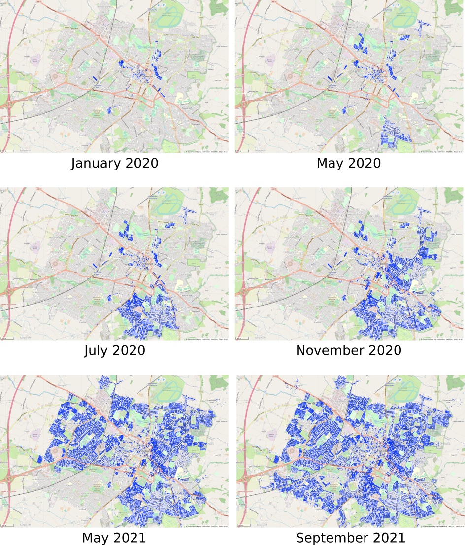
I started collecting addresses in earnest in mid-April 2020, continuing to August 2021. I collected addresses at least once per week but usually more. I’d walk for anywhere from 30 minutes to four hours at a time.
Initially I focused on part of the town. By concentrating my efforts there, progress was easier to visualise, helping to keep me motivated. (Please don’t use a “scattergun” approach; go street-by-street, mapping comprehensively.)
There are various mobile editors such as Vespucci and StreetComplete (which now has an overlay for addresses), and the more recent Every Door (which didn’t exist when I collected addresses). I didn’t use any of them. Instead, I collected data and added it at home later as:
- Mobile editors are fiddly to use, especially in wet and cold weather.
- Often you’ll find buildings that are missing, need to be split, rotated, re-aligned, etc. You could use mobile editors only for simple cases, but then you’d have to make more complicated changes with other editors later. I find it easier to use one editor.
Experiment and use what tools work for you; consider what follows as a suggestion.
Tools
OsmAnd
I collected addresses using OsmAnd, recording a GPS trace as I walked, adding waypoints for addresses. This is basic but flexible; you can easily note other things to be changed or added, and you’ll likely develop your own system of abbreviations to become more efficient.
Here’s what OsmAnd looked like on my phone after an address collection survey:

I copied the GPX files from OsmAnd to my laptop and opened them in JOSM.
JOSM
JOSM is great! Yes, it’s unusual to use at first, and some things about it still irritate me, but it’s so powerful. Take the time to learn it and you shall be rewarded.
Here are just a few of the things I find useful in JOSM.
A superior validator
JOSM’s validator is powerful. It warns for things like:
- Duplicate house numbers on the same street
- House number without a street
- Similarly named ways (can indicate typos)
The validator caught several of my mistakes.
Coloured Streets
JOSM offers lots of different rendering styles. Coloured Streets is really useful for addresses. It makes it easy to spot certain kinds of mistakes. A friend described it as “syntax highlighting for streets and addresses”, which is an interesting way of looking at it.
See my Coloured Streets diary post for more details.
Buildings tool
You’ll likely find missing buildings, and the JOSM buildings tool is fantastic for quickly adding buildings to the map in two or three clicks. You can easily make buildings parallel to others or to roads.
See also Mapbox’s excellent fast building tracing tutorial.
Often the buildings tool and extrude are mentioned together. That’s fine, and although extrude is very useful for buildings, it can be used for much more. You can extrude a node along a way, which is great if you want to extend a cul-de-sac’s final node while keeping the road straight.
Terracer
Terracer is excellent for splitting large blocks of terraced houses (also called row houses or townhouses) into individual houses.
Only late into my address mapping did I discover a useful time-saver: if you’re splitting a building into two semi-detached houses, you don’t need to enter the highest number. Terracer determines it for you. It’s a small saving but adds up.
Angle snapping
Angle snapping lets you add lines with fixed angles between segments.
Imagine you’re adding a driveway which runs perpendicular from a road and then turns 90°. With angle snapping, when you add a node, the next segment of the way can be at a precise 90° (or other angle) to the previous. No more fiddling trying to make sure the angle is exactly what you want.
Circle arc
Circle arc is part of the useful UtilsPlugin2 and makes it easy to create proper curves and corners. I use it for circles too, as JOSM’s built-in “Align nodes in circle” feature often produces poor results.
UtilsPlugin2 includes some other essential features:
- “Split area”: split a closed way between two points. Useful for splitting a complex or irregularly-shaped building into two semi-detached houses.
- “Add nodes at intersections”: this is useful if you’re adding a service road that goes through a building. Select the road and the building, and points will be added where the road and the building meet. Then you can split the road and tag the section that goes through the building as
covered=yes.
OSMUK cadastral parcels
During my address mapping, OSMUK created a public cadastral parcels overlay. You can show it on top of aerial imagery to see land parcel boundaries. It’s useful for figuring out how many houses are in a terrace, and also useful for alignment.
It’s available in iD and JOSM.
Overpass Turbo
Overpass Turbo allows you to query OSM data and visualise the results on a map. I used it for seeing which buildings were missing addresses:
[out:json][timeout:60][bbox:{{bbox}}];
// gather results
(
  way["building"]["addr:housename" !~ "."]
  ["addr:housenumber" !~ "."]["building" !~ "construction"];
);
out qt center meta;
… and also for visualising the addresses that I’d added:
[out:json][timeout:60][bbox:{{bbox}}];
// gather results
(
  nw["addr:housenumber"];
  nw["addr:housename"];
 );
nw._(newer:"2020-01-01T00:00:00Z")(user: "nickjohnston");
// print results
out center;
Leigh Dodds wrote an excellent Overpass QL tutorial if you want to learn more.
If Overpass Turbo seems like too much work, try Simon Poole’s QA map (tick “no address” or “has address”).
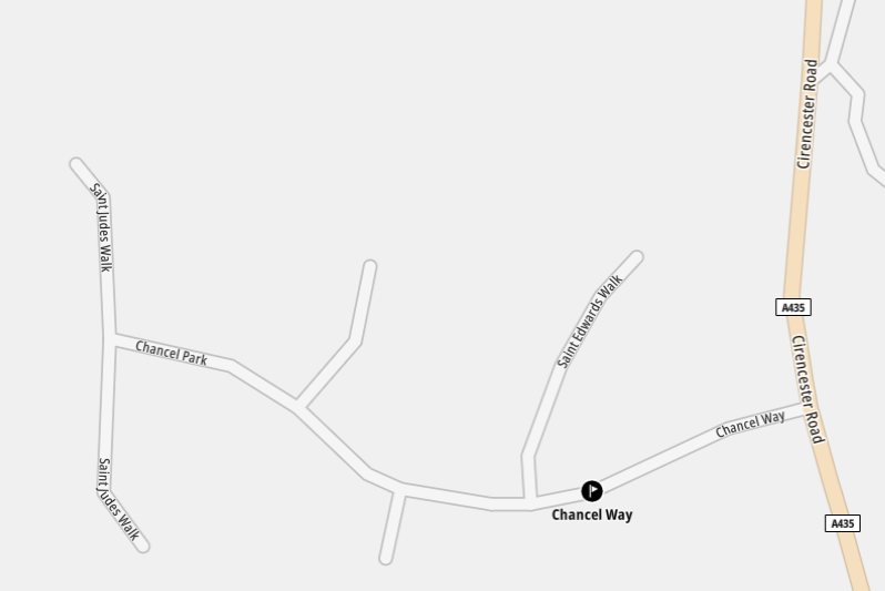
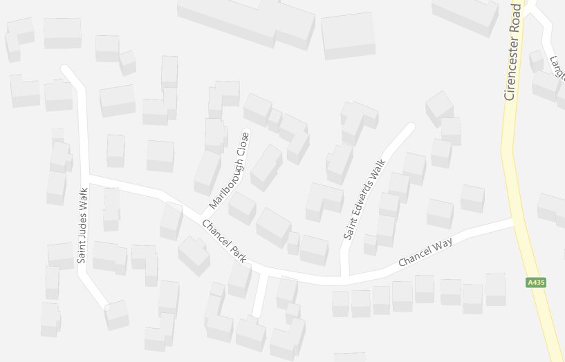
Strange addresses
You’ll soon discover plenty of strange addresses. My favourites are:
- A house with an address on a street that no longer exists (56 Worcester Street)
- Two houses numbered 10 on the same street (Upper Bath Street)
Advice
So you want to start collecting addresses? Great. Here’s some practical advice for surveys:
- Wear a high-visibility vest. Having people think you’re a delivery driver or parking warden is a lot better than a burglar.
- Bring a power bank and charging cable. If buying a new power bank, make sure it supports USB PD. Even if your current phone doesn’t support USB PD, it allows the power bank itself to be charged much more quickly.
- Keep your power bank inside a dry bag.
- Carry plenty of water and snacks.
- Don’t worry about people questioning you. There are far more friendly and interesting people than nasty ones. I’ve had many interesting conversations with people. A café owner even gave me a doughnut for free!
Some thoughts on attribution
Attribution can be a controversial topic within the OpenStreetMap community. Many people believe in clear, on-map attribution for maps based on OpenStreetMap data. Others are happy for attribution to be shown only when tapping an “i” or similar icon.
Now that I’ve spent hour upon hour out in rain, sun, snow, wind, heat, and cold collecting data (and later adding it to the map), I better understand why people feel so strongly about this. I’ve used OsmAnd so much that static parts of its UI are burned into my phone’s OLED screen. I’ve had a bird poo on me. Someone called the police who stopped and questioned me. So I’d say it’s not too much to ask that people attribute OpenStreetMap clearly and directly.
Visualisation of my progress
Pro-tip: with this tiny bit of MapCSS, Overpass Turbo results for buildings without an address are much clearer (small markers):
{{style:
node, way, relation {
  symbol-size: 1;
}
}}
Some thanks
Huge thanks to people in the #osm-gb IRC channel for their help, advice, and encouragement.
Also thanks to a friend (you know who you are) who twice gave me snacks and cold drinks when I was surveying near his house.