OpenStreetMap logo OpenStreetMap

pratikyadav's Diary

Recent diary entries

All Mapbox users, using an access token from their own account, are allowed to create derivatives from Mapbox Satellite for contribution to OpenStreetMap via manual or automated processes for free.

Guidelines

  • All extractions must be non-commerical or OSM-improving. Examples:
    • an academic researcher could use the imagery for a non-OSM use
    • a company or individual could use the imagery for adding to OSM
  • All use of this service is subject to the Mapbox TOS, with a link to our TOS.
  • If you have another purpose for your extractions, get in touch with us via sales@mapbox.com.
  • You’ll need to have a Mapbox account and to use a token from your Mapbox account for all your ML requests. This will help us interpret any traffic issues and communicate with you if they come up.
  • Safe rate limit for downloading satellite tiles is 100 request per second. If you want to exceed that rate, please reach out to community@mapbox.com .

Whether powered by machine learning or not, we’d love to hear about your imagery use cases. And as always, if you have any questions, please reach out to us!

We recently rolled out 8.2 million km² of high-resolution satellite imagery from DigitalGlobe to our base map. Read more about it here → https://blog.mapbox.com/updating-8-2-million-km%C2%B2-of-high-resolution-satellite-imagery-b68070bdf4b2

All this imagery is available to be used by OpenStreetMap contributors for mapping! 🎉

Here is a breakout of the extents:

Asia Major cities and urban corridors in Middle East, India, China, Turkey, Vietnam, Thailand, Malaysia, South Korea, Indonesia, and the Philippines.

Africa Egypt and parts of Kenya.

Europe Major cities in Poland, Ukraine, Romania, Iceland, and Hungary. Also Paris and Moscow.

South America Major parts of Brazil, Paraguay, Uruguay, Argentina, and Chile.

North America Large parts of Mexico, Cuba, and Central America, along with southern cities of Canada.

This imagery will enable mappers to trace intricate details like buildings intrusions, turn lanes, trees and so much more! Happy mapping! 🌐

Rio de Janeiro Rio de generio

Floating logs in Vancouver Floating logs in Vancouver

Ijen volcano East Java, Indonesia Ijen volcano  East Java Indonesia

The new Presidential Palace, Abu Dhabi (UAE)  The new Presidential Palace, Abu Dhabi (UAE)

FAQ

Mapping: All this imagery is licensed for OSM tracing use.

Source: All this imagery is provided by DigitalGlobe from its satellites.

Date: Varies. We do not publish fine-grained date metadata, but we know it’s important to OSM and we hope to provide it in the future.

Local problems with imagery, requests to prioritize specific areas, and other feedback: Please submit through this form →https://www.mapbox.com/feedback/satellite/

Joining HOT

Posted by pratikyadav on 6 February 2017 in English.

I am PratikYadav and I work with Mapbox based in Bangalore, India. I came to know about OpenStreetMap and HOT after joining Mabox two years ago and been involved with both of them ever since. I started with taking part in the HOT projects where Mapbox team joins to help HOT in mapping and validation of various tasks over the year.From past few, month I have been working with HOT imagery coordination group to make sure the the request coming for imagrey can be quickly processed by Mapbox.

I worked with Mikel last year to understand the spatial spread of all past HOT tasks. 1

I am a big fan of HOT’s work specially the concept of involving remote-volenters who are willing to help and link them to the people actually using these information on ground. My sepecific intrest this year will be to facilitate imagery coodination so that the most clear and recent imagery can be provided to mapping volenteers during crisis and how can we pre-identify and improve imagery coverage at hot spots. I talked about this last year at HOT summit (slides) and very excited to work with larger HOT team around this.

Location: 37.764, -122.434

We just updated Mapbox basemap imagery in Washington, DC with 2015 aerial imagery at 3 inch (7.5 cm) resolution.

DC-3 
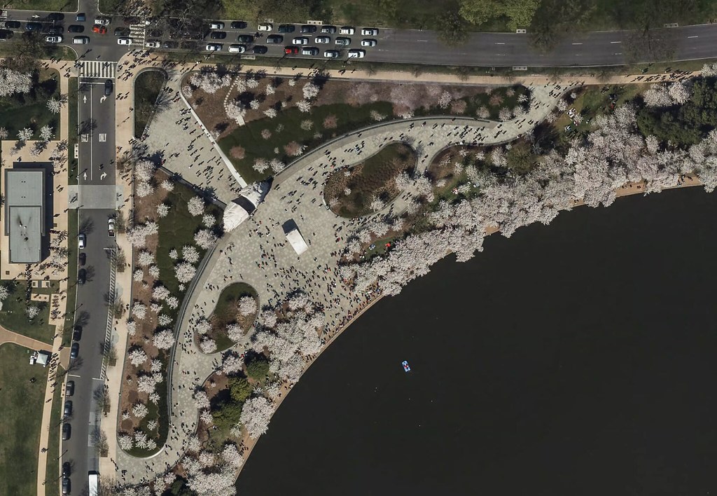
Cherry blossoms at the Martin Luther King, Jr. Memorial

The source data is openly licensed by DC.gov, thanks to the District’s open data initiative.

The imagery is ready for tracing in OpenStreetMap, where its high resolution will help with detail mapping for buildings, parks, and navigation features like turn lanes.

Happy mapping!!

screen shot 2016-08-11 at 4 16 52 pm

http://www.bhopalmunicipal.com/city-information/informative-map.html

नगर पालिका भोपाल द्वारा प्रकाशित नक्शा जो के सारे वार्डस को दिखता है.

OSM पर यह जानकारी अभी नहीं है.

English version

Published by Bhopal Municipal Corporation, the map shows all admin-wards.

The information is not yet in OSM and could be a good addition.

Location: Peer Gate Area, Ibrahimpura, Bhopal, Huzur Tahsil, Bhopal District, Madhya Pradesh, 462001, India

Open Peer Review Process at Mapbox

Posted by pratikyadav on 20 April 2016 in English. Last updated on 25 April 2016.

As part of the Mapbox Data team, we make sure that our contributions to OpenStreetMap from our mapping projects, through user feedback and support to HOT activations are at par with the OpenStreetMap data quality standards. One of the ways we check data quality is through our weekly manual peer review process.

To be more open towards our QA processes, we are bringing our manual peer review accessible for anyone to participate.

cwe5a3kxiaact3a

The process of manual peer review are as follows:

  • Every Wednesday a new Peer Review Ticket will be opened in our mapping repo with the following information:
  • List of projects the team worked on last week;
  • Link to each member’s edits (in .osm format) extracted using osm-history-processor
  • Instructions on loading data to JOSM.

  • After loading the data for a specific team member in JOSM, we compare the edits to the latest data.
  • We use JOSM filters to see only the edits of a specific team member.
  • We review quality based on the context of the mapping project. Specifically, we look for:
  • proper tags used;
  • geometric accuracy;
  • common mistakes like overlapping way, roads that need splitting, unconnected roads, etc.

  • The reviews are compiled as ticket comments for each team member providing links to changeset/ways/nodes that should be fixed.
  • Each team members will check all reported issues and correct the edit if necessary. In case of disagreements, we use changeset comments to discuss specific edits.

Aside from the manual peer review, we also run daily automated error detection with OSMLint and validation using the Tasking Manager.

We invite the community to take part in the process and improve workflow. Feel free to comment on the peer review ticket to report any quality issues in our edits.

Happy mapping.

HOT Global Footprint

Posted by pratikyadav on 15 February 2016 in English.

Last month I worked on a map of all HOT tasks (until January 5, 2016).

screen shot 2016-01-08 at 5 13 57 pm

The map is available at http://pratikyadav.github.io/HOT-Task-Map

You can read more about it at https://hotosm.org/updates/2016-02-08_the_global_footprint_of_hot

If you are interested in the code and shapefile of the task, then see this repo at GitHub https://github.com/pratikyadav/HOT-Task-Map

I prefer staying on JOSM while mapping and try to find missing features using satellite imagery. This becomes hard sometimes as one has to download OSM data to actually see if that feature (building, road, waterway etc) is present or not. To make this a little simple, I use custom Mapbox layers made using Mapbox Studio Classic.

The url of the layer created will be something like https://api.mapbox.com/v4/pratikyadav.93f1df6f/page.html?access_token=pk.eyJ1IjoicHJhdGlreWFkYXYiLCJhIjoiMTA2YWUxNjRkNmFmZGQ4YzAxZWFiNDk0NDM1YjE1YjAifQ.4P6N5dNmA_WQXd3BsJvu5w#14/23.2687/77.3938

Add tms[99]: at the start of the layer url, remove zoom/lat/log from the end and replace page.html? with {zoom}/{x}/{y}.png?.

The new TMS url ready to be used in JOSM will look something like this-

tms[99]:https://api.mapbox.com/v4/pratikyadav.93f1df6f/{zoom}/{x}/{y}.png?access_token=pk.eyJ1IjoicHJhdGlreWFkYXYiLCJhIjoiMTA2YWUxNjRkNmFmZGQ4YzAxZWFiNDk0NDM1YjE1YjAifQ.4P6N5dNmA_WQXd3BsJvu5w

Open imagery preferences in JOSM and use add new tms tab to add the layer url and layer name.

Roads

tms[99]:https://api.mapbox.com/v4/pratikyadav.93f1df6f/{zoom}/{x}/{y}.png?access_token=pk.eyJ1IjoicHJhdGlreWFkYXYiLCJhIjoiMTA2YWUxNjRkNmFmZGQ4YzAxZWFiNDk0NDM1YjE1YjAifQ.4P6N5dNmA_WQXd3BsJvu5w

screen shot 2015-12-26 at 12 09 19 pm Missing service roads

Buildings

tms[99]:https://api.mapbox.com/v4/pratikyadav.332dd523/{zoom}/{x}/{y}.png?access_token=pk.eyJ1IjoicHJhdGlreWFkYXYiLCJhIjoiMTA2YWUxNjRkNmFmZGQ4YzAxZWFiNDk0NDM1YjE1YjAifQ.4P6N5dNmA_WQXd3BsJvu5w

screen shot 2015-12-26 at 12 10 17 pm Missing buildings

Water and Waterways

tms[99]:https://api.mapbox.com/v4/pratikyadav.93b9339f/{zoom}/{x}/{y}.png?access_token=pk.eyJ1IjoicHJhdGlreWFkYXYiLCJhIjoiMTA2YWUxNjRkNmFmZGQ4YzAxZWFiNDk0NDM1YjE1YjAifQ.4P6N5dNmA_WQXd3BsJvu5w

screen shot 2015-12-26 at 12 12 25 pm Incomplete waterway

Landuse

tms[99]:https://api.mapbox.com/v4/pratikyadav.4417f8bf/{zoom}/{x}/{y}.png?access_token=pk.eyJ1IjoicHJhdGlreWFkYXYiLCJhIjoiMTA2YWUxNjRkNmFmZGQ4YzAxZWFiNDk0NDM1YjE1YjAifQ.4P6N5dNmA_WQXd3BsJvu5w

screen shot 2015-12-26 at 12 29 56 pm Missing parking areas

Road names

tms[99]:https://api.mapbox.com/v4/pratikyadav.640d9a4d/{zoom}/{x}/{y}.png?access_token=pk.eyJ1IjoicHJhdGlreWFkYXYiLCJhIjoiMTA2YWUxNjRkNmFmZGQ4YzAxZWFiNDk0NDM1YjE1YjAifQ.4P6N5dNmA_WQXd3BsJvu5w

screen shot 2015-12-26 at 12 28 59 pm Road without name tag in red color

Admin level 2 boundary

tms[99]:https://api.mapbox.com/v4/pratikyadav.60790d53/{zoom}/{x}/{y}.png?access_token=pk.eyJ1IjoicHJhdGlreWFkYXYiLCJhIjoiMTA2YWUxNjRkNmFmZGQ4YzAxZWFiNDk0NDM1YjE1YjAifQ.4P6N5dNmA_WQXd3BsJvu5w

screen shot 2015-12-26 at 12 28 18 pm

Happy Mapping

Mapbox Mapping Project Guide

Posted by pratikyadav on 17 December 2015 in English.

Over the last few months, we’ve begun and completed several mapping projects. As our team has grown, we’ve needed clear guidance for the team to run a lead a mapping task from inception to completion in line with the best practices of mapping and ensuring the highest quality of contributions to the map.

12314225_818843284893542_7459455561395015025_o Mapbox team during a mapping huddle

We have put together a simple guide to how the data team approaches a mapping project on OSM.

Broadly the guide provides a checklist for a project lead to work through during the different phases of a mapping project:

  • Inception : Background research on the project and identify the Why? question.
  • Getting Started : Capture scope, tools and mapping workflow on a ticket.
  • Trial Workflow : Involve the community in a clear and effective mapping workflow. Do a trial run with a small team to find do's and don't.
  • Scale Up : Train the whole team for scaling up the project.
  • Mapping : Publicise the project on relevent channels and involving active members of local OSM community. Constantly monitor progress, and identify tools and process to improve the workflow.
  • Wrap Up : Improve mapping documentation, capture statistics and publish a final report on the OSM diary.

We invite everyone to have a look at our Mapping Project Guide, and give us feedback, or track any of our recent and ongoing projects in the Mapbox mapping repository.

Chennai Flood

Posted by pratikyadav on 3 December 2015 in English.

The south Indian city of Chennai is facing one of the biggest floods in a century with close to 120 cm rainfall this month. It has already claimed 200 lives and has affected the lives of over 6 million residents. The meteorological department has forcasted more rain in the next 48 hours and the situation has been termed crucial.

cvr6ffwuaaanest

Source: twitter

Members of the Indian OSM community created tool to crowdsource reports of flooding, and has recieved reports of over 5700 flooded streets in 48 hours. Check the flood-map to see the extent of flooding in the city.

pz3uo4y

The inner city part of Chennai city is well traced but the outskirts still miss a lot of details in road network. We have setup a project on the tasking manager to trace out these missing roads and waterways.

!screen shot 2015-12-03 at 11 55 12 am

Please join the project when you get time to improve the road coverage around Chennai which can be used to report more flooded streets: http://tasks.openstreetmap.in/project/62

Location: Ward 58, Zone 5 Royapuram, Chennai, Chennai District, Tamil Nadu, 600001, India

Tokyo Road Improvement

Posted by pratikyadav on 9 November 2015 in English.

As part of the Japan Road improvement series, we just completed the most important project of aligning major roads in Tokyo to orthorectified imagery from GSI using the tasking manager.

screen shot 2015-11-09 at 2 46 13 pm

The project included: - Realigning and merging major highways (motorway, trunk, primary and secondary) - Create dual carriageways on divided highways with link roads and correct oneways

Compared to the previous road improvement projects concluded in Japan (Kyushu , Osaka , Mito , Fukushima , Ishikawa , Beppu-Oita , Aomori and North Mutsu ), Tokyo was in better state in terms of road alignment with GSI imagery.

screen shot 2015-11-05 at 2 04 35 pm

The project included 630 task blocks and had a total participation of 31 mappers from both the Japan OSM community and the Mapbox Data team which supported the project with the entire team of 19 mappers.

screen shot 2015-11-09 at 3 23 04 pm screen shot 2015-11-09 at 3 22 41 pm Students from Aoyama Gakuin University took part in the task using id-editor and posted there progress on the mapping ticket

To make it easy for non English contributors, the instructions have been made available in Japanese, Spanish and Russian.

Join us in the next project of realigning roads in the Nagoya region

You can read more about the Data issues in Japan (Japanese version) and keep a track of the data cleanup progress on our public Mapbox mapping project tracker.

In light of the previous post by planemad and MAPconcierge about major road realignment issues in Japan, OSM Japan community is now focusing on fixing roads in Tokyo and surrounding areas.

2015-10-23 12 51 42 TeachOSM Tasking Manager for Tokyo. http://tasks.teachosm.org/project/91

The objective is to:

  • Realign and merge major highways (motorway, trunk, primary and secondary)
  • Create dual carriageways on major highways with link roads and correct oneways

Being the country’s capital, and host to many Japanese mappers, the overall quality of data is very good. But, another pass of review can certainly improve the data.

Come join your hands with Japan OSM community by contributing to this task. The instructions are available in English, Japanese, and Russian, hit me or MAPconcierge if you want to translate in your own language.

Visit http://tasks.teachosm.org/project/91 for details on how to map.

Happy Mapping.

भारत की सबसे जायद उपयोग में आने वाली भाषा हिंदी है. परन्तु ओपन स्ट्रीट मैप पे हिंदी टैग्स की संख्या काफी काम है. टैग इन्फो के माध्यम से देखा जा सकता है की हिंदी भाषीय टैग्स की कुल गिनती केवल २३०९ है. इनमे से ४३१ नोड्स भारत के अंदर आते है.

screen shot 2015-10-13 at 4 06 38 pm

भारत में जयदतर हिंदी टैग्स केवल बड़े शहर में सिमित है.

screen shot 2015-10-13 at 3 47 13 pm

मैप को देखने के लिए उसपे क्लिक करे

हिंदी टैग्स को किसी भी नोड में समलित करना काफी आसान है. इसके लिए जो टैग उपयोग किया जाता है वो है name:hi. जैसे- अगर आपको किसी सड़क का हिंदी नाम हिंदी में पता है तो आप उसे name:hi=महातम गांधी मार्ग टैग से नोड /वे में जोड़ सकते है.

उपयोगिता -

मानचित्र (आसान भाषा में मैप ) की खािसत ये होती है की वो सभी लोगो के काम आजाता है. हिंदी मैप के माध्यम से वो सरे लोग भी ओपन स्ट्रीट मैप का इस्तेमाल कर सकते है जो सिर्फ हिंदी भाषा का उपयोग करते है.

आपके द्वारा जोड़ी गए टैग्स उसी समय ओपन स्ट्रीट मैप पे यहाँ देखे जा सकते है -

ओपन स्ट्रीट मैप के बारे में और जानकारी के लिए निचे दिए गए लिंक्स देखे - http://overpass-turbo.eu/s/bZT

Mapping Streams in Mountain Areas

Posted by pratikyadav on 17 August 2015 in English.

Some tricks to map Streams in Mountain Area.

Mapping streams/rivers in mountain region could be very tricky. Sometimes it’s difficult to differentiate between the valley and the peaks. Other times the imagery is covered with cloud, snow or not visible due to the shadow. image Satellite Image showing parts of Gangotri National Park, India.

A few steps can be very helpful to deal with such problems.

Overview of the area

Before jumping into the task of mapping, take some time to have an overview of the whole area. This helps to have a better understanding of the region.

Switching between layers

Better to select the layer that best shows your interest features clearly. A better resolution imagery is not always the best one.

Using terrain layer

Basic knowledge contours could be very helpful while tracing rivers and streams, specially when hill shadow makes it difficult to see the riverbed. It helps to differentiate between peaks and valley. Also, you can easily find the way of the stream. Try using a combination of both terrain data and satellite imagery, works best.

Bottom to top approach

Water always flows from higher ground to lower(into the sea). Better to mark the big streams first, one which are major rivers and easily visible. Now try to upstream connecting small streams. Won’t be a good thing to leave a stream going nowhere

What not to mark?

Mountain regions are filled with landslides and very small seasonal streams. It’s very difficult to defferntiate between them. What is the correct way to map them? natural=scree,hazard_type=landslide or waterway=stream & intermittent=yes? What do you think?

image

Happy Mapping.

Location: Peer Gate Area, Ibrahimpura, Bhopal, Huzur Tahsil, Bhopal District, Madhya Pradesh, 462001, India