
sagarawrz07
- Mapper since:
- November 09, 2016
About me
- I am a historian who enjoys cartography, historical maps and is interested in Spatial Turn.
- Currently looking to learn more about the Historic Urban Landscape framework
- Graduate studies in techno humanities, data viz, and GIS
- Particular interest in disaster response
- Part of the Humanitarian OpenStreetMap Team as an Information Manager
- Nomad “based” in Panama; mapping done outside, ID, MapRoullette, or Tasking Manager, is usually ground-truthed.
- Love trying new apps, currently using on and off: StreetComplete, Every Door, OsmAnd, Vespucci, pic4review, and Organic Maps. Please recommend any you know :)
Languages: Spanish, English, and French – learning Russian
Some of my favorite maps are:
- 1720 , Antonio Alvarez, Alarife Mayor de la Ciudad y Miguel Rivera, one of the maps that got me into urbanism, it was so unexpected to find how people in XVIII in the Americas had maps depicting trash collection for planning.
- Plano de la Ciudad de México, Pedro Arrieta, seeing one of the cities where I grew up represented in such detail got me interested in New Spain as a study subject.
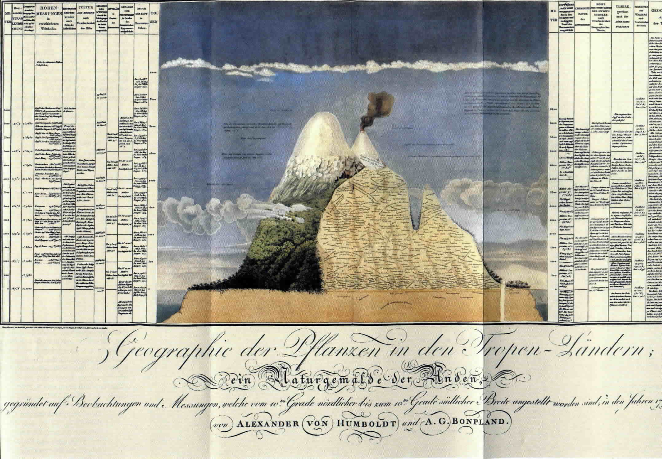
- Humboldt Maps and infographics also Naturgemalde der Ande, a cross between map and infographic that set a standard and is an early example of conceiving nature as an ecosystem. This graphic shows how Humboldt was able to see unity and variety and the importance of location for de development of organisms.
- Japanese Maps, the use of color and contrast to call the viewer attention is beautiful, as it is the “minimalist” approach and use of negative space.
- Saint-Bélec slab, a large representation that appears to be depicting political boundaries and resources from the Bronze Age.
- The Map of the Inca Empire inside the Quoricancha Temple in Cuzco, such a different way to represent distance and space!
- The first photograph ever made showing the division between the troposhere and the stratosphere and also the actual curvature of the earth, early sights of a new way to look at the earth and abstract/represent it from high altitud.
- Martin Behaim’s Erdapfel Globe, 1492, world’s oldest extant globe. Texts and drawings – especially in to fill the “void” – are great insights into the “cosmic vision” of those times.