Loading...
Way History: 132071461
Version #6
Konkretisierungen im Neubau Gebiet dipps
- Edited by Pitcom2017
- Changeset #70342419
Tags
Nodes
7 nodes
- 1453572520
- 2435307830 (part of way 235478011)
- 1453572521
- 1453572514
- 1453572513
- 1776140220
- 1453572520
Version #5
(no comment)
Tags
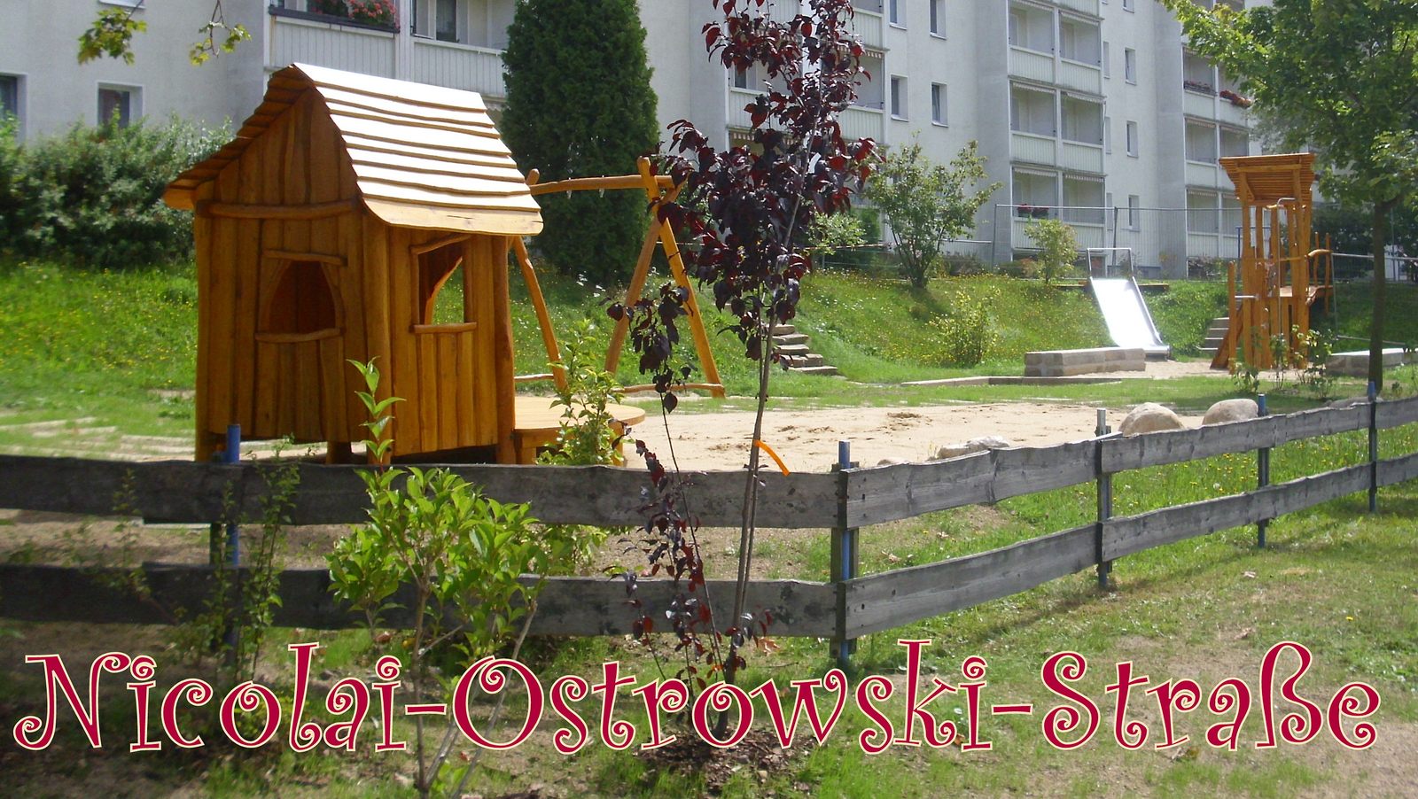
| image | http://wiki.openstreetmap.org/w/images/6/6a/Dippoldiswalde_Spielplatz_Nicolai-Ostrowski_Stra%C3%9Fe.jpg |
|---|---|
| leisure | playground |
| website | http://schmiedeberg.xobor.de/f38-Kinderspielplaetze.html |
Nodes
7 nodes
- 1453572520
- 2435307830 (part of way 235478011)
- 1453572521
- 1453572514
- 1453572513
- 1776140220
- 1453572520
Version #4
Spielplätze Dippoldiswalde image website und korr.
Tags
| image | http://wiki.openstreetmap.org/w/images/6/6a/Dippoldiswalde_Spielplatz_Nicolai-Ostrowski_Stra%C3%9Fe.jpg |
|---|---|
| leisure | playground |
| website | http://schmiedeberg.xobor.de/f38-Kinderspielplaetze.html |
Nodes
Version #3
Wasserwacht an der Talsperre Malter und Weidegut Paulsdorf
Tags
| image | http://files.homepagemodules.de/b563523/pictures_u292_c9fddf.jpg |
|---|---|
| leisure | playground |
| website | http://schmiedeberg.xobor.de/g26p292-Nicolai-Ostrowski-Strasse.html |
Nodes
Welcome to OpenStreetMap!
OpenStreetMap is a map of the world, created by people like you and free to use under an open license.
Hosting is supported by Fastly, OSMF corporate members, and other partners.
| https://openstreetmap.org/copyright | https://openstreetmap.org |
| Copyright OpenStreetMap and contributors, under an open license | |