Changeset: 57882545
More buildings in Bergen
Closed by galrot
Tags
| changesets_count | 17 |
|---|---|
| created_by | iD 2.7.1 |
| host | https://www.openstreetmap.org/edit |
| imagery_used | Bing aerial imagery |
| locale | en-US |
Discussion
-
Comment from FredrikLindseth
Hei galrot,
and welcome to OpenStreetMap.
If you have a look at the map now you can see that many of your builds are overlapping roads and other objects already in the map.The aerial imagery from Bing is poorly offset and have to be adjusted/corrected before drawing buildings.
One alternative is to use the Digital Globe Premium and Standard imagery along with Bing and see what fits best. All the roads are imported from Kartverket, so you can use that to adjust against.
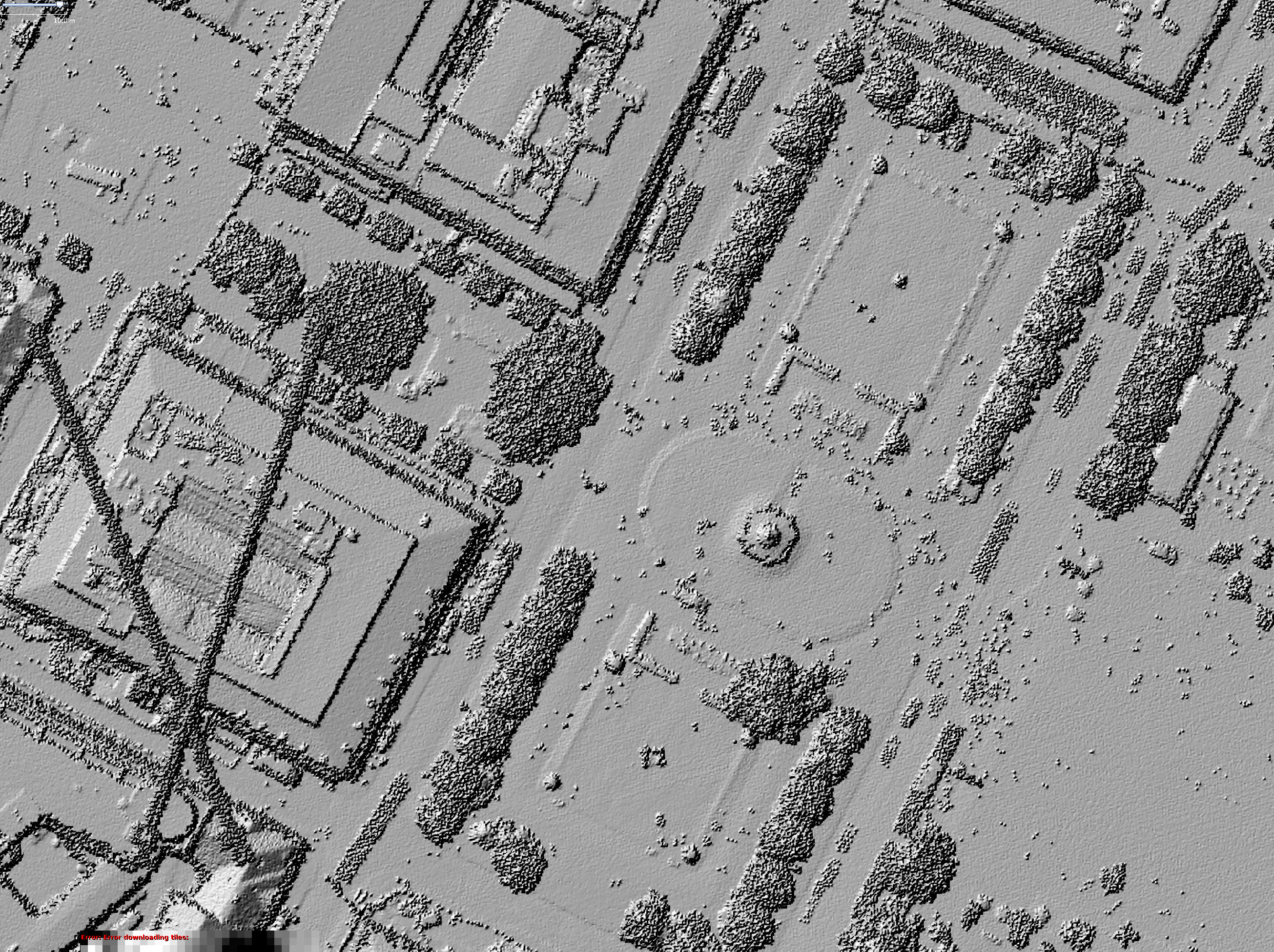
Another possibility is to use another editor like JOSM and use the laser scans. They have a very good resolution and its easy to see the buildings, see here https://wiki.openstreetmap.org/w/images/4/4f/LidarBergen10pkt_zoomedIn.png
Good luck!
-
Comment from galrot
Hey. Sorry, that was not my intention. I have now downloaded the JOSM editior to try that one out instead, but where do I find the laser view?
-
Comment from FredrikLindseth
I tried to write an explanation of how to get this here https://wiki.openstreetmap.org/wiki/Bergen_(Norway)#Imagery
Just send me a message if you have any questions. You can also ask on the forum https://forum.openstreetmap.org/viewforum.php?id=68 or the chat room http://webchat.oftc.net/?channels=osm-no
There are always active people in the chat room :-)
Ways (6)
Nodes (1-20 of 25)
- 1
- 2
Welcome to OpenStreetMap!
OpenStreetMap is a map of the world, created by people like you and free to use under an open license.
Hosting is supported by Fastly, OSMF corporate members, and other partners.
| https://openstreetmap.org/copyright | https://openstreetmap.org |
| Copyright OpenStreetMap and contributors, under an open license | |