OpenStreetMap

Ævar Arnfjörð Bjarmason's Diary

Recent diary entries

Interesting things have been happening for OpenStreetMap in Iceland recently. The city of Reykjavík just approved that they'll be commissioning an interactive cycle and pedestrian map base on "open data" (aka. OpenStreetMap data). And there are upcoming talks between OpenStreetMap contributors on Iceland and the city's own GIS team, perhaps we'll get a data donation as well.

The background is that the minority Independence Party with Gísli Marteinn Baldursson (a member of Reykjavík city council and cycle enthusiast) made the news in Iceland recently with Gísli's suggestion that they city commission an interactive cycle map for the city. Gísli pointed out that Seattle already had such a map, linking to Ride The City, a cycle map based on OpenStreetMap data.

I, Björgvin Ragnarsson and others in the Icelandic OpenStreetMap community promptly responded (in Icelandic) that numerous such websites for Iceland already existed based on OpenStreetMap data. And that the city's resources would be best spent not by commissioning their own proprietary system (as they've done for their bus network routing), but instead that they should contribute to such open data efforts.

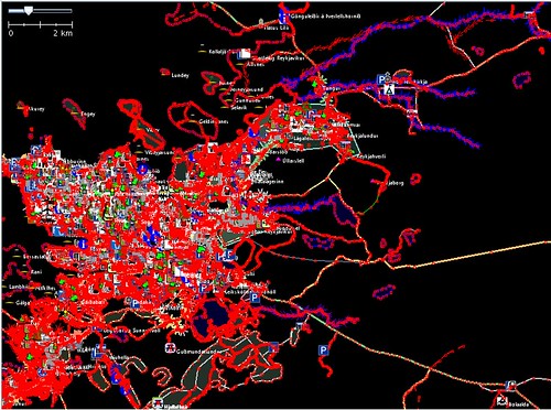
To reinforce the point we bought hjolavefsja.is (literally: cyclemap.is) and worked with the fantastic guys at Ride The City to make a cycle map for Reykjavík with an Icelandic interface in a hurry. They did all the work, we just contributed the translation.

Gísli and others in government liked the idea, and approved it formally at a recent meeting.

The relevant part is article 8 which states that the city will commission an online cyclemap and pedestrian routing application, and that its implementation shall use open source software and open geodata.

As if that wasn't good enough Björgvin and others will be having a meeting with the city's GIS department.

We have no idea what'll come out of it, but the city has an award-winning GIS database that includes basically every man-made object within the city limits (including streets, sidewalks, water pipes and contours every dozen centimeters or so) in vector format. We have no idea what if anything we'll get from them, but this could end up being one of the biggest (measured in sheer detail) data contributions in OpenStreetMap's history.

Oh, and for the meeting we want to show them the area on the OpenStreetMap planet with the best cycle coverage. I know about bestofosm.org, but I don't know what to pick. Suggestions?

Location: Miðbær, Miðborg, Reykjavik, Capital Region, Iceland

hjólavefsjá.is er komin hálfa leiðina í loftið. Ëg fjallaði áður um þörfina á þessu verkefni í fyrri bloggpósti.

Hér er líka önnur grein um verkefnið, Gísli Marteinn tekur vel í þetta, vonandi kemur eitthvað haldbært út úr þessu.

Location: Laufás, Miðborg, Reykjavíkurborg, Höfuðborgarsvæðið, Ísland

Í dag lögðu fulltrúar D-listans í Reykjavík fram tillögu þess efnis að gerð verði hjólavefsjá fyrir Reykjavík. Gísli Marteinn Baldursson - sem áður hefur beitt sér fyrir málefnum hjólreiðafólks - greinir frá þessu á blogginu sínu, og umfjöllun má einnig nálgast á mbl.is og visir.is.

Grunnhugmyndin er góð, Gísli Marteinn bendir á máli sínu til stuðnings viðlíka hjólavefsjá fyrir Seattle, og virðist leggja til (ég hef ekki lesið sjálfa greinagerðina) að Reykjavík búi til álíka vefviðmót fyrir sína sýn, og nefnir þar strætó.is máli sínu til stuðnings.

Slíkir vefir eru nothæfir, en það er hægt að gera mun betur með meiri áherslu á frjáls gögn en einstaka vefi.

Vefurinn fyrir Seattle er ekkert nema þunn sýn á OpenStreetMap kortagögnin, og er varla meira en dagsverk að búa svona sýn til. Seattle kortasýnin notar CloudMade forritunarviðmótið fyrir sína vegvísun, og er hægt að nálgast álíka sýn fyrir Reykjavík bæði á vef CloudMade, og á fjölmörgum öðrum vefum eins og OpenRouteService, YOURS og fleiri. Sjálfur viðheld ég t.d. hjólakorti af Íslandi fyrir Garmin tæki byggt á OpenStreetMap gögnunum.

Það eina sem borgin þarf að gera til að bæta þessar og aðrar hjólavefsjár er gefa út gögn sem eins og Gísli bendir á "[eru] til í tölvukerfum borgarinnar" undir frjálsu notkunarleyfi.

Sjálfboðaliðar eins og ég munu þá flytja gögnin inn á OpenStreetMap þar sem þau munu blandast saman við viðlíka gögn sem eru til fyrir allan heiminn. Þá munu gögnin ekki aðeins vera nothæf á einni kortasjá sem borgin heldur við, heldur á þúsundum kortasjám af ýmsum gerðum, bæði í prenti, á vefnum og farsímum o.s.f.

Reykjavík ætti ekki að vera gera aðra strætó.is, heldur gefa út grunngögnin sem þarf til að byggja slíka vefi. Ríkisstjórnir og bæjarfélög annars staðar í heiminum eru óðum að uppgötva verðmæti þess að deila gögnum á þennan hátt.

Reykjavík ætti að ganga þeim til liðs, og gæti verið í fararbroddi í þessum efnum. Frjáls gögn eru fjárfesting til framtíðar, og ágoðinn af þeim er mun meiri og varanlegri heldur en ein kortasjá

Gísla Marteini og öðrum er boðið að ræða þessi mál við OpenStreetMap samfélagið á Íslandi.

Location: Austurbær, Miðborg, Reykjavíkurborg, Höfuðborgarsvæðið, 101, Ísland

You can no longer sign up for a new account without agreeing to the new contributor terms. They're long and legalese, here's an attempt at shortening them to something human readable.

Suggestions welcome. I think we should offer something like this (but obviously better worded) to explain what the terms mean to people who don't feel like reading a wall of defensive legalise.


  • You promise only to submit content that you have permission to submit, e.g. stuff you made.

  • You grant the OpenStreetMap foundation an irrevocable license to do anything with your content, forever.

  • "Anything" is only licensing it under the ODbL 1.0, DbCL 1.0, CC-BY-SA 2.0 or another free license. Which free license is up to the OSMF members (those paying to be part of the foundation), and at least 2/3 of active contributors.

  • An active contributor is someone who's edited in at least 3 out of the last 12 months. And doesn't take longer than 3 weeks to reply to E-Mail.

A feature I wrote (ticket, commit) to link from /browse/* pages to the wiki just got deployed (thanks Tom). Here's an example of it working in the wild.

If you add new wiki pages to describe tags they won't appear right away. We'll periodically update our index for the website.

This also works for people that don't speak English. If you're using e.g. a German locale you'll get links to natural=volcano instead of natural=volcano. Note that the volcano link stays the same, that's because there's no German page for the natural=volcano tag yet.

The ourFootPrints.de import into OpenStreetMap which I ran on January 14-15 has been almost completely integrated into OpenStreetMap.

8,337 ways were imported and all but 239 have now been either deleted because they were redundant or given proper OpenStreetMap tags and been connected to the rest of our data.

Now only the capital area has ourFootPrints ways which haven't been integrated yet. This is the area around Reykjavík that still needs to be worked on:

OurFootPrints.de import into OpenStreetMap: 247 ways left to process

Integrating ways in built-up areas takes a bit longer since there are a lot of merge operations that have to be done compared to just adding a rural highway.

Overall this import turned out very well. We've added a lot of national highways and other rural data that we didn't have before and improved data we already had. Generally when some data was both on OpenStreetMap and ourFootPrints the OpenStreetMap data would be more accurate (as judged by GPX traces, local knowledge, node density etc.) but there were also a lot of cases where I deleted OpenStreetMap data and dropped in the ourFootPrints version because it was more accurate.

I'm also very happy with the method I used to import the data. Everything I imported I gave "shadow tags" such as ofp:highway=residential instead of highway=residential. This meant that this data wasn't visible to anyone using map renderings or other produced data like Garmin maps until someone had gone through it, integrated it and given it real tags.

This meant that we could collaboratively work on integrating the data using normal editing tools without affecting normal users.

Location: Háaleiti, Háaleiti og Bústaðir, Reykjavik, Capital Region, Iceland

I added NearMap to the list of imagery presets in Potlatch 1.2f which'll hopefully be live soon. This makes mapping Australia slightly easier:

NearMap in Potlatch 1.2f

Unfortunately due to a Potlatch bug the full detail of NearMap isn't available in it. It's a bit harder to set up JOSM for NearMap but the resulting detail is insane, here are some people on the beach on Rottnest Island at zoom 23 in JOSM:

NearMap: beach visitors on Rottnest Island at at zoom 23 in JOSM

Location: The Settlement, City Of Cockburn, Western Australia, 6161, Australia

Whether we should tag streets indicating whether it has an associated footway/cycleway is a discussion that comes up again and again on OpenStreetMap forums. Currently there's an ongoing discussion on the mailing list for Denmark discussing whether or not the cycleways in Copenhagen should be represented as cycleway=lane tags on the streets or as separate highway=cycleway ways alongside the street.

Rather than discuss that specific issue I think it's worth stepping back and thinking about it makes sense to represent the sort of complex map data we're likely to get in the future where we want to accurately represent highways, pedestrian areas, intersections and other things like that.

Right now most intersections in OSM look like this:

OpenStreetMap intersection without footways/cycleways

These ways may or may not have an associated pedestrian pavement.

Here's the same intersection with added pedestrian ways & crossings:

OpenStreetMap intersection with separate footways

No tags on the way (within reason) are going to intuitively represent where I should cross the street without making separate ways. It's also easy to add to the map where e.g. a button I can press to activate the pedestrian crossing is.

And this is what I think OSM should look like in The Future:

OpenStreetMap intersection with separate footways/cycleways and areas representing the ways

Here we have an intersection with pedestrian ways alongside the road & areas for both the road and the pedestrian areas (if this was accurate enough you could automatically drive an RC car with OSM data). There's a cycleway on the street that has been mapped separately, although not as an area because I was lazy when making this example.

Someone who doesn't want to do intelligent routing can just ignore all these fancy areas and just use highway=* ways which aren't areas. This is the case with rivers/riverbanks at the moment where we support both:

But would anyone be crazy enough to map everything as areas? Yes, this is how traditional GIS databases have been maintained for decades, here's an example of an intersection from Reykjavík, Iceland in LUKR:

How an intersection looks like in a non-free GIS system (for Reykjavík, Iceland)

This is on overdue follow-up to a previous blog posting where I managed to flood my GPS by swimming with it.

After I got out of the water the display briefly had color distortions before the unit turned off completely. I unwisely tried to power it on again with out success.

After I got home I pondered taking the unit in for warranty repair. I'd bought it in Iceland but was presently in Germany, after contacting my dealer I found that Garmin had global warranty which I could use in Germany, but I might have to provide a receipt which was in Iceland. Instead of dealing with all that I decided to try to repair it myself.

So here's the unit after disassembly:

My GPS disassembled

When I opened it a bit of water flooded out, probably equivalent to at least 1-2 tablespoons.

I dried off the water I could see with a cloth and then dried all the components for 12 days at room temperature. After that I assembled it again:

Clicking it together

Today the unit works perfectly. The only problem is that to disassemble it I had to take off the rubber cap at the top shielding the antenna which entailed ripping off the glue that held it in place. I could attach it again if I find some more glue like that.

I also don't consider the unit to be waterproof down to 1 meter as advertised.

Too see more pictures view my set on flickr.

The main OpenStreetMap website can now be translated on the web using Translatewiki. I originally floated the idea in July and after meeting up with the maintainers of Translatewiki at Wikimania 2009 we made it happen. Nikerabbit and Siebrand (Translatewiki guys) have done some great work on making this happen.

If you want to translate OpenStreetMap site you can now do so at the Translatewiki site.

Since it was imported yesterday from the OpenStreetMap SVN server we've had 1500 edits to the translations by 10 different users. 9 of those are to languages that didn't have translations already (although they're still small):

These translations aren't automatically being synced back to the OpenStreetMap SVN repository yet. Me and Nikerabbit have been fixing bugs in the import/export process required to make this happen. Those bugs don't affect translations on Translatewiki.net, but it might be a few days before we can start committing back so the translated strings will show up on the OpenStreetMap site.

So please go to Translatewiki and help make OpenStreetMap available in your language!

I finally finished the Garmin MapSource installer I blogged about in June. It's a program aimed at distributors of Garmin maps who can easily zip it up along with their maps to support installation via MapSource on Windows.

Here's what it looks like currently:

And this is the installed map in MapSource:

It works for me but it could still use some work. So I'm asking people to test it out.

Please download this installer to install my map of Iceland into MapSource. I've done this in a virtual machine with Windows XP but I haven't used MapSource to install it to a Garmin device.

If you're a Garmin map distributor I'm interested to know if this program is sufficient to suit your purposes. If not then I want to know why. Maybe I can add whatever features you need to support.

mkgmap now has support for sea polygons. This means that when you view a map generated by it the ocean will actually be blue, as opposed to the same color as the land with a small coastline separating the two which was previously the case.

I've updated my daily map export of Iceland to use this feature. Here's a before & after picture taken using QLandKarte:
The new --generate-sea support in mkgmap

Location: Skagafjörður, Northwestern Region, Iceland

It happens that I get so frustrated at the lack of a feature in JOSM that I actually go and implement it. The last time that happened I added regex search support. Now I've added plugin search support:

Searching for plugins in JOSM

Now when I want to install some plugin it won't take me a minute just to find it.

Usually there are easier ways to implement features in JOSM. You just whine (kindly and specifically) on their bugtracker and the code fairies will take care of it.

I'm currently at Wikimania 2009 and I'll be giving a talk tomorrow on August 27 about the integration of OpenStreetMap into Wikimedia projects, including Wikipedia.

The talk will be held at the Centro Cultural General San Martín.

Location: Microcentro, San Nicolás, Buenos Aires, Comuna 1, Autonomous City of Buenos Aires, C1005AKK, Argentina