Loading...
Changeset: 43202377
Corrected highway classification per imagery evidence and overall road network
Closed by TeaTime13
Tags
| created_by | JOSM/1.5 (10966 en) |
|---|---|
| source | Bing |
Discussion
-
Comment from burtlang
The ref number should be 48
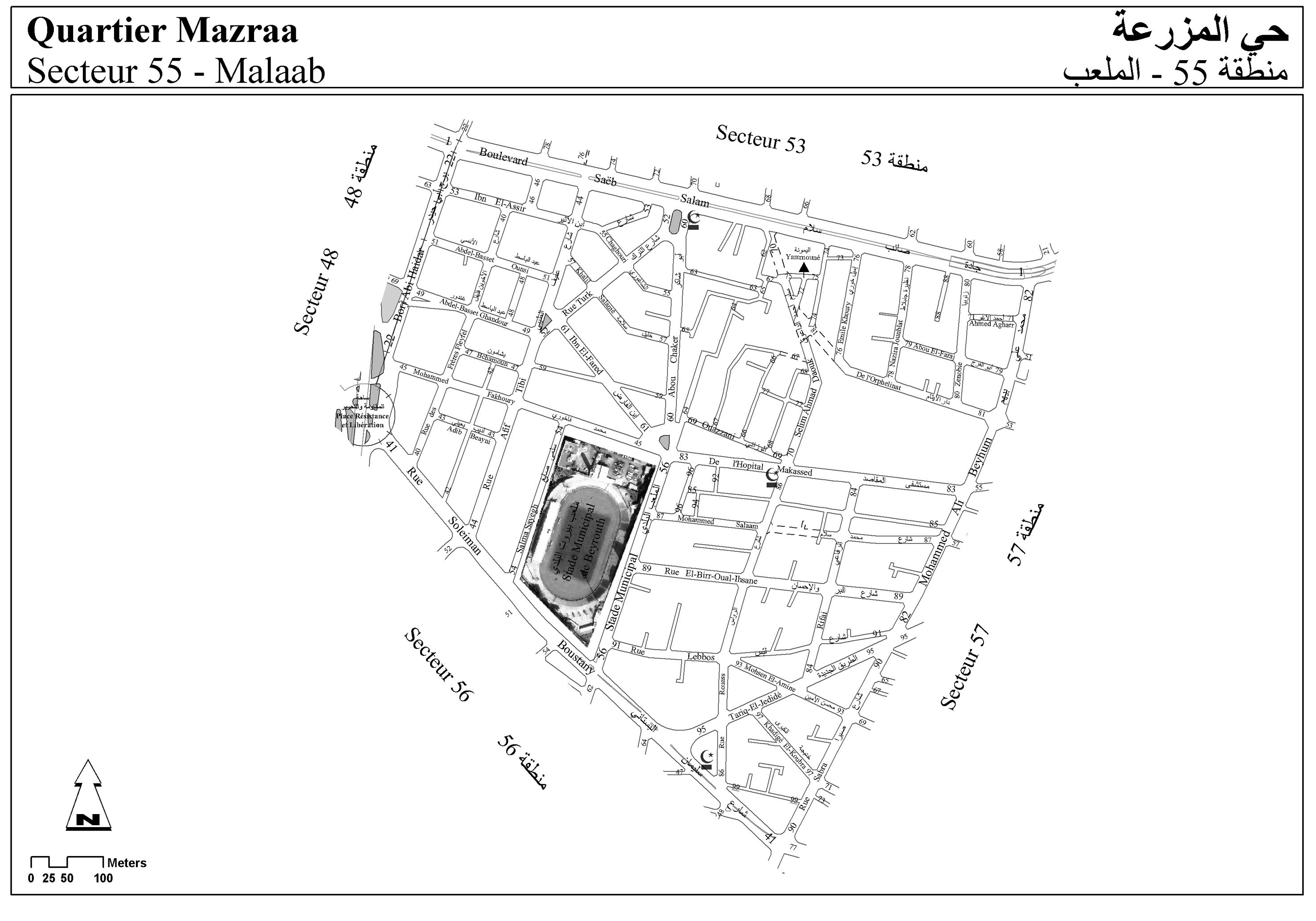
http://wiki.openstreetmap.org/w/images/b/bc/55_Mazraa_Malaab.jpg
Ways (17)
- 42 (5087756), v8
- 46 (5087769), v6
- 59 (25872846), v11
- 59 (34259325), v3
- 64 (34184739), v5
- 65 (34184741), v5
- 84 (5087773), v5
- شارع عبد الباسط الأنسي (5087778), v9
- شارع أديب بعيني (5087755), v9
- شارع الشاغوري (25872904), v17
- شارع إبن الفارض (5087745), v14
- شارع خليل سلامة (5228971), v15
- شارع إبن الأثير (211496412), v4
- شارع الترك (34184133), v5
- شارع اليمونة (26844138), v7
- 5087746, v5
- شارع الوزاني (25873008), v9
Welcome to OpenStreetMap!
OpenStreetMap is a map of the world, created by people like you and free to use under an open license.
Hosting is supported by Fastly, OSMF corporate members, and other partners.
| https://openstreetmap.org/copyright | https://openstreetmap.org |
| Copyright OpenStreetMap and contributors, under an open license | |