Changeset: 53164508
Change Greenway paths to designated type
Closed by Bexhill-OSM
Tags
| created_by | JOSM/1.5 (12921 en_GB) |
|---|---|
| source | survey, tag fixing |
Discussion
-
Comment from Mike Baggaley
HI in this changeset way 202360158 has been tagged as foot=no, bicycle=no when it is also tagged as a public bridleway. Can you please review?
Thanks,
Mike -
Comment from Bexhill-OSM
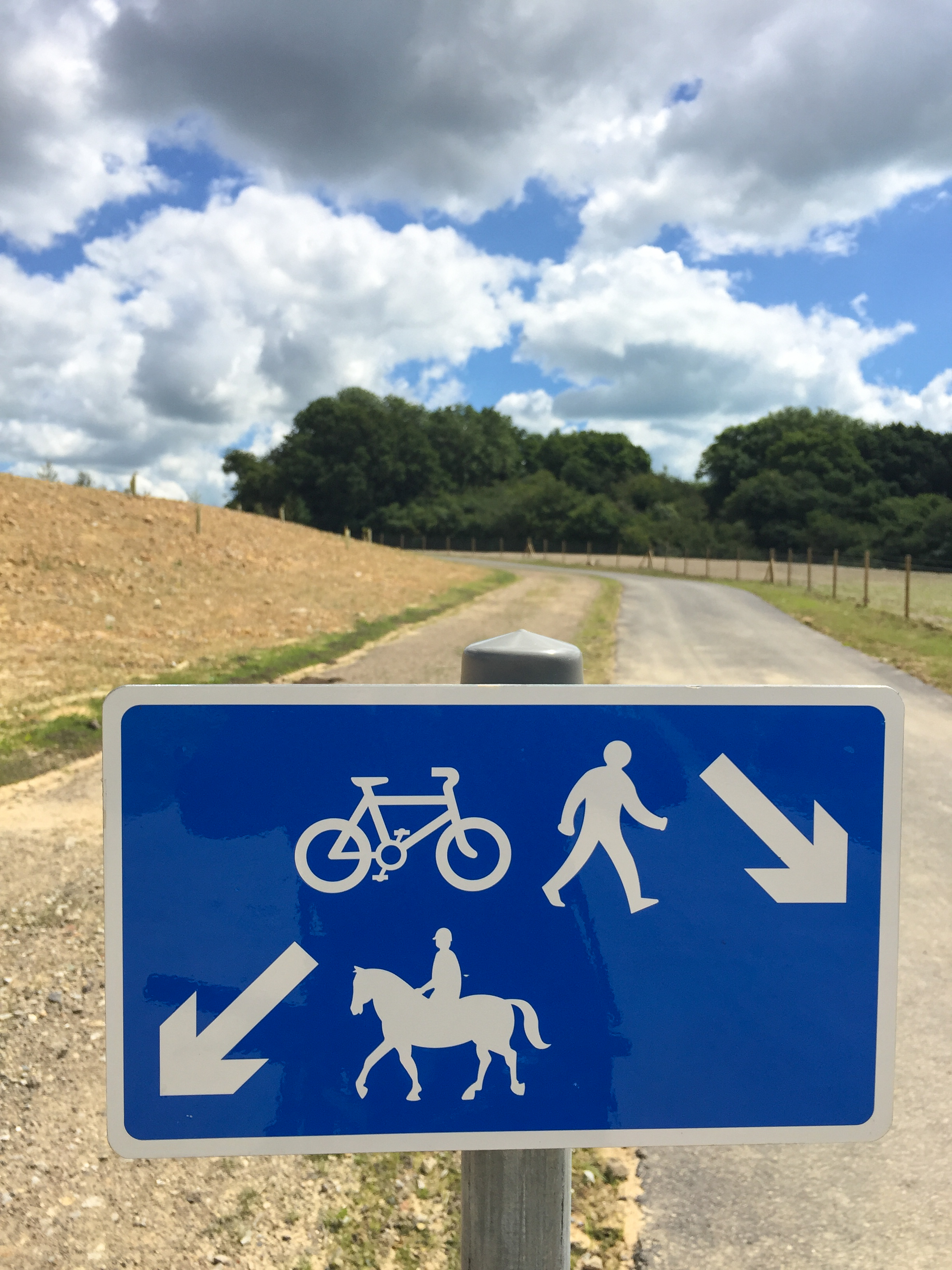
Hi Mike, yes foot and bike traffic is split with horses at this point with a sign similar to this (http://news.eastsussex.gov.uk/wp-content/uploads/sites/4/2016/07/Greenways-2.jpg).
Although, I should have / now will set the bridleway to horse=designated.
Thanks,
Alex -
Comment from Mike Baggaley
HI Alex, a public bridleway is legally open to cyclists and pedestrians, and is normally signed with the words "public bridleway". I suspect in this case, the way is probably not legally a public bridleway, in which case it should have the highway=bridleway tag, but not designation=public_bridleway. If the two run directly side by side, then just use a single way, possible using cycleway=sidepath and similar.
Does that make sense?
Mike -
Comment from Bexhill-OSM
Mike,
Indeed, wherever the paths run side-by-side I have put them as a single way.
I was assuming because this horse only section that breaks away from the foot and bicycle path is still a Public Right of Way (see https://www.eastsussex.gov.uk/leisureandtourism/countryside/rightsofway/map/map.aspx, gridref: TQ770107), it still needed some kind of designation tag?
Alex -
Comment from Mike Baggaley
HI Alex, on the map shown, the bridleway and cycleway loop are shown as dotted lines, which according to the key is a licensed/permissive bridleway and hence they are not public bridleways and should not have the designation tag at all. I'm very pleased to see a council not only providing this information, but also explicitly stating it can be used to update OSM!
Regards,
Mike -
Comment from Bexhill-OSM
Hi Mike, yes it's been an invaluable asset to finding paths around my neighbourhood to survey. They also supply a wms overlay (https://data.gov.uk/dataset/rights-of-way-not-definitive-for-east-sussex) which works great with josm.
I'll remove those licensed/permissive designation tags on my next changeset - thanks for explaining and bringing this to my attention.
Alex
Ways (18)
- Bexhill to Hastings Greenway (202360158), v8
- Bexhill to Hastings Greenway (202360630), v10
- Bexhill to Hastings Greenway (202360642), v9
- Bexhill to Hastings Greenway (405467529), v8
- Bexhill to Hastings Greenway (413429965), v9
- Bexhill to Hastings Greenway (438017190), v5
- Bexhill to Hastings Greenway (438017191), v6
- Bexhill to Hastings Greenway (442636555), v6
- Bexhill to Hastings Greenway (442636556), v5
- 442636558, v4
- 442636560, v5
- Bexhill to Hastings Greenway (442636563), v4
- Bexhill to Hastings Greenway (442636565), v6
- 472191812, v4
- Bexhill to Hastings Greenway (472191817), v3
- Bexhill to Hastings Greenway (487013962), v3
- Bexhill to Hastings Greenway (487013963), v3
- Bexhill to Hastings Greenway (493106897), v2
Welcome to OpenStreetMap!
OpenStreetMap is a map of the world, created by people like you and free to use under an open license.
Hosting is supported by Fastly, OSMF corporate members, and other partners.
| https://openstreetmap.org/copyright | https://openstreetmap.org |
| Copyright OpenStreetMap and contributors, under an open license | |