Changeset: 53851714
Add few streams, tracks, peak elevations
Closed by Nikita Kozlov
Tags
| created_by | JOSM/1.5 (13053 en) |
|---|---|
| source | knowledge |
Discussion
-
Comment from stephankn
You might be really knowledgeable, but hundreds of them including exact elevation? Your source statement sounds a bit strange. Can you please document this import including the source of the data?
-
Comment from Nikita Kozlov
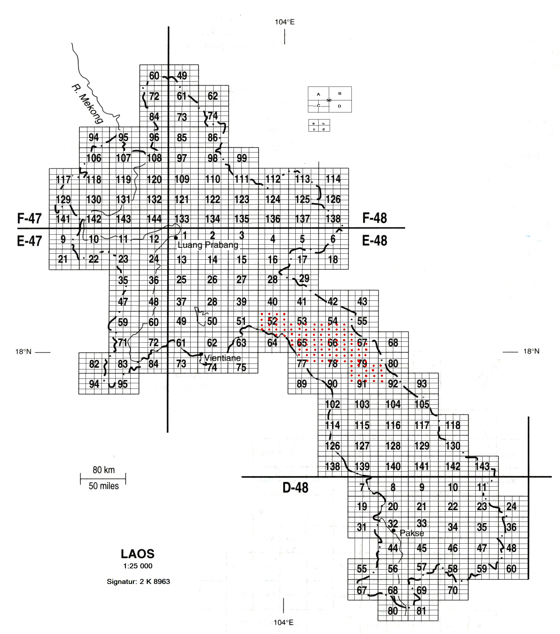
Source is 1:50000 AMS maps available via TMS done by webrian, with position adjustment by comparing with digitalglobe imagery, and few 1:25000 maps of 1993 year, which I have from Berlin library: http://staatsbibliothek-berlin.de/fileadmin/user_upload/zentrale_Seiten/kartenabteilung/topo/2k8963.jpg. Anyway what is the goal of your question?
-
Comment from stephankn
It sounded like an import, so I wondered what source was used and whether it would also contain data for Thailand. Rendering of all those unnamed peaks is a bit weird, but this is a different story.
Can you document on how to get the AMS maps on the main page of Laos together with other data sources? https://wiki.openstreetmap.org/wiki/WikiProject_Laos
Where can these maps be obtained from? is this complete? Are there instructions somewhere on how to adjust projection and alignment and how to use as an imagery layer? I probably also ask directly Adrian for How-To details.
http://legacy.lib.utexas.edu/maps/ams/thailand/For the large number of peaks, probably only document where they are from and what the source was in case others wonder about it as well.
Welcome to OpenStreetMap!
OpenStreetMap is a map of the world, created by people like you and free to use under an open license.
Hosting is supported by Fastly, OSMF corporate members, and other partners.
| https://openstreetmap.org/copyright | https://openstreetmap.org |
| Copyright OpenStreetMap and contributors, under an open license | |