Loading...
Directions
Distance: 309km. Time: 4:32.
| 1. Start on unnamed road | 20m | |
| 2. Turn left onto unnamed road | 300m | |
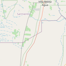
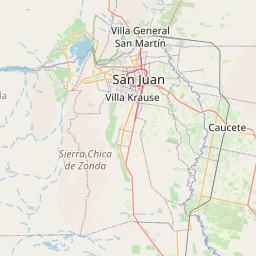
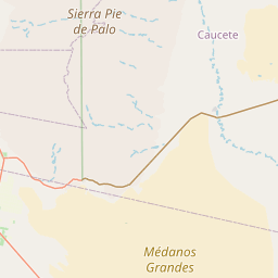
| 3. At the end of the road turn left onto Ruta Nacional 141 (RN141) | 23km | |
| 4. Turn left onto Ruta Nacional 20 (RN20) | 16km | |
| 5. Turn right onto Calle 10 (RP279) | 13km | |
| 6. Turn left onto La Plata (RP246) | 3.7km | |
| 7. Continue on Ruta Provincial 246 (RP246) | 2.9km | |
| 8. Continue on Independencia (RP246) | 3.5km | |
| 9. Continue on Yanzón (RP295) | 3.5km | |
| 10. At the fork turn left onto Eugenio Vargas (RP162) | 10km | |
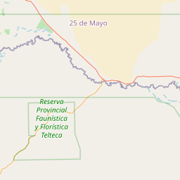
| 11. Continue on 25 de Mayo (RP162) | 400m | |
| 12. Turn right onto Avenida Uruguay | 1.7km | |
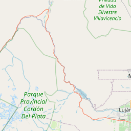
| 13. Merge left onto Ruta Nacional 40 "Libertador General Don José de San Martín" (RN40) | 31km | |
| 14. Merge left onto Ruta Nacional 40 "Libertador General Don José de San Martín" (RN40) | 1000m | |
| 15. Continue on Libertador General Don José de San Martín (RN40) | 3.7km | |
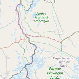
| 16. Continue on Ruta Nacional 40 (RN40) | 54km | |
| 17. Continue on Leteral Este | 1000m | |
| 18. Continue on Ruta Nacional 40 (RN40) | 5km | |
| 19. Continue on Desvío (RN40) | 500m | |
| 20. Continue on Ruta Nacional 40 (RN40) | 9km | |
| 21. Continue on Avenida Fuerza Aérea (RN40) | 3.7km | |
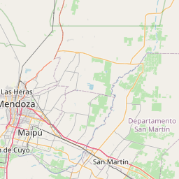
| 22. At the roundabout take the 2nd exit onto Gobernador Ricardo Videla (RN40) | 90m | |
| 23. Exit the roundabout onto Gobernador Ricardo Videla (RN40) | 2.9km | |
| 24. At the fork turn right onto Gobernador Ricardo Videla (RN40) | 200m | |
| 25. Continue on Pedro Bonifacio Palacios (RN40) | 190m | |
| 26. Take the ramp on the left towards RN40 | 110m | |
| 27. Merge right onto Gobernador Ricardo Videla (RN40) | 40m | |
| 28. Take the ramp on the right towards Acceso Este | 90m | |
| 29. Merge left onto Avenida de Acceso Este (RN40) | 1000m | |
| 30. Take the ramp on the right towards RN40, RN7 | 300m | |
| 31. Merge left onto Acceso Sur (RN40) | 23km | |
| 32. Take the ramp on the right | 600m | |
| 33. Continue on Carretera Libertador General San Martín (RN7) | 1300m | |
| 34. Turn left onto RN7; RP79 | 30m | |
| 35. Turn left onto RN7; RP79 | 30m | |
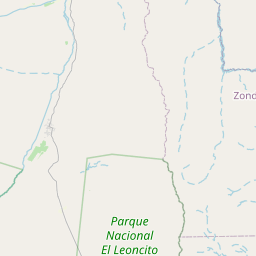
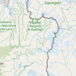
| 36. At the fork turn right onto Carretera Libertador General San Martín (RN7) | 91km | |
| 37. Slight right onto Ruta Nacional 149 (RN149) | 180m | |
| 38. Turn right onto Cerro Barauca | 150m | |
| 39. Turn right onto Tolosa | 60m | |
| 40. Reach destination |
Directions courtesy of OSRM (FOSSGIS)
Welcome to OpenStreetMap!
OpenStreetMap is a map of the world, created by people like you and free to use under an open license.
Hosting is supported by Fastly, OSMF corporate members, and other partners.
Map Layers
Enable overlays for troubleshooting the map
Map Key
Share
Link or HTML
Geo URI
Image
Only the following layers can be exported as an image:
- Standard
- Cycle Map
- Transport Map


| https://openstreetmap.org/copyright | https://openstreetmap.org |
| Copyright OpenStreetMap and contributors, under an open license | |