Node History: Großsteingrab AHA 19 (2146264311)
Version #12
removed site_type= as transitional simultaneous tagging with archaeological_site=, as discussed in https://community.openstreetmap.org/t/implementation-of-new-tagging-scheme-of-archaeological-site/7850
- Edited by ChillyDL
- Changeset #138539972
- Location: 52.2774545, 11.3608634
Tags
Version #11
transitional simultaneous tagging of site_type= and archaeological_site= as discussed in https://community.openstreetmap.org/t/implementation-of-new-tagging-scheme-of-archaeological-site/7850
- Edited by ChillyDL
- Changeset #132104861
- Location: 52.2774545, 11.3608634
Tags
Version #10
revert buggy mass edit
- Edited by woodpeck_repair
- Changeset #131530757
- Location: 52.2774545, 11.3608634
Tags
Version #9
transitional simultaneous tagging of site_type= and archaeological_site= as discussed in https://community.openstreetmap.org/t/implementation-of-new-tagging-scheme-of-archaeological-site/7850
- Edited by ChillyDL
- Changeset #131503279
- Location: 52.2774545, 11.3608634
Tags
Version #8
Revert 129888769
- Edited by chris66
- Changeset #129956635
- Location: 52.2774545, 11.3608634
Tags
Version #7
changed tag from site_type to archaeological_site
- Edited by geozeisig
- Changeset #129888769
- Location: 52.2774545, 11.3608634
Tags
Version #6
Anpassung an neue Commons-Cats, - vom Urheber unerwünschte Foto-Deeplinks; Haldensleber Forst
- Edited by ChillyDL
- Changeset #120790717
- Location: 52.2774545, 11.3608634
Tags
Version #5
+ Details Großsteingräber AHA 19 - 20
- Edited by ChillyDL
- Changeset #103120284
- Location: 52.2774545, 11.3608634
Tags
Version #4
Korrektur Landmarken und Archäologische Anlagen Historische Quadratmeile Haldensleben/Süplingen/Bebertal/Hundisburg
- Edited by AndreasMD
- Changeset #48307227
- Location: 52.2774545, 11.3608634
Tags
Version #3
Vervollständigung und Korrektur Wege und Landmarken Neuhaldensleben/Kiefholz u Veltheimsburger Heide
- Edited by AndreasMD
- Changeset #43612375
- Location: 52.2774545, 11.3608634
Tags
Version #2
KKonkretisierung und Korrektur POIs Veltheimsburger Heide
- Edited by AndreasMD
- Changeset #40531327
- Location: 52.2774545, 11.3608634
Tags
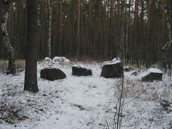
| historic | archaeological_site |
|---|---|
| image | http://tw.strahlen.org/praehistorie/sachsenanhalt/16011-Haldensleben020.jpg |
| megalith_type | grosssteingrab |
| name | Rest Grosssteingrab |
| site_type | megalith |
| website | http://tw.strahlen.org/praehistorie/sachsenanhalt/haldensleben020.html |
Version #1
großsteingräber haldensleben
- Edited by cucu
- Changeset #14953604
- Location: 52.2774545, 11.3608634
Tags
Welcome to OpenStreetMap!
OpenStreetMap is a map of the world, created by people like you and free to use under an open license.
Hosting is supported by Fastly, OSMF corporate members, and other partners.
| https://openstreetmap.org/copyright | https://openstreetmap.org |
| Copyright OpenStreetMap and contributors, under an open license | |