Loading...
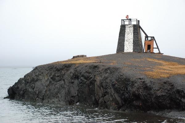
Node: Навигационный знак «Желания» (3027774037)
Version #4
adding matching wikidata items - fixing and cleaning up wikipedia/wikidata using https://wiki.openstreetmap.org/wiki/Wikidata%2BOSM_SPARQL_query_service
- Edited by nyuriks
- Changeset #52001717
- Location: 76.9551361, 68.5640306
Tags
| description:en | Geographic point of reference to mark the separation between the northern ends of the Barents Sea and the Kara Sea |
|---|---|
| image | http://photos.wikimapia.org/p/00/01/31/32/97_big.jpg |
| man_made | beacon |
| name | Навигационный знак «Желания» |
| name:de | Turm Kap Zhelaniya |
| seamark:type | building |
| wikidata | Q2464613 |
| wikipedia | ru:Мыс Желания |
Welcome to OpenStreetMap!
OpenStreetMap is a map of the world, created by people like you and free to use under an open license.
Hosting is supported by Fastly, OSMF corporate members, and other partners.
| https://openstreetmap.org/copyright | https://openstreetmap.org |
| Copyright OpenStreetMap and contributors, under an open license | |