
The New York Times has maps tracking the Russian invasion of Ukraine. I wondered what the data source of the first one was: were they maybe using OSM?
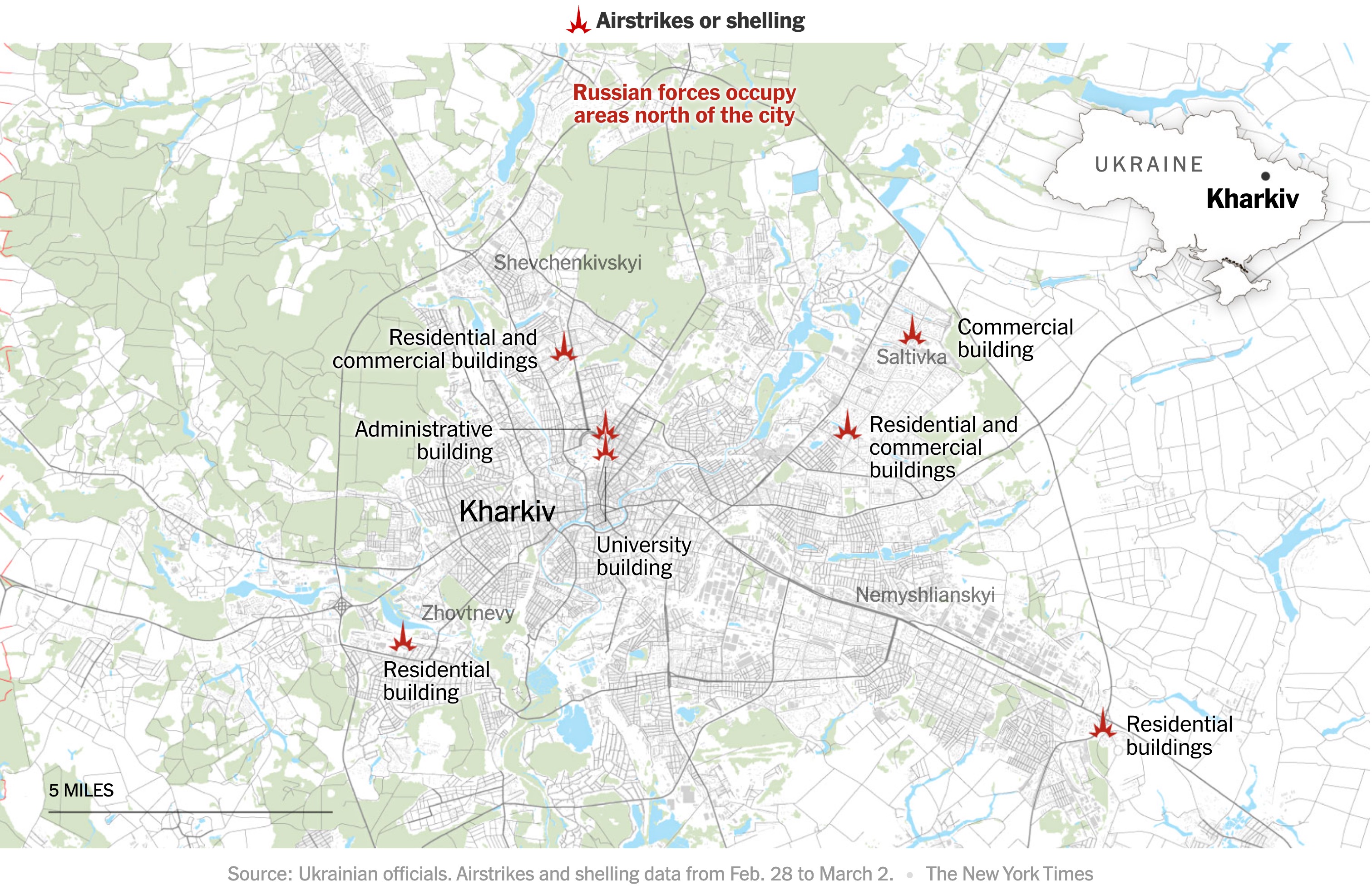
Mappers on the #openstreetmap IRC channel quickly found some differences. Just to be absolutely sure, I used the QuickOSM plugin for QGIS to download OSM data for the area from overpass. I then quickly styled the map, using the colour picker to copy the Times map. In half an hour, I had my own map of Kharkiv.
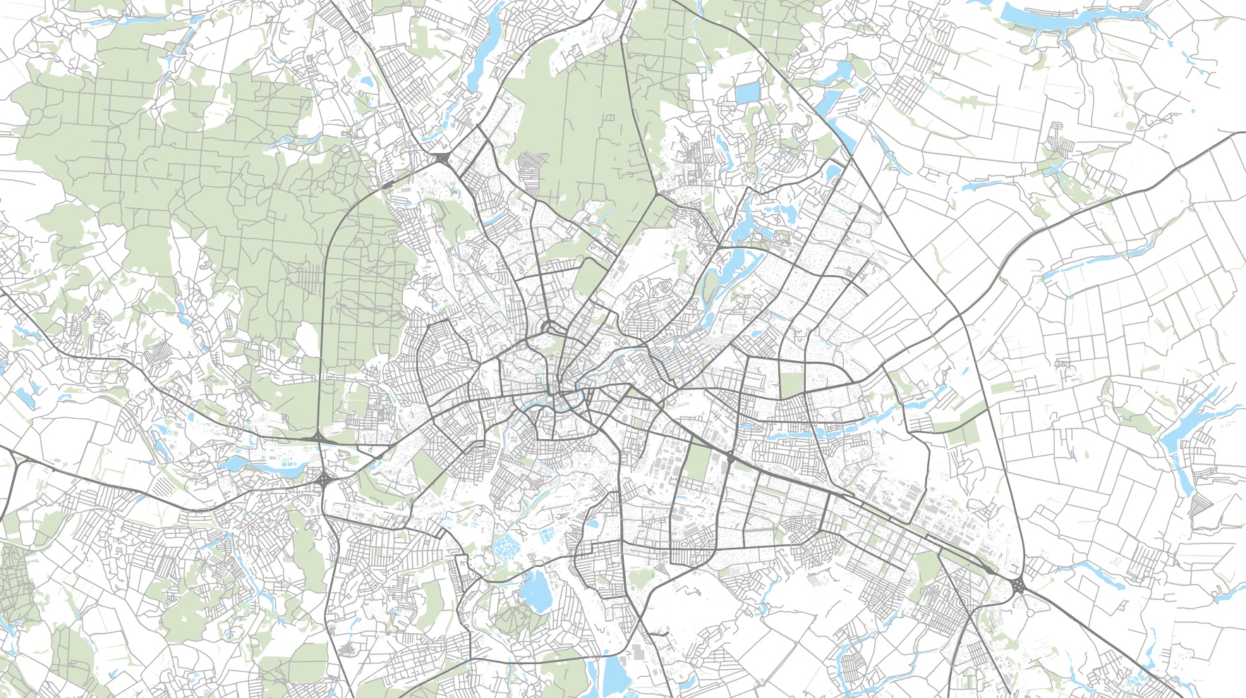
The maps are quite different. The OSM-based one has more roads, especially in the forest. The land use is more accurate and up to date. The Ukraine community has done a great job.
The New York Times isn’t using OpenStreetMap, but an inferior, probably commercial source. Otherwise, their map would be better ;).
Discussion
Comment from lalolan on 3 March 2022 at 18:34
Russia is using it, at least “for the camera”: https://www.youtube.com/watch?v=1OIf-b9aX3I Compare background map with https://www.openstreetmap.org/#map=7/46.932/31.816 specially in Sea of Azov borders.
Comment from jose_ecu on 4 March 2022 at 18:17
Bad people using a good idea.
Comment from Sammyhawkrad on 13 March 2022 at 09:05
It could possibly be an old export of OpenStreetMap