OpenStreetMap

mapeadora's Diary

Recent diary entries

Durante la última semana de noviembre, participé a la Conferencia de Gestión popular de riesgos de desastres y OpenStreetMap LATAM 2022 organizada por OSM Perú y el nuevo capítulo de Youthmappers Llamitas Mapeadoras, en la Universidad Nacional Mayor de San Marcos en Lima.

Aquí redacto unas reflexiones personales como contribuidora de OSM LATAM.

1.Fue un evento muy concurrido, sin ser un State of the Map y siendo esencialmente un evento nacional, pero con participantes internacionales. Pero rescato sobre todo que tuvo una participación de personas realmente interesadas en el tema y con real intención de colaborar, conocer, escuchar de experiencias de otr@s, reflexionar junt@s para aportar a sus situaciones comunitarias en materia de gestión de riesgo, y esto desde un enfoque no especialista y profesional, sin tampoco cerrarse al mismo. En este sentido, para mi, fue un evento muy integrador y me emocionó mucho. Logró la “I” de la sigla “GIRD”.

Participaron un gran número de estudiantes; estudiantes activos en capítulos nuevos y no nuevos de Youthmappers (nacionales y andinos); académicos investigadores y profesores; personas de la sociedad civil de muy diversos perfiles que actuan en su comunidad para la gestión de riesgo; contribuidores en general de OSM Perú; contribuidores de mapeo humanitario en Perú y otros lado; profesionales y administrativos de la gestión de riesgo en Perú.

Tuvo una amplia cobertura en redes que se puede ver en Twitter, Instagram y más redes con los hashtags #grdosm entre otros, en las redes de OSMPe, Llamitas Mapeadoras, mapeoabierto_la, EsOpenstreetmap, y seguramente más cuentas personales. Página del evento. Fotos del evento

2.Fue un evento que permitió la dimensión humana clave para la colaboración: propició bastante espacios (formales e informales) de discusión, de experimentación, de construcción de ideas, de ampliar panoramas de trabajos que las personas hacemos localmente, descubrimos tecnologías e días de cómo hacer un uso ventajoso de ellas, comprendimos necesidades y perspectivas de comunidades distintas, etc.

3.Mi impresión es también que algo que los organizadores tenían claro desde el inicio -y se refleja con el seguimiento posterior que se le está dando- fue que esta conferencia no iba a ser únicamente para presentar trabajos y conversar, sino que debía llevar a soluciones, ampliar reflexiones, crear contactos y sinergias para ayudarse de forma concreta, motivar y remotivar. Siento que una buena parte de las personas participantes regresaron a casa con planes en la cabeza y habiendo creado una relación amena con quien les puede guiar y apoyar. Es algo que comúnmente se da en eventos comunitarios pero diría que la escala de este evento y su foco en una misma temática, fortaleció más los vínculos. Un tema entre otros, que concentró intereses e ideas de proyectos, es el uso de drones “baratos” y la coordinación regional entre droneros para su uso en temáticas de gestión de riesgo de desastres.

Imágen de OSMPe Imágen de OSMPe Imágen de OSMPe Imágen de OSMPe Imágen de OSMPe

Location: 06760, Cuauhtémoc, Ciudad de México, México

Recimentar la comunidad OSM LatAm

OSM LatAm como comunidad se consolidó, se puede decir, a raíz de un evento de AbreLatam ConDatos en la Cineteca Nacional de México en 2014, al darnos cuenta que varias personas usuarias y apasionadas de OSM, desde varios países, estábamos presentes, pues nos conocimos y decidimos crear un canal común para reunir a las personas de esta región.

De allí nació el canal de Telegram OSM-Latam, lista de email y Twitter. Telegram en particular se ha vuelto un espacio con participación variable pero intensiva desde entonces, sin necesariamente resultar en actividades conjuntas como región.

A raíz de discutir sobre esta oportunidad nuevamente al final de 2021, el grupo MapTime Bogotá contó cómo sus actividades locales, juntas mensuales y actividades como la resolución organizada de notas, habían logrado consolidar mucho la comunidad en Bogotá, y acordamos su ayuda para impulsar el arranque de algo similar a nivel LatAm. Porque a veces solo falta un empujoncito o una palmada.

Acordamos al menos tener una junta periódica, la primera siendo una parte misma de la junta mensual de MaptimeBogotá. Allí nos conocimos varias personas, tomamos unos acuerdos iniciales como principalmente qué hacer con esta junta, cómo comunicarla y moderarla de manera que facilite la integración de más personas, y construimos una agenda “cumulativa” que se irá tratando poco a poco permitiendo avanzar y también socializar. Estarán documentadas en la ahora página de wiki LatAm

Actividades detonadoras: el Notathón

MaptimeBogotá y Fundación OSM Colombia ya tenían instalada esta actividad, y por lo dicho sirvió bastante para federar las personas alrededor de OSM y hacer grupo, además de mejorar el mapa notablemente, y encontrar un medio de comunicación sana y de integración con mapeadores ocasionales que contribuyen más con notas que con mapeo directo.

Durante la junta OSM LatAm, se habló de varias ideas de actividades en conjunto, que se irán construyendo. Pero es atractivo y fácil subirse al tren de una actividad ya estructurada, así que mensualmente, están las personas de LatAm invitadas a unirse al Notathón.

Aquí pego los diarios de @AngocA que describen todo lo que hay que saber:

Y finalmente la wiki en la página de LatAm.

Mis impresiones

  • Me pareció una gran oportunidad el que ya exista y se sostenga este dinámica por sí sola, desde una comunidad local, ya es madura y el sentido está claro para todas las personas participantes. Lo veo como un gran potencial para unirnos en la región. Es un gran ejemplo de unión desde abajo (lo local y lo concreto) hacia arriba (lo regional)
  • Como actividad, es atractiva: es concreta, es inusual (pocas personas se dedican a esta labor de mantenimiento necesaria en OSM) entonces para muchas personas puede resultar motivador, pues se aprende algo nuevo (resolver notas, pero también como etiquetar objetos no necesariamente ligados a nuestro interés primero). Si algo es común considero, en nuestra pasión por OSM, es el gusto de aprender siempre.
  • Es a-local: es local pero no importa dónde, podemos realizarlo cada quien en su área geográfica, y seguir compartiendo impresiones, cuestiones, orientaciones conectad@s en una misma aula virtual.
  • Haciendo esto, nos relacionamos de manera amena y nos llegamos a conocer
  • La actividad es pretexto para otras elaboraciones que benefician a la región: estructurar partes de la wiki regional, poblar su contenido, pensar nuevas actividades (jornada de capacitaciones variadas como editar la wiki; resolver notas y con diferentes herramientas, con pretexto de las notas meter mano en nuevos editores de OSM, etc…)

A seguirle, únanse cuando gusten, es mensual y se promociona en el canal de Telegram OSM-LatAm. También únanse a las juntas bimestrales de OSM-LatAm anunciadas y planeadas colaborativamente en la wiki LatAm.

Location: 06080, Cuauhtémoc, Ciudad de México, México

Este mes de octubre de 2020, se ha lanzado oficialmente el capítulo de YouthMappers en la Universidad Autónoma del Estado de México (UAEM), facultad de Geografía, en el campus de Toluca.

Alt text

Este capítulo se ha ido gestando por algunos años ya, por el liderazgo de profesores investigadores de esta facultad, en particular Sandra Lucía Hernández Zetina, gran promotora de OSM y de la Información Geográfica Voluntaria en general, y gran pedagoga; y con el apoyo por años, desde las primeras Jornadas de GvSIG, de un grupo de users de esta comunidad: @EldesbasteMap, @mapanauta, @ juane90, @epl, y yo @mapeadora ofreciendo capacitaciones recurrentes a las y los estudiantes de esta facultad, generando liderazgos invitándoles a ser tutores en talleres a otras comunidades estudiantiles, e invitándoles a participar a otros proyectos cartográficos, incluso a través de un subgrant de HOTOSM y Geochicas. Esto permite tener en este momento de lanzamiento, una experiencia ya amplia en la facultad, capitalizada en sus profesores con un conocimiento preexistente de Openstreetmap, de sus dimensiones comunitarias, y de gestión.

El punto fuerte de esta facultad es la carrera de Geografía, no tan común en las universidades del país, y la licenciatura de Geoinformática . El perfil de participantes del capítulo es potencialmente diverso y con habilidades muy útiles para integrarse a la comunidad permanente de OpenStreetMap.

A través de nuestra gestión, el intento es dar al capítulo la oportunidad de promover la Información Geográfica Voluntaria en diferentes niveles: contribuyendo a OSM a a la producción de datos libres pero más allá, también trabajando a la integración de OSM con las instituciones del país, promoviendo así la adopción amplia de los datos libres en diferentes sectores que los pueden consumir, lo cual me parece de suma importancia, además de ser altamente formador para estudiantes.

La idea que quiero valorizar es que la cultura de lo libre trasciende la sola producción de datos y el ejercicio de mapeo. Es clave que las y los jóvenes adopten esta visión en todas sus dimensiones, volviéndose activistas de datos que tanto necesita el país.

En este sentido, este capítulo de YouthMapper tiene una relación nativa con el INEGI para conectar el proyecto de Cartografía Participativa de este instituto con OpenStreetMap, y una relación nativa con Geochicas, ofreciendo una colaboración con su proyecto Las Calles de las Mujeres.

Es importante resaltar que YouthMappers es un mecanismo de aprendizaje y de liderazgo, y el plan de trabajo y las actividades los eligen sus participantes. Los mentores y colaboradores externos solo proponen, guían, ofrecen capacitaciones, de las cuales puede disponer el grupo.

Dicho esto, como mentora externa a la facultad, buscaré la manera de dar el conocimiento más importante y orientar al grupo para que de su justa importancia a ciertos principios que rebasan los aspectos técnicos del mapeo y favoreceran su integración para el largo plazo en OSM:

  • Entender cómo se organiza OpenStreetMap

  • La comunidad atrás de los datos, su complejidad, sus roles, su gobernanza

  • La autogestión

  • La importancia de la comunicación a través de los canales previstos

  • La importancia de la cordialidad y conducta, la existencia del Código de Conducta

  • El espiritu incluyente de OpenStreetMap y la horizontalidad

  • El principio de aportar y sumar al esfuerzo colectivo

Enfin, mientras puedan estructurarse, organizarse y publicar en su propio nombre en los canales, invito a l@s miembr@s de la comunidad a conocerles y tenerles empatía, también ofrecer su mentoría como lo vean útil. Este mes tendrán su capacitación básica de OSM con los puntos anteriores además de principios básicos de edición del mapa y recursos para ubicar todos los materiales, convenciones, wikis y tutoriales de OSM. Cuando veamos sus ediciones, les podremos extender una mano y orientarlos como lo incluyentes que somos :D

Bienvenid@s al YouthMappers de Toluca!

https://www.youthmappers.org/chapters https://twitter.com/ym_uaemex Tendrán más canales que ellos mismos presentarán.

Un gusto saludarles! @mapeadora

Location: Delegacion De San Mateo Oxtotitlan, Toluca, 50100, México

Geochicas is a group of Spanish-speaking women from OpenStreetMap formed before SOTM-LATAM in Sao Paolo in 2016, around the pre-event discussions about the very low participation of female in proposals.

Derived from this observation in the Telegram channel of OSM-LATAM, the discussion about the low participation of women in this regional chat as well as in the community in general, in its local, regional and global scales was broadened.

Following this observation, @SeleneYang (Argentina), @Mapanauta and @Mapeadora (Mexico) decided to organize together a series of activities in this SOTM to initiate a collective reflection on gender inequality in this regional community, raise the key issues, develop perennials lines of work.

These lines were:

  1. The decision to have in every SOTM-LATAM a space for reflection on gender equity in the form of a talk and a panel with the assembly, looking for continuity
  2. Form a group of women with a reserved chat called Geochicas, created in the conference with about 30 attendees
  3. Have a proactive communication effort in the OpenStreetMap LATAM networks to keep the debate on gender equity active
  4. Promote in the group of women peer-to-peer teaching of technical and theoretical topics
  5. Promote our continuous participation in data and free technologies events, and a systematic participation in the SOTMs.

From 3 people the group grew during Sao Paolo- SOTM event to 30, and brings together, a year and a half later, around 150 people of diverse origins, from numerous communities, with very broad profiles.

In this line of action, I participated on behalf of Geochicas in the State of the Map 2018 in Milan, with a presentation of the group’s activities and achievements, and presented the results of our survey on gender representation in OSM. Alt text

With the intention of contributing to the construction of an OSM agenda on equity, we collaborated with @Heather Leson and Kate Chapman @Wonderchook in this session to brainstorm among the attendees about opening our communities.

Alt text

A mixed assistance and of all countries opined around 3 premises: I will do; We should stop doing; We should start or continue.

Alt text Alt text

The ideas expressed can be summarized and grouped as follows:

I will:

  • I will give an active female role model in the community of labels
  • I will pay attention to the concerns of women in the community
  • I will promote the organization of community activities, with attention to a diverse participation, and take care of the conditions of safe access
  • I will get involved in local communities and invite women to join
  • I will participate more in debates about the community, I will listen and not judge
  • I will promote the development of easy-to-use tools to contribute to the map
  • I will be alert to violent tones and harassment in communication channels
  • I will have more reflection on the subject of privileges and inequity
  • I will inquire about COCs and be more sensitive to the issue of respectful treatment
  • Consider and take advantage of diverse abilities, in the modes of contribution to OSM

We should stop:

  • To communicate the results with a ranking or competition system. we have to commit ourselves more to inclusion, to value different skills and different centers of interest
  • To consider the essence of OSM as a technological project
  • To have a prejudice about the motivations for contributing
  • To have a limited vision of genders, and expand the focus to all genders
  • From supporting the foundation until a complaint system of harassment is complied with
  • Stereotyping people, groups, nationalities
  • To conceal or tolerate harassment, provocations, abuses and toxic modes, all forms of discrimination
  • To pretend that inequality and discrimination in OSM does not exist and is not a problem
  • To limit the concept of diversity to gender diversity, expand the focus

We should start to:

  • Listen with empathy and respect disagreements and differences in vision, interest, and values
  • Measure changes systematically, periodically, with surveys or other instruments
  • Improve the mechanisms for the integration of new people
  • Analyze the fine mechanisms of exclusion of marginalized groups towards debates, community, activities and OSM events. Have a constant search for integration
  • Have a financing council to know projects and proposals with a need of development, and be able to channel resources towards a greater diversity
  • Have a solid strategy of awareness on diversity and equity, diverse interests, with a much broader understanding (gender, LGBTQIA, ages, physical conditions, etc.), address racial discrimination, work on access to marginalized communities
  • The board must have a specific work axis on diversity and clear objectives
  • Promote our allies
  • Have a more motivating perspective and also make visible the efforts and changes
  • Collaborate with allies and stakeholders with a clear stance in favor of diversity and equity
  • Develop safe spaces for women and other groups
  • Build a Code of Conduct, moderations, and an anonymous reporting system, and systems to identify micro-aggressions by the community
  • Expand the debate on the topic to share experience and co-create solutions
  • Support initiatives focused on women, such as #letgirlsmap, @OsmGirls, @geochicasosm, develop them at all scales
  • Have a formal work on the tagging system, with gender vision

(The complete list of comments and ideas written by participants to the brainstorming is transcribed in the mail list diversity-talk@openstreetmap.org)

This collective exercise of brainstorming has been invaluable. It allows us to better understand, with an expanded and diverse vision, the dimensions of the diversity and equity problem in OpenStreetMap. It allows us all to guide our actions in all the sectors where we participate and expresse a voice from the community towards the OSM Foundation to demand a development of the agenda that does belong to everyone. Alt text

Location: 06880, México

Geochicas es un grupo de mujeres de Openstreetmap de habla hispana, formado poco antes del SOTM-LATAM en Sao Paolo en 2016, alrededor de los debates previos al evento sobre la muy baja participación femenina en las propuestas.

Derivado de esta observación en el canal de comunicación de OSM-LATAM (chat de Telegram), se amplió la discusión sobre la baja participación de mujeres en este chat regional así como en la comunidad en general, en sus escalas locales, regionales y global.

Siguiendo esta constatación, @SeleneYang (Argentina), @Mapanauta y @Mapeadora (México) decidimos organizar juntas una serie de actividades en este SOTM para iniciar la reflexión colectiva sobre la inequidad de género en esta comunidad regional, plantear los temas claves, desarrollar líneas perenes de trabajo.

Estas líneas fueron:

  1. La decisión de tener en todos los SOTM de este continente un espacio de reflexión en forma de charla y panel con la asamblea, sobre la equidad de género, podiendo dar continuidad y medir progresos
  2. Formar un grupo de mujeres con un chat reservado llamado Geochicas, creado en el mismo momento de la asamblea con unas 30 asistentes
  3. Tener un esfuerzo de comunicación proactivo en las redes de Openstreetmap LATAM para mantener activo el debate sobre equidad de género
  4. Promover en el grupo de mujeres la enseñanza de temas técnicos, el debate de nivel teórico
  5. Promover nuestra participación continua en eventos de datos y tecnologías libres y una participación sistemática en los SOTM.

De 3 personas el grupo creció durante el evento a 30, y reúne, año y medio después, a 150 personas de orígenes diversos, de numerosas comunidades, con perfiles muy amplios.

En esta línea de acción, participé en nombre de Geochicas en el State of the Map 2018 de Milán, con una presentación del grupo de sus actividades y logros, y presenté los resultados de nuestra encuesta sobre representación de género en OSM.
Alt text

Con la intención de aportar a la construcción de una agenda en OSM sobre equidad, colaboramos con @Heather Leson y Kate Chapman @Wonderchook en esta sesión para hacer un brainstorming entre los asistentes sobre lo que podemos hacer para abrir nuestras comunidades.

Alt text

Una asistencia mixta y de todos paises opinó alrededor de 3 premisas: Yo haré; Deberíamos dejar de hacer; Deberíamos empezar / continuar de hacer.

Alt text Alt text

Las ideas expresadas se pueden agrupar y resumir así:

Haré:

  • Daré un modelo de rol femenino activo en la comunidad
  • Tendré atención a las preocupaciones de las mujeres de la comunidad
  • Impulsaré la organización de actividades comunitarias, con atención a una participación diversa, y cuidando de las condiciones de acceso seguro
  • Me involucraré en comunidades locales e invitaré a mujeres a unirse
  • Participaré más en debates sobre la comunidad, escucharé
  • Impulsaré el desarrollo de herramientas fáciles de uso para contribuir al mapa
  • Seré alerta hacia tonos violentos y acoso en canales de comunicación, tendré mayor reflexión sobre el tema de privilegios y de inequidad
  • Indagaré sobre COCs y seré más sensible a la cuestión del trato respetuoso
  • Considerar y aprovechar abilidades diversas, en los modos de contribución a OSM

Deberíamos dejar de:

  • Comunicar los resultados con un sistema de rankings, comprometernos más con la inclusión, valorizar habilidades distintas e centros de interes distintos
  • Considerar la esencia de OSM como un proyecto tecnológico
  • Tener prejuicio sobre las motivaciones por contribuir
  • Tener una visión limitada de los géneros, y ampliar el foco a todos los géneros
  • Apoyar a la fondación hasta que se cumpla con un sistema de denuncia del acoso
  • Estereotipar personas, grupos, nacionalidades
  • Encubrir o tolerar el acoso, las provocaciones, abusos y modos tóxicos, todas formas de discriminación
  • Pretender que la inequidad y discriminación en OSM no existe y no es un problema
  • Limitar el concepto de diversidad a la diversidad de género, ampliar el foco

Deberíamos empezar a:

  • Escuchar con empatía y respetar los desacuerdos y las diferencias de visión, interés y valores
  • Medir cambios sistematicamente, periodicamente, con encuestas
  • Mejorar los mecanismos de integración de nuevas personas
  • Analizar los mecanismos finos de exclusión de grupos marginados hacia los debates, la comunidad, las actividades y los eventos de OSM. Tener una busqueda constante de integración
  • Tener un consejo de financiamiento para conocer proyectos y propuestas con necesidad de desarrollo y poder canalizar recursos hacia una mayor diversidad
  • Tener una estrategia sólida de concientización sobre diversidad y equidad, intereses diversos, con un entendimiento mucho más amplio (géneroS, LGBTQIA, edades, condiciones físicas, etc.), abordar la discriminación racial, trabajar en el acceso hacia comunidades marginadas
  • El board debe de tener un eje de trabajo concreto sobre diversidad y objetivos claros
  • Promover nuestros aliados
  • Tener una perspectiva más motivadora y visibilizar también los esfuerzos y los cambios
  • Collaborar con aliados y grupos de interés con una postura clara a favor de la diversidad y equidad
  • Desarrollar espacios seguros para mujeres y otros grupos
  • Construir un Código de Conducta, moderaciones, y un sistema de denuncia anónimo, sistemas de identificación de microagresiones por la comunidad
  • Ampliar el debate sobre el tema para compartir experiencia y co-crear soluciones
  • Apoyar las iniciativas enfocadas a mujeres, como #letgirlsmap, @OsmGirls, @geochicasosm, desarrollarlas en todas las escalas
  • Tener un trabajo formal sobre el sistema de etiquetas con visión de género

(La lista completa de comentarios e ideas escritas por los participantes al taller están retranscritas en la lista de mail diversity-talk@openstreetmap.org).

Este ejercicio colectivo de propuestas ha sido valiosísimo. Nos permite entender mejor, con una visión ampliada y diversa, las dimensiones del problema de diversidad y equidad en OpenStreetMap. Nos permite a todos orientar nuestras acciones en todos los sectores donde participamos, y expresa una voz de la comunidad hacia la OSM Fundación para exigir un desarrollo de la agenda que, subrayamos, es de todos. Alt text

Location: 06880, Cuauhtémoc, Ciudad de México, México

On behalf of the organization where I work, World Resources Institute Mexico for the Latin America area, and also for my efforts as part of OpenStreetMap Mexico, I participated in the State of the Map 2018 in Milan. I got a scholarship from the organizers, for which I am very grateful. I presented a state of the art on public transport data standards such as can be used in countries not very advanced technologically speaking and with low technical capacities in governments to integrate data to urban planning, with the challenge then of promoting useful and timely information. I finally presented the interest for several global organizations, to allow improvements in this topic, to group and concentrate resources, approaches and debates: data repositories, technologies, data collection methodologies and also form a visible, accessible, friendly platform and perennial to link actors and share experiences.

Alt text It can be viewed at minute 30:00 of the video of the event.

This participation was very useful to personally meet part of the working group on transport in the OpenStreetMap community, with which we must continue to build, and debate about the best opportunity -depending on each situation and the very variable characteristics of transport systems in each city and country- between producing first data in OpenStreetMap and exporting them using OSM2GTFS tools or to other formats; or produce first, under controlled conditions, a basic format (shapefile) and integrate or convert to any other platforms and format, where OSM becomes one of the recipients among others. The conversion and integration of data in one case or another have different difficulties, although the second option makes the use of OpenStreetMap much more laborious.

The main challenges of these alternatives, which still need to be discussed, seem to be:

  1. Do not lose certain data about the service that would have no place in the OpenStreetMap tag system but are essential for the fine regulation of the service: as the variable speed averages of the transport units according to the time of the day and period of the year, the frequency and times of bus passage for example
  2. The development of data extraction and conversion tools (such as OSM2GTFS, etc.) and routing, with interfaces designed for users with low technological level and low financial resources, considering that most of the developments carried out in the OpenStreetMap sphere they are the fruits of voluntary work and of people with a high level of technology (also coming mostly from countries with access to data and particular urban problems in Western countries). For the developing world, this last point is still a limitation for the full use of OpenStreetMap. The funders could contribute a lot in this direction.

Alt text We agreed to be in contact and continue in the construction of the subject in the transit mailing list

Location: 06880, Cuauhtémoc, Mexico City, Mexico

En nombre de la organización donde trabajo, World Resources Institute México para el área de América Latina, y también de mis esfuerzos como parte de Openstreetmap México, participé en el State of the Map 2018 de Milán. Obtuve un scholarship por parte de los organizadores, por lo cual estoy muy agradecida. Presenté un estado del arte sobre estándares de datos de transporte público tal cómo pueden ser utilizados en países no muy avanzados tecnologicamente hablando y con bajas capacidades en gobiernos para integrar datos a la planeación urbana, con el reto entonces de promover información útil y oportuna. Presenté finalmente el interés para varias organizaciones globales, para permitir mejoras en este tema, de agrupar y concentrar los recursos, enfoques y debates: repositorios de datos, tecnologías, metodologías de levantamientos de datos y también formar una plataforma visible, accesible, amigable y perene para vincular actores y compartir experiencias.

Alt text Se puede visualizar en el minuto 30:00 del video del evento.

Fue bastante útil esta participación para conocer personalmente a parte del grupo de trabajo sobre transporte en la comunidad OpenStreetMap, con el cuál debemos seguir construyendo, y debatiendo sobre la mejor oportunidad -dependiendo de cada situación y las características muy variables de los sistemas de transporte en cada ciudad y país- entre producir primero datos en OpenStreetMap y exportarlos mediantes herramientas OSM2GTFS o hacia otros formatos; o bien producir primero, en condiciones controladas un formato básico (shapefile) e integrar o convertir a cualquier otras plataformas y formato, donde OSM se vuelve uno de los receptores entre otros. La conversión e integración de datos en un caso u en otro tiene dificutades distintas, aunque la segunda opción vuelve mucho más laboriosa el aprovechamiento por Openstreetmap de la información.

Los principales retos de estas alternativas, que hay que discutir aún, parecen ser:

  1. No perder ciertos datos sobre el servicio que no tendrían cabida en el sistema de tags de OpenStreetMap pero son esenciales para la regulación fina del servicio: como la velocidad variable de las unidades de transporte según el horario del día y periodo del año, la frecuencia y horarios de paso de los autobuses por ejemplo
  2. El desarrollo de tools de extracción y conversión de datos (como OSM2GTFS, etc.) y de ruteo, con interfaces pensadas para usuarios con bajo nivel tecnológico y bajos recursos financieros, considerando que la mayoría de los desarrollos realizados en la esfera de OpenStreetMap son frutos de un trabajo voluntario y de personas con alto nivel tecnológico (también provenientes en su mayoría de países con condiciones de acceso a datos y problemáticas urbanas particulares de países occidentales). Para el mundo en desarrollo este último punto sigue siendo un limitante para el pleno aprovechamiento de OpenStreetMap. Los financiadores podrían aportar mucho en esta dirección.

Alt text Acordamos estar en contacto y seguir en la construcción del tema en la mailing list de https://lists.openstreetmap.org/listinfo/talk-transit.

Location: 06880, México

OpenStreetMap Mexico’s data governance strategy

In Mexico, a working group of 8 people from the OpenStreetMap Mexico community has been formed since 2014, with varied profiles and several axes among which [1] the community training to add more users to OpenStreetMap, [2] the management with local and federal public institutions for the integration of OpenStreetMap and other geographical open data sources to their planning actions as well as for the opening of public data, and [3] an evolution of their methods to include a greater participation of the citizenship in the production and use of information.

One of the most consolidated topics of the international OpenStreetMap community is the generation and distribution of data in humanitarian contexts, in a preventive manner or after a crisis. The high frequency of natural cataclysms that affect the Mexican territory has given this group many opportunities for dialogue and collaborations with federal institutions and organizations (National Digital Strategy, CENAPRED, Red Cross, Doctors Without Borders, Greenpeace, Techo, Observatorio de la Vivienda, etc.), as well as towards affected states, for the generation and opening of up-to-date territorial data that make it possible to speed up rescue and reconstruction operations.

The first type of effort was training officials and organizations to familiarize them with OpenStreetMap and its potential for sustainable local management of territorial data. In response to various disasters since 2014, we have acted more directly to collaborate by providing information in real time to these institutions through tasking managers.

In parallel, we have had a constant effort of long-term linkage to establish a critical path where OpenStreetMap remains in the panorama of the actors of the data ecosystem for post-disaster interventions.

The main difficulty in this initiative has been to identify the correct channels to give an output to the information mapped by the community in Tasking-Managers created on each occasion, and identify with local institutions the real data needs to intervene on site. The administrative context is a general lack of access to public information, both for civil society and for other administrations. Another difficulty is the absence of clear critical routes so that organizations and institutions that collaborate with data can organize themselves and fulfill useful roles without overlapping.

The impact is a great difficulty and confusion to simply think together about the concrete need for data and the idea of collaboration, as well as about the potential for enriched data once opened and socialized.

Invitation from OSM Mexico to the working group on humanitarian data and technologies

As a result of a continuous and persistent presence during several years, the federal institution of risk management (National Center for Disaster Prevention - CENAPRED) invited us to be part of a scheme that will leave the next government for 2019. This working group is justified by the same shared awareness of the value of companies and civil society with expertise and stability over time, to act hand in hand with the Federal Government and collaborate with their communities in data creation. It is also justified by the awareness of the challenge of generating an institutionalized scheme and lasting channels of joint work. Finally, in Mexico as in other countries, the changes of administration represent another challenge: to transmit a vision, a learning, and a structure to the next administration, and to go beyond a single governmental team.

The group of humanitarian data and technologies faces these three challenges. Given the imminent and repeated risk of other disasters and the need to have different skills, the group brings together civil society organizations, companies and different public institutions with a multiplied potential for action, monitoring and evaluation of public action.

Functions of the workgroup

The group, interconnected continuously and with biannual meetings, will be able to follow up on different types of emergencies and define actions under a principle of complementarity and immediacy, as well as risk prevention and vulnerability reduction through information. In the face of a disaster threat, specifically, each member will be able to fulfill a role, a type of data to be generated or processed, to be the bridge to other specialized networks and communities. It will also be possible to define lines of action in the long term, working on vulnerabilities through data, technologies and infrastructures. The group could act as an entity that evaluates transparency and monitoring.

Part of the first actions before the change of government at the end of 2018 will be a digital simulation, which will measure the reaction capacity of the members and better define roles and specialties.

Long-term objective of OpenStreetMap Mexico

Through this participation, we intend to contribute to the construction of a sustainable public data ecosystem where authorities, private and civil communities share in a very short time an improved information for each one.

  1. Design of an accurate collaboration scheme with companies and institutions providing satellite images
  2. Definition of data not provided in an updated manner and accessible by the National Institute of Statistics and Geography or by another agency, and necessary
  3. Construction of the precise channel of information exchange in real time
  4. Construction of specialized groups of emergency mappers by OpenStreetMap
  5. A system of direct communication of the data for download destinated to the workgroup and the authority-destination, as well as towards the general public.
Location: 06800, Cuauhtémoc, Mexico City, Mexico

La estrategia de gobernanza de datos de OpenStreetMap México

En México, un grupo de trabajo de 8 personas de la comunidad OpenStreetMap México se ha conformado desde el 2014, con perfiles variados y siguiendo varios ejes entre cuales [1] la capacitación comunitaria para sumar más usuarios a OpenStreetMap, y [2] la gestión con instituciones públicas locales y federales para la integración de OpenStreetMap y otras fuentes de datos geográficos abiertos a sus acciones de planeación así como para la apertura de los datos públicos, además de [3] una evolución de sus métodos para incluir una mayor participación de la ciudadanía en la producción y uso de la información.

Uno de los temas más consolidados de la comunidad internacional de OpenStreetMap es la generación y distribución de datos en contexto humanitario, de manera preventiva o después de una crisis. La elevada frecuencia de cataclismos naturales que afecta el territorio mexicano ha dado a este grupo muchas ocasiones de diálogo y gestiones con instituciones federales y organizaciones (Estrategia Digital Nacional, CENAPRED, Cruz Roja, Médicos Sin Fronteras, Greenpeace, Techo, Observatorio de la vivienda, etc.), así como hacia estados afectados, para la generación y la apertura de datos territoriales actualizados que permiten agilizar las operaciones de rescate y reconstrucción.

El primer tipo de esfuerzos fue de capacitaciones a funcionarios y organizaciones para familiarizarlos con OpenStreetMap y su potencial para una gestión local sustentable de los datos territoriales. Ante distintos desastres desde el 2014, actuamos de manera más directa para colaborar aportando información en tiempo real a estas instituciones a través de tasking managers.

De manera paralela, hemos tenido un esfuerzo constante de vinculación a largo plazo para establecer una ruta crítica donde OpenStreetMap quede en el panorama de los actores del ecosistema de datos para intervenciones post-desastre.

La principal dificultad en esta iniciativa ha sido identificar los canales correctos para dar una salida a la información mapeada por la comunidad en [Tasking-Managers creados en cada ocasión(https://tasks.hotosm.org/contribute?difficulty=ALL&text=mexico), e identificar con las instituciones locales las necesidades reales de datos para intervenir en sitio. El contexto administrativo es una falta de acceso generalizada a la información pública, tanto para la sociedad civil como para otras administraciones. Otra dificultad es la ausencia de rutas críticas claras para que las organizaciones e instituciones que colaboran con datos puedan organizarse y cumplir con roles útiles sin superponerse.

El impacto es una gran dificultad y confusión para simplemente pensar en conjunto sobre la necesitad concreta de datos y la idea de colaboración, así como sobre el potencial de enrequecimiento de los datos una vez abiertos y socializados.

Invitación de OSM México al grupo de trabajo sobre datos y tecnologías humanitarias

Como efecto de una presencia continua y persistente de varios años, la institución federal de gestión de riesgos (Centro Nacional de Prevención de Desastres) nos invitó el formar parte de un esquema que dejará al próximo gobierno para 2019. Este grupo de trabajo se justifica por la misma conciencia compartida del valor de las empresas y organizaciones de la sociedad civil con cierta expertise y estabilidad en el tiempo, para actuar de la mano con el Gobierno Federal y colaborar con sus comunidades en la gestión de datos. Se justifica también por la conciencia del reto que representa generar un esquema institucionalizado y canales duraderos de trabajo conjunto. Finalmente, en México como en otros países, los cambios de administración representan otro reto: trasmitir una visión, un aprendizaje, y una estructura a la administración siguiente, y tracender un solo equipo gubernamental.

El grupo de datos y tecnologías humanitarias se enfrenta a esos tres retos. Ante el riesgo inminente y repetido de otros desastres y la necesidad de contar con diferentes pericias, el grupo junta a organizaciones de la sociedad civil a empresas y distintas instituciones públicas con un potencial multiplicado de acción, de seguimiento, de evaluación de la acción pública.

Funciones del grupo de trabajo

El grupo, interconectado de manera contínua y con juntas bianuales, podrá dar seguimiento a diferentes tipos de emergencia y definir acciones bajo un principio de complementariedad y de inmediatez, además de prevención del riesgo y reducción de vulnerabilidades a través de la información. Ante una amenaza de desastre, concretamente, cada miembro podrá cumplir con un rol, un tipo de datos por generar o procesar, ser el puente hacia otras redes y comunidades especializadas. Tambien se podrán definir líneas de acción a largo plazo, trabajando sobre vulnerabilidades a través de datos, tecnologías e infraestructuras. El grupo podría fungir como un ente evaluador de transparencia, y de monitoreo de las acciones del CENAPRED y otras instancias de gobierno.

Parte de las primeras acciones antes del cambio de gobierno a finalizar el año, será un simulacro digital, que permitirá medir la capacidad de reacción de los miembros y definir mejor roles y especialidades.

Objetivo a largo plazo de OpenStreetMap México

A través de esta participación pretendemos abonar a la construcción de un ecosistema de datos públicos sostenible donde autoridades, privados y comunidades civiles comparten en un tiempo muy corto una información mejorada por cada uno.

  1. Diseño de un esquema de colaboración preciso con empresas e instituciones provedoras de imágenes satelitales
  2. Definición de los datos no proveidos de manera actualizada y accesible por el Instituto Nacionale de Estadística y Geografía ni por otro organismo, y necesaria
  3. Construcción del canal preciso de intercambio de información en tiempo real
  4. Construcción de grupos especializados de mapeadores de urgencia por OpenStreetMap
  5. Sistema de comunicación directa de los datos en descarga para el grupo de trabajo y la autoridad-destino, así como hacia el público.
Location: 06880, Cuauhtémoc, Ciudad de México, México

How does the OpenStreetMap community perceive gender equity?

Posted by mapeadora on 21 June 2018 in English. Last updated on 9 December 2020.

In #Geochicas -women from OpenStreetMap in Latin America-, we want to contribute to the debate on discriminations and gender inequality in the community with concrete data, and also with testimonies. For this purpose, we have built a survey disseminated in the community during most of the year 2017, in 7 languages.

The preliminary results have been analyzed and presented in the State of the Map Latam in Lima in 2017 and Global State of the Map in Aizuwakamatsu in 2017. The full results will be presented at the global State of the Map in Milan in July 2018

While we update the results, I share here the preliminary results, which illustrate the community’s experience of discrimination and harassment between genders. The survey has been disseminated on all OpenStreetMap channels and on social networks, repeatedly during 2017.

  • People from 14 countries answered the survey
  • 33 men and 24 women
  • About 60% of women have had difficulty expressing a point of view or have felt minimized by men in their community
  • About 73% of men consider that no one in their community has difficulty expressing themselves or defending their point of view
  • 33% of women have felt hostility from men in their community
  • 82% of men consider that there is no hostility towards women or another sub-represented gender within their community
  • 82% of men and 75% of women would consider it necessary to have codes of conduct and friendly spaces in the community
  • 20% of women and 28% of men consider that OpenStreetMap does not have a balanced gender representation
  • 22% of women, and 25% of men recognize that the lack of representation and participation of women negatively affects the data, the map, and community activities
  • 18% of women and 21% of men conclude that because of this inequality, the map and its uses do not benefit the entire population

In conclusion, the men who have participated in the survey perceive in the same way or more pronounced the lack of presence and participation of women, and the negative impact that this has on the ability of the data and the map to represent the needs of the whole society and its diversity.

Alt text Alt text Alt text

The sampling of the universe population, possibly does not represent faithfully the perception of the whole community. The consideration very commonly expressed by men in forums/lists and OpenStreetMap chats, that the gender inequality in the community is not a problem, let us think that they would not have considered it of interest to answer this survey.

Let’s wait for the final results soon at Geochicas.org

The construction of this survey, its translation into different languages to permeate the largest number of local communities, and the analysis and representation of results has been collaborative and has gathered the support of many people, who we thank warmly.

All women who wish to join the conversations and discussions about gender, can join the Telegram channel of GeochicasOSM, and also all the people are invited and invited to follow us on Twitter @GeochicasOSM.


Update (dec. 2020)

The updated synthetic results can be viewed in English there: https://infogram.com/gender-survey-results-geochicas-1h8n6me10q192xo.

The survey also contains free comments and qualitative answers that can be synthetized this way:

  • There is aggressive energy common in community channels
  • Discrimination against less experienced users is common
  • Women are assumed to be less experienced users
  • There is a general tolerance towards disrespect
  • Regulatory mechanisms are lacking (codes of conduct, or mechanisms for their application, sanctions, moderators assuming this role)
  • There is a resistance to giving place to the issue of diversity in internal debates, to the idea of the relationship between diversity and data.
  • Cases of harassment towards women exist

My personal understanding of these results and my experience:

On community inertias:
  • There are asymmetries in the perceptions of relationships and treatment in community channels.
  • Asymmetry in the perception of leadership: women feel they have greater leadership than men recognize them.
  • A certain resistance to questioning and change, in general, is notable.
  • The denial of the idea of ​​privilege and the hidden dimensions of exclusion is manifested in different and repeated spaces: “OSM is a means of free access, if there is no participation of any group, it means that it does not have the interest.”
  • There is permanence of users in all spaces that consider all types of affirmative action as victimizing.
Final reflection on the role of “separatist” spaces:
  • The data-tech and hard science communities are de facto separatist spaces (predominantly men)
  • The style of treatment and communication of a conformist majority discourages difference when openness to it is not specifically considered
  • Mixed spaces (where women participate with men even though they are a minority) are and will continue to be the majority, they are not endangered by the appearance of women’s groups
  • The separation into momentary and parallel circles allow spaces for healthy confrontation, preparation, training, self-development, thematic development (diversity on the map)
  • The development of knowledge within protected spaces benefits dialogue with the entire community, and is a good basis for progress towards an inclusive mindset and better inclusion mechanisms

@mapeadora

Location: 06880, Mexico

En #Geochicas -mujeres de OpenStreetMap de América Latina-, hemos querido contribuir al debate sobre disciminaciones y desigualdad de género en la comunidad con datos crudos y concretos, y tambien con testimonios. Con este propósito hemos construido una encuesta diseminada en la comunidad durante casi todo el año 2017, en 7 idiomas.

Los resultados preliminares han sido analizados y presentados en el State of the Map Latam de Lima en 2017 y State of the Map global en Aizuwakamatsu en 2017. Los resultados completos serán presentados en el State of the Map global de Milan en Julio 2018

Mientras actualicemos los resultados, comparto aquí los resultados preliminares, que ilustran la experiencia de la comunidad sobre discriminación y acoso entre género. La encuesta ha sido difundida en todos los canales de Openstreetmap y en redes sociales, repetidamente durante 2017.

  • Las personas de 14 países respondieron la encuesta
  • 33 hombres y 24 mujeres
  • Cerca del 60% de las mujeres han tenido dificultad para expresar un punto de vista o se han sentido minimizadas por hombres de su comunidad
  • Cerca del 73% de los hombres consideran que nadie en su comunidad tiene dificultades para expresarse o defender su punto de vista
  • 33% de las mujeres han sentido hostilidad por parte de hombres de su comunidad
  • 82% de los hombres consideran que no existe hostilidad hacia mujeres u otro género dentro de su comunidad
  • 82% de los hombres y y 75% de las mujeres considerarían necesario tener códigos de conducta igualitarios y espacios amigables en la comunidad
  • 20% de las mujeres y 28% de los hombres consideran que Openstreetmap no tiene una representación equilibrada de géneros
  • 22% de las muejres, y 25% de los hombres reconocen que la falta de representación y de participación de mujeres afecta negativamente los datos, el mapa, y las actividades de la comunidad
  • 18% de las mujeres y 21% de los hombres conluyen que por esta desigualdad, el mapa y sus usos no benefician al conjunto de la población

En conclusión los hombres que han aprticipado a la encuesta perciben de igual manera o de manera más pronunciada la falta de presencia y participación de muejres, y el impacto negativo que esto tiene el la capacidad de los datos y del mapa en representar las necesidades del conjunto y diversidad de la sociedad.

Alt text Alt text Alt text

El muestreo de la población universo, posiblemente no representa de manera fiel la percepción del conjunto de la comunidad. La consideración muy comunmente expresadas en los foros / listas y chats de Openstreetmap, por hombres, de que el problema de desigualdad de género en al comunidad no es un problema, nos deja pensar que no habran considerado de interés contestar esta encuesta.

¡ Esperen los resultados finales pronto en Geochicas.org !

La construcción de esta encuesta, su traducción a distintos idiomas para permear en el mayor número de comunidades locales, y el análisis y representación de resultados han sido colaborativos y ha reunido el apoyo de muchas personas, que agradecemos calurosamente.

## Todas las mujeres que deseen unirse a las conversaciones y discusiones sobre género, pueden entrar al canal de Telegram de GeochicasOSM y también todas las personas están invitados e invitadas a seguirnos en Twitter @GeochicasOSM

@geochicas @mapeadora

Location: 06880, Cuauhtémoc, Ciudad de México, México

The dialogue of the Openstreetmap LATAM community in the channels used (chats, lists, forums, events) has revealed a very low female participation and the need to develop a general and permanent reflection on gender in this community.

Staring 2016, with this objective, a group of 10 female mappers (Geochicas) has been formed within the community, who dedicate a particular effort to help the development of this debate, in addition to mapping activities directed by and toward women with a gender perspective. One of the channels for this debate is through the organization of panels for reflection and discussion at each event of the OpenStreetMap community (State of the Map) and different events in communities related to technologies and open data. Alt text

Since the creation of Geochicas, we had organized three panels focused on gender which took place in SOTM LATAM 2016 (Sao Paulo, Brasil), SOTM International 2017 (Aizu Wakamatsu, Japón), CubaConference 2017 (La Habana, Cuba), SOTM LATAM 2017 (Lima, Perú) and other activities in different events such as the 1st Meeting of Cyberfeminism in Ecuador, Digital Security Workshop in Paraguay, among others. At the end of 2017, the main channel of Geochicas has 74 members and about 15 active people.

The purpose of the panels is to demystify the gender topic, sensitize the community to the existence of a gap, understand the problem that this gap represents in terms of production (technology, information, space representation, definition of work agendas), of data generation and validation, to raise awareness about the structures that condition participation, and also about difficulties and discriminations in the community.

The panels give many lessons in the simple observation of the type of participation

Only a few men participate in the dialogue, many leave, maybe considering the talk of little interest for them or considering it is a panel for women. Those who stay tend to take an observer role or to provide an idea to the mode of the statement, of the testimony, but do not debate or pay too much attention to the answers.

The panel made during the SOTM Latam de Lima, has made visible what was said previously, a little participation from men, but also contributed to understand that a lack of participation and silence are a response from the community about their position regarding integration and diversity. From Geochicas we emphasize that the map is a structural reflection of those who build it. Alt text Alt text

Geochicas also conducts research projects to learn more about these aspects within the community

We are doing a survey on the gender gap and the type of participation women have in global OSM, which aims to contribute to the dialogue between peers of the community. See preliminary results of the survey -in Spanish-

Main findings

  • Women express a difficulty from the different communities where they participate (careers in engineering and technology, in their families, in activist communities, etc.) to communicate and express their opinions, both because of the place they are granted within these communities to participate in leadership activities, the legitimacy received inside and outside by their peers, as well as the weight of their daily activities, the insecurity that affects their mobility, etc.
  • We observed through in both the survey and the panels, that men tend to consider there is a kind of freedom and equality to access topics such as technologies and data sciences, and to access to activist communities. This idea reduces to a matter of free will and personal taste the participation of women in these careers, activities and communities, invalidating the weight of social structures on the assignment of roles to genders.
  • According to Agnieszka Leszczynski and Sarah Elwood, researchers from the Geography schools of the University of Washington and the University of Birmingham, gender inequality in a community such as OSM is based on the editorial leadership conferred on a male majority, which has an authority implicitly endorsed within the discourse of “open and democratic community” that raises the truths of a world built by a masculinized vision, since they determine what may or may not exist within a spatial data schema, and impulse work lines and topics, in mapping activities and events.

In conclusion, there is a very broad road to travel to: 1. Know the causes and effects of low gender diversity in the community 2. Generate a successful analysis on inclusion within OSM communities 3. Innovate in communication methods that are given within the community as in the production of data and information so that it is relevant to everyone on the map 4. Achieve open, keep open, and expand the dialogue in the community on gender, with a sensitive, in-depth, responsible participation, on the part of all the people who collaborate and the diversity of genders. Let’s move from testimonies and statements to a real dialogue and collective construction of the agenda.

The activities carried out by Geochicas in the framework of the SOTM Latam 2018 in Lima, Peru, were thanks to the support of the OpenStreetCam Team and Mapbox, who have been a fundamental contribution for the projects of the collective and also for the possibility of participating in events of community.

Geochicas actively seeks for the support of companies, groups as well as the community to carry out projects focused on closing the gender gap in OSM, and also financial support to achieve greater participation of more women in the OpenStreetMap and open technologies events.

Location: 06880, Cuauhtémoc, Mexico City, Mexico

El diálogo de la comunidad Openstreetmap LATAM en sus canales (chats, listas, foros, eventos) ha revelado la muy baja participación femenina y la necesidad de desarrollar una reflexión general y permanente sobre género en esta comunidad.

A partir de 2016, con este objetivo, se ha conformado dentro de la comunidad un colectivo de unas 10 mujeres mapeadoras (Geochicas) que dedican un esfuerzo particular hacia el desarrollo de este debate, además de actividades de mapeo orientadas por y hacia mujeres con perspectiva de género. Uno de los medios para este debate, es a través de la organización de paneles de reflexión y discusión en cada evento de la comunidad Openstreetmap (State of the Map) y eventos de comunidades sobre tecnologías y datos abiertos.

Alt text

Desde la conformación de Geochicas, se han realizado 4 paneles sobre género, en SOTM LATAM 2016 (Sao Paulo, Brasil), SOTM International 2017 (Aizu Wakamatsu, Japón), CubaConference 2017 (La Habana, Cuba), SOTM LATAM 2017 (Lima, Perú) y otras actividades en diferentes eventos como el 1er Encuentro de Ciberfeminismo en Ecuador, Taller de Seguridad Digital en Paraguay, entre otros. Al final de 2017, el grupo de Telegram de Geochicas tiene 73 miembros y cerca de 15 personas regularmente activas.

El objetivo mismo de los paneles es desmitificar el tema de género, sensibilizar la comunidad a la existencia de una brecha, del problema que representa esta brecha en término de producción (de tecnología, de información, de representación del espacio, de definición de agendas de trabajo), generación y curación de datos, sensibilizar sobre las estructuras que condicionan la participación, y sobre las dificultades y discriminaciones obvias o más sutiles.

Los paneles dan muchas enseñanza en la misma observación de la participación

Pocos son los hombres que participan en la reflexión, muchos salen considerando la charla de poco interés para ellos. Los que se quedan tienden a tomar un rol de observador, o emiten una idea al modo de declaración pero no debaten ni prestan demasiada atención a las respuestas. El panel realizado durante el SOTM Latam de Lima, visibilizó lo dicho anteriormente, una baja participación de parte de los hombres presentes, pero también puede entenderse esa falta de participación y ese silencio como una postura con respecto a la integración y diversidad en la comunidad. Desde Geochicas se plantea que el mapa es un reflejo estructural de quienes lo construyen. Alt text Alt text

Geochicas también realiza proyectos de investigación

Se trata de conocer más ampliamente estos aspectos dentro de la comunidad, como la reciente encuesta de diagnóstico sobre la brecha de género y el tipo de participación de las mujeres en OSM global, que apunta a contribuir al diálogo entre pares de la comunidad. Véase los resultados preliminares de la encuesta en español

Principales hallazgos de la encuesta de distribucion de géneros en la comunidad

  • Observamos que las mujeres expresan una dificultad desde las diferentes comunidades donde participan (carreras de ingenierías y tecnologías, en sus familias, en comunidades activistas, etc.) para desenvolverse, expresar sus opiniones, tanto por el lugar que les es otorgado dentro de estas comunidades para participar en actividades de liderazgo, la legitimidad recibida dentro y fuera por parte de sus pares, como por el peso de sus actividades cotidianas, la inseguridad que afecta sus posibles desplazamientos, etc.
  • Un hallazgo común tanto en la encuesta como en los paneles es la consideración de una suerte de libertad e igualdad ante el acceso a temáticas como las tecnologías y ciencias de datos y a sus comunidades activistas. Esta idea reduce a una cuestión de libre albedrío y de gustos la participación de mujeres en dichas carreras, actividades y comunidades, invalidando el peso de las estructuras sociales sobre la asignación de roles a ciertos géneros.
  • Según Agnieszka Leszczynski y Sarah Elwood, investigadoras de las escuelas de Geografía de la Universidad de Washington y la Universidad de Birmingham, la inequidad de género en una comunidad como OSM, se fundamenta desde el liderazgo editorial conferido a una mayoría masculina, que tiene una autoridad implícita avalada dentro del discurso de “comunidad abierta y democrática” que plantea las verdades de un mundo construido por una visión masculinizada, ya que determinan qué puede o no existir dentro de un esquema de datos espaciales.

En conclusión, queda un camino muy amplio por transitar para:

  1. Conocer las causas y efectos de la baja diversidad de género en la comunidad
  2. Generar un análisis acertado sobre la inclusión dentro de las comunidades OSM
  3. Innovar en métodos de comunicación que se dan dentro de la comunidad como en la producción de datos e información para que sea relevante para todos y todas dentro del mapa
  4. Lograr abrir, mantener abierto, y ampliar el diálogo en la comunidad sobre el tema de género, con una participación sensible, a profundidad, responsable, de parte de todas las personas que colaboran y la diversidad de géneros. Pasemos de testimonios y declaraciones a un real diálogo y construcción colectiva de la agenda.

Las actividades realizadas por Geochicas en el marco del SOTM Latam 2018 en Lima, Perú, se deben al apoyo del OpenStreetCam Team y de Mapbox. Geochicas busca de manera constante apoyos tanto para llevar a cabo los proyectos enfocados en cerrar la brecha de género de la comunidad, como para lograr tener una mayor participación de mujeres en los eventos de OpenStreetMap y tecnologías abiertas.

Location: 06880, México

The OpenStreetMap Latin American community communicates constantly in a Telegram chat in addition to other social networks, on technical issues, methodological challenges or local communities dynamics, projects, achievements, sometimes opinion debates, etc. The dialogue has led subgroups to form, as Geochicas last fall 2016, and collective projects to emerge around a conjuncture or a shared interest. A chat allows everybody to join a dynamic in process. Integrating, learning along the way or just observing, soaking up, and also identifying as a community. I think the anniversary mapathon was a great opportunity for this in the LATAM community.

A happy coincidence led this community to plan a continental scale mapathon, on the occasion of the 13th anniversary of OpenStreetMap.

From Mexico, after 2 years of repeated massive training efforts in universities and other civil and government communities, the tendency of the OSM Mex group is to make a pause and dedicate more, for a time, to the improvement of the map through remote mapathon promoted in the existing community.

On the other hand the group Geochicas, from their debates on the different ways to produce information and improve the database of OpenStreetMap in a sense that benefits women, and taking advantage of these activities to empower women in the community, we also decided a few months back to organize at some point a large remote mapathon on areas where women experience an acute level of vulnerability. Vulnerable areas, in general, would benefit from mapping and women, in particular, would receive an even greater impact as a result of overall improvement of information, as well as promoting a parallel and permanent mapping of equipment and points of interest considered useful for women. This second category of data, being more difficult to collect without a fine local knowledge, it seemed more feasible to organize a general mapathon of vulnerable settlements.

We started in the LATAM chat to talk about the 13th anniversary of OpenStreetMap. Several people, among whom Humberto Yances and the women of Geochicas, mentioned the possibility of making a LATAM mapathon where the communities of all the active countries would be coordinated during August.

Due to the inclination of some participants towards the humanitarian dimension, also worried from Mexico by the great lag in the map of the South of this country, regularly affected by cataclysms, we agreed to promote the topic of vulnerable irregular settlements, among others.

Humberto Yances took a proactive role in the methodology and coordination of this mapathon, guiding groups in the collection of priority polygons using pre-existing links with specialized organizations in the continent and in countries, in housing or in vulnerable areas, such as in particular Techo Internacional; Organizing and guiding the participants to construct a series of Wikis (see list below) to carry out the operation in an articulated way and with a systematic documentation; And also training us in the use of the Tasking Manager Colombia so that each group could realize its projects and will drive the mapping in their respective communities.

Alt text Alt text

In Mexico, we used information from Techo México as well as from the IMPLAN of Ciudad del Carmen that represents an area of high vulnerability to hurricanes, with rapid and disorganized urban growth affecting natural areas of mangroves, where @Mapeadora has direct contact. For the long term, we added another project with the municipalities of the country with a high level of social marginalization, established from CONEVAL (National Council for the Evaluation of Social Development Policy) in 2010. Cuauhtémoc (@eldesbastemap) worked hard to prepare the information and @mapeadora created and manages the Tasking Manager.

During August, the projects of the whole region were promoted in the networks and also through face-to-face mapping activities with students and other communities. Thread on twitter

In Mexico, we started August with a mapathon at the Autonomous University of the State of Mexico with which we have a solid collaboration, and we reached the participation of 90 students, guided by @Mapanauta and @Beny Carbajal. Alt text

Results

Alt text Alt text Missingmaps leaderboards

Learning

  1. In terms of community and networking, learning is invaluable. The mapathon represents a collective project that strengthens ties and is a powerful vector of knowledge transmission.

  2. On collaborations with institutions specialized on housing and climate vulnerability (international or national scale), with Municipal Institutes, we have been able to understand better the needs in terms of data management and use, the urgency to improve information as it deals with resilience and disaster prevention, and the great opportunity to provide more specific support and make links this mapping work with action in areas of risk (case of the Island of Carmen). The map is a lever for more in-depth collaboration, timely knowledge of territories, and action.

  3. On local community strengthening strategies, the Mexican community is not large or united enough to achieve meaningful participation through a single open call. Despite our desire to temporary stop massive training activities, it was in this way that we were able to obtain a relevant participation, implying another difficulty: a strong need for guidance.

The most common edits difficulties are:

  • Lack of habit in the observation of the imagery, which discards many important objects, such as natural elements, rivers, etc.
  • A difficulty to correctly map buildings with an orthogonal shape because they are only partially seen in the imagery
  • A low tolerance towards despair, having to map a dense built area, or opening cells with few objects to map.
  • A low understanding of the need to articulate the contents of the cells with each other which leads students to use the cell boundary as the strict limit of objects.

Alt text Alt text Alt text Alt text

We also find meticulously covered tasks: Alt text

We understand that involving a large number of beginners in such an extensive mapping operation means important monitoring, validation and cleaning work on our part.

This leads to several strategies (please share comments and experiences)

  • The first concerns the balance between objects quantity and quality. In the current conditions of the Mexican community, privileging quality over quantity in the first instance would mean to give up progress on the map.
  • If we decide instead to involve large groups of beginners who will be trained with the hope they’d be part of the active community of OpenStreetMap, and accepting the cost of significant monitoring and correction work by very few people, forces us to look for new ways to save time on other tasks and optimize teaching methods.

We now consider it is necessary to integrate mapping exercises into the school programs where we collaborate in a continuous way, articulated with courses on cartographic tools and not only establishing incentives and valuations but also qualification mechanisms by the University. We are devising a scheme to coordinate with the teachers, to think about the most functional mechanisms to monitor the editions on complete semesters and to qualify each mapper, besides creating some certificate validated by OpenStreetMap and the partners of Humanitarian OpenStreetMap Team. Humanitarian support has the potential to generate strong interest in students, which, in addition, strengthen professional skills by learning the use of mapping and monitoring tools, and eventually analyzing cartographic databases.

https://wiki.openstreetmap.org/wiki/OSM_Latam/AniversarioXIII_OSM https://wiki.openstreetmap.org/wiki/Mapat%C3%B3n_Aniversario_XIII_OSM_Latam:_Listado_de_Proyectos https://wiki.openstreetmap.org/wiki/OSM_Latam/AniversarioXIII_OSM#Tabla_de_Mapatones https://wiki.openstreetmap.org/wiki/AniversarioXIII_OSM_Coordinaci%C3%B3n https://wiki.openstreetmap.org/wiki/OSM_Latam/instrucciones_TM https://wiki.openstreetmap.org/wiki/OSM_Tasking_Manager

Resources for viewing changes during mapping

Monitoring Tools

Location: 06880, Cuauhtémoc, Mexico City, Mexico

La comunidad latinoamericana de OpenStreetMap se comunica de manera constante en un chat de Telegram además de otros medios, sobre preguntas técnicas, retos metodológicos o de comunidades locales, proyectos, logros, a veces debates de opinión, etc. El diálogo ha llevado subgrupos a formarse, como fue el caso de Geochicas desde el otoño pasado 2016, o proyectos colectivos emerger entorno a alguna coyuntura, un interés compartido. Un chat permite unirse a una dinámica en proceso. Agregarse, aprender en el camino o simplemente observar, empaparse, y también interactuar e identificarse como comunidad. Considero que el mapaton aniversario fue una gran ocasión para esto en la comunidad LATAM.

Una feliz coincidencia llevó esta comunidad a planear un mapaton de escala continental, en ocasión del 13vo aniversario de OpenStreetMap.

Desde México, después de 2 años de esfuerzos repetidos de capacitación masivas en universidades y otras comunidades civiles y gubernamentales, la tendencia del grupo de OpenStreetMap es pausar este tipo de esfuerzo para dedicarse más, durante un tiempo, a la mejora del mapa a través esta vez de mapatones remotos promovidos en la comunidad existente.

Por otro lado el grupo Geochicas, por sus reflexiones sobre las distintas maneras de producir información y mejorar la base de datos de OpenStreetMap en un sentido que beneficie a las mujeres, y aprovechando estas actividades para empoderar a las mujeres de la comunidad, también llegamos meses atrás a la decisión de organizar en algún momento un gran mapaton remoto sobre zonas donde las mujeres experimentan un nivel agudo de vulnerabilidad. Las zonas vulnerables en general podían resultar beneficiadas del mapeo y las mujeres de estas zonas recibirían un beneficio aún más grande por efecto de la mejora general de la información, además de impulsar un mapeo paralelo y permanente de equipamientos y puntos de interés considerados de utilidad y de importancia para las mujeres. Esta segunda categoría de datos siendo más difícil de recabar sin un conocimiento fino de la zona, parecía más factible organizar de entrada un mapaton general sobre asentamientos vulnerables.

Empezamos en el chat LATAM a hablar del aniversario 13 de OpenStreetMap. Varias personas entre quienes Humberto Yances y las mujeres de Geochicas, mencionamos la posibilidad de realizar un mapaton LATAM donde se coordinarían las comunidades de todos los países activos durante el mes de agosto.

Por la inclinación de algunos participantes de la comunidad hacia la dimensión humanitaria, también preocupados desde México por el gran rezago en el mapa del Sur del territorio, regularmente afectado por cataclismos, coincidimos en impulsar el tema de asentamientos irregulares vulnerables entre otros.

Humberto Yances tomó un rol propositivo en la metodología y en la coordinación de este mapaton, orientando cada grupo en la recolección de polígonos prioritarios aprovechando enlaces preexistentes con organizaciones especialistas en el continente y en cada país en la vivienda o en zonas vulnerables, como en particular Techo internacional; organizando y guiando a los participantes para la construcción de una serie de Wikis (ver lista abajo) para llevar la operación de manera articulada y con una práctica sistemática de documentación; y tambien capacitándonos en el uso del gestor de tareas o [tasking manager Colombia] (http://tareas.openstreetmap.co) para que cada grupo realizará sus proyectos e impulsará el mapeo en sus comunidades respectivas.

Alt text Alt text

En México utilizamos información de Techo México así como del IMPLAN de Ciudad del Carmen donde @mapeadora tiene un contacto directo y que representa una zona de alta vulnerabilidad a huracanes, con un crecimiento urbano rápido y desorganizado que afecta las zonas naturales de manglares. Para el largo plazo, añadimos otro proyecto con los municipios del país con alto nivel de rezago social a partir de una clasificación de la CONEVAL (Consejo Nacional de Evaluación de la Política de Desarrollo Social) en 2010. @Cuauhtémoc trabajó arduamente en preparar la información y @mapeadora creó y gestiona los Tasking Manager.

Durante ese mes de agosto los proyectos de todos los países fueron promovidos en las redes y también a través de actividades presenciales de mapeo con estudiantes y otras comunidades. Hilo en twitter

En México iniciamos el mes de agosto con un mapatón en la Universidad Autónoma del Estado de México con la cual tenemos una colaboración sólida, y logramos así la participación de 90 estudiantes, guiados por @mapanauta y @Beny Carbajal. Alt text

Resultados

Alt text Alt text Missingmaps leaderboards

Aprendizajes

  1. En término de comunidad y de red, el aprendizaje es invaluable. El mapatón representa un proyecto colectivo que fortalece los lazos y es un poderoso vector de transmisión de conocimiento.

  2. A nivel de colaboraciones con instituciones de distintos auges: especialistas de la vivienda y zonas vulnerables (escala internacional o nacional); e Institutos Municipales, nos permite entender las necesidades en materia de gestión y aprovechamiento de datos, la urgencia de mejorar la información ya que trata de resiliencia y prevención del desastre, la gran oportunidad para dar asesorías más puntuales y vincular este trabajo de mapeo con acciones reales en zonas de riesgo (caso de la Isla de Carmen). El mapatón es una palanca para colaboraciones más a profundidad, conocimientos puntuales sobre los territorios, y acción.

  3. En cuanto a estrategias de fortalecimiento de comunidad local, la comunidad mexicana no es lo suficientemente numerosa ni unida para lograr una participación significativa a través de un solo llamado abierto. Pese a nuestro deseo de dejar en pausa las actividades de capacitación masivas, fue de esta manera que pudimos obtener una participación relevante, implicando otra dificultad: una necesidad de orientación sostenida. Las observaciones más comunes son:

  • Falta de costumbre en la observación de las fotos, lo cual descarta muchos objetos importantes, como elementos naturales, ríos, etc.
  • Una dificultad para mapear correctamente los edificios con una forma ortogonal debido a que se ven sólo parcialmente en la imagen
  • Una baja tolerancia hacia la desesperación, al tener que mapear una zona densa en edificios, o al abrir celdas con pocos objetos que mapear.
  • Un entendimiento bajo de la necesidad de articular el contenido de las celdas entre sí lo que llevan los estudiantes a utilizar el límite de la celda como límite estricto de los objetos.

Alt text Alt text Alt text Alt text

También encontramos tareas meticulosamente cubiertas: Alt text

Entendemos que involucrar un gran número de principiantes en una operación tan extensa de mapeo implica un importante trabajo de monitoreo, validación y limpieza de nuestra parte.

Esto nos conduce a varias estrategias (agradecemos comentarios)

  • La primera sobre sobre el equilibrio entre cantidad y calidad de objetos. En las condiciones actuales de la comunidad mexicana, privilegiar la calidad sobre la cantidad en primera instancia, equivaldría a renunciar a tener progreso en el mapa.
  • Si al contrario decidimos involucrar a grandes grupos de principiantes que capacitamos con la esperanza de que formen parte de la comunidad activa de OpenStreetMap, y aceptando el costo de un trabajo importante de monitoreo y corrección por muy pocas personas, nos obliga a buscar formas de ahorro de tiempo en otras tareas y optimizar nuestros métodos de enseñanza.

Consideramos ahora necesario integrar el mapeo a los programas escolares donde colaboramos de manera contínua, articulado con cursos de herramientas cartográficas y estableciendo ya no sólo incentivos y valorizaciones pero mecanismos de calificación por parte de la universidad. Estamos ideando un esquema que coordinar con los profesores que han sido líderes de los mapatones en su institución, para pensar en los mecanismos más funcionales para monitorear las ediciones sobre semestres completos y calificar cada mapeador, además de crear un reconocimiento o diploma validado por OpenStreetMap y los socios de Humanitarian OpenStreetMap Team. El apoyo humanitario tiene el potencial de generar interés en los estudiantes, los cuales, además, fortalecen competencias profesionales al aprender el uso de herramientas, entender y eventualmente analizar bases de datos cartográficos.

Ligas de las wikis de coordinación

https://wiki.openstreetmap.org/wiki/OSM_Latam/AniversarioXIII_OSM https://wiki.openstreetmap.org/wiki/Mapat%C3%B3n_Aniversario_XIII_OSM_Latam:_Listado_de_Proyectos https://wiki.openstreetmap.org/wiki/OSM_Latam/AniversarioXIII_OSM#Tabla_de_Mapatones https://wiki.openstreetmap.org/wiki/AniversarioXIII_OSM_Coordinaci%C3%B3n https://wiki.openstreetmap.org/wiki/OSM_Latam/instrucciones_TM https://wiki.openstreetmap.org/wiki/OSM_Tasking_Manager

Recursos para visualizar cambios durante mapatones presenciales

Herramientas para monitoreo

Location: 06880, Cuauhtémoc, Ciudad de México, México

A sensitive mapping of public space, #CallesVioletas (VioletStreets)

Posted by mapeadora on 16 March 2017 in English. Last updated on 17 March 2017.

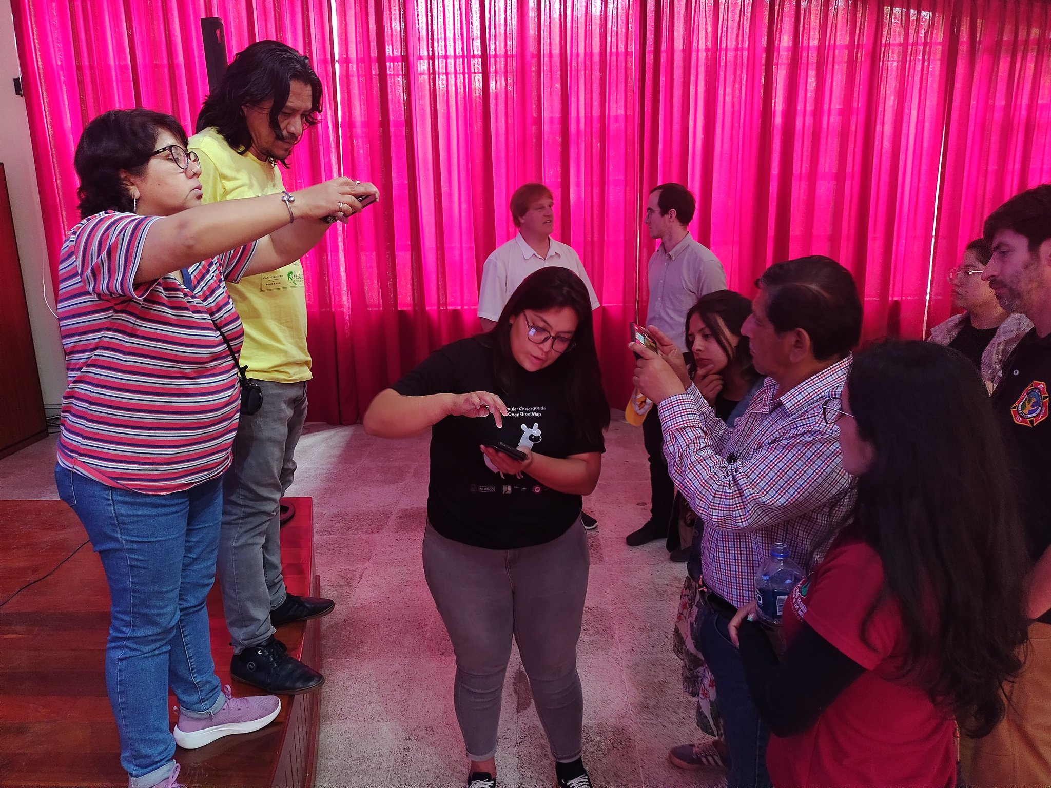
The exercises of mapping from the citizenship, which are the basis of the present introspection, take origin in the work group of #Repubikla. This group, through several projects articulated among themselves, encourages citizens and organized civil society to be empowered by generating robust data for public policies, and forms a framework where all the urban stakeholder are interrelated and aware from their different and complementary perspectives, in an inclusive way. These two objectives serve the central objective that is the construction of an egalitarian and inclusive city, with high participation in its processes, of the whole of the society.

Through the initiatives of #Mapeaton (Mapathon for and by pedestrians) and then #CrucesNegros (BlackCrosses), we have been approaching methods that sharpen our reading of public space, in a fine level of detail, and in its less visible and tangible dimensions, but more practical and perceptive.

Approaches to qualitative and inclusive methods of auditing the public space

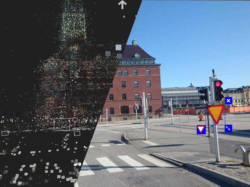
Users of the streets that do not have any motor problem, are the majority of the people in charge of directing the walks during which the audits are carried out. What elements of the transit space can a person who walks without difficulty, easily notice? The tip of the iceberg, the most obvious tangible elements, that even a robot could interpret with banks of images of the city. And for this, we can soon leave the task to artificial intelligence systems (#Mapillary and #OpenStreetCam advance in this sense and will be a reality achievable in a few years).

Alt text Alt text

If the recognition of the most obvious problems of the infrastructure is not the main added value, how to reach a more acute level of perception of our environment? And how to express it? To move towards greater sensitivity, the #Mapeaton methodology quickly included models within the exercise. The models are people with any difficulty to move, compared to the user omnipresent in the social representations and also the most attended by public policies: the young man, with good physical conditions, middle class, without any accompanying person. When performing the exercises with a population made invisible, we pretend to have a correct representation of the citizenship that moves in our cities.

Alt text Alt text Alt text

By integrating to the Mapeaton methodology the fine observation of how the models move, with the timely and sequential documentation using #Mapillary, of each rise of the sidewalk, crossing, sidewalk in variable conditions, invaded by infinity of obstacles, it helped with no doubt to see imperceptible dimensions of our space, by having different physical conditions.

Alt text Alt text (Mapillary.com)

Evaluate the infrastructure, or perceive the experience of the others?

The visual observation is here the vector to be able to try to transmit the experience of the subject-model. But what happens at the level of experience and interaction between the participants? Other types of mapping projects have helped to understand several things: something not only occurs at the visual level; the physical infrastructure problems, as well as their classification to give a digested result of the direct exercise to the urban designer, are not the only interesting dimension, nor the most important, to be treated as urban public space.

When performing participatory audit exercises, which have a precise practical function, we still loose the most hidden part of the iceberg.

This is how #Mapeaton and its variants have become a window of experimentation towards modes of more sensitive representations of space, where the result is not the only purpose, but also the process. Interaction with subjects who are aware of the problem, not only through observation but through dialogue and testimonies, helps to perceive otherness, to try a different experience from the others’ shoes, and to capture an environment from which we do not have the keys to understand it.

Deconstruction of cartographic practice

Following the Mapeaton methodology, two specific experiences have led us to a more sensitive understanding of the mapping exercise, an exercise at an exploratory level, which we now consider fundamental and * prior * to recognition exercises of physical elements of the infrastructure and their classification for design and public policies.

The first experience was with the project Performance of the Walk by Fabiola Rayas, which represents, with photographic sequences, the last known routes of missing people (a massive phenomenon) in Michoacán, Mexico.

The use of photomapping as a memory support, collective and performative homage with families, and claiming, represents a powerful use of cartography, where the boundary between instrument, support, and message, is much more abstract, as well as the function of the map.
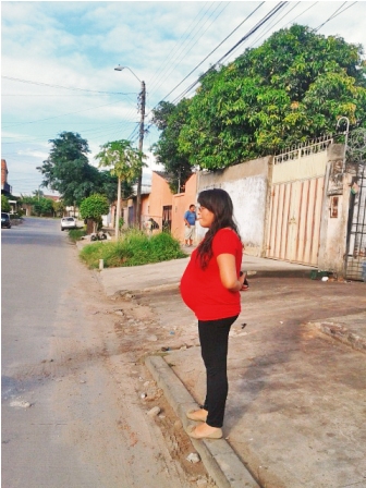
Alt text Mapillary sequence Alt text

This mapping is the accidental result of a #Mapeaton exercise focused on the vision of women working in public space all day, to help identify the hot spots of these streets, as a participation in the art project Carpa orgánica de La Soledad by Santiago Robles. The uncontrolled conditions of this practice transformed the experience, from an audit of the infrastructure with the eyes of a type of user of the space, to another very perceptive experience of a latent and little tangible violence and balance of power.

Alt text

Again, the streetview is a medium of expression of an ambient, rather than a medium of identification and classification of physical elements. The streetview “narrates” an itinerary made through streets of La Merced with permanent fear to the eyes of those who control the area, to be seen with strangers, to be seen recording with a cell phone.

Alt text Mapillary sequence

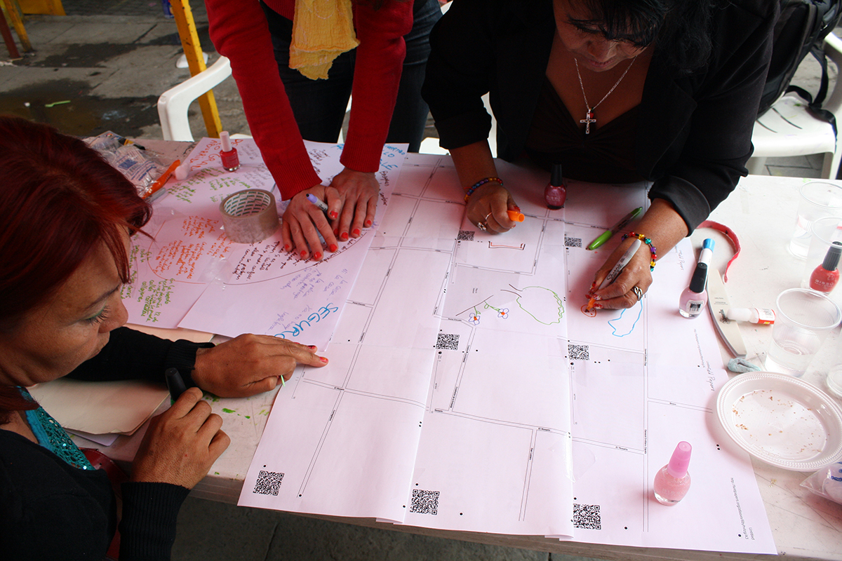
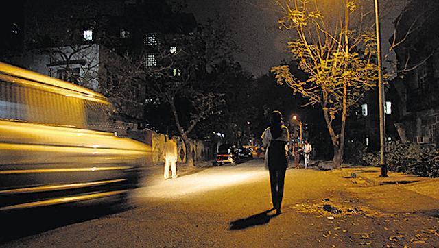
#CallesVioletas, a participatory mapping of the hostility of space for women

Since the beginning of the Repubikla project, working methods have been experimented to document the violence suffered by women in the public space, with feminist groups and public institutes such as the Institute of Women (InMujeres) of Mexico City, based on web mapping of the hot spots of the city for cyclists, and in photomapping. In the framework of the UN #SafeCities program, the Institute of Women of Mexico City has organized walks in violent areas of almost all the delegations of Mexico City, with inhabitants, officials, and experts, by day and at night. In the process of conceptualization, we have provided methodological advice to systematize the exercise with photomapping.

In this same context, we will carry out other exercises in March and April 2017, with groups of the Peatonal League, integrating the learning described above to achieve an exploratory and sensitive mapping of public spaces according to the perception and experience of women.

The #CallesVioletas exercise is a sensitive reading, with violet glasses, of anxiety, hostility, fear that can generate the space to the women. It is a previous and independent exercise, to the recognition and classification of tangible elements of the infrastructure.

The method is based on the following points:

  • Organization of a walk with one or more groups, exclusive of women, of approximately 10 people, with a majority of inhabitants and users of the place, as well as local officials from different agencies, experts on gender violence, urban planners, mobility experts, etc.
  • Guide: a person guides the walk in a slow pace, making frequent stops where she invites the group of inhabitants to express their feelings in this place, day and night, to relate events, to dialogue.
  • A person records the stories (audio or text note)
  • A person performs a photomapping sequence with the dedicated Mapillary account #CallesVioletas * in front of the group * avoiding to record the group in the photos
  • Another person with the same account makes shots of physical elements in case they are mentioned by the group, but without conditioning people to do so (do not give the instruction)

Alt text

NB: (If the context needs it, other people can take specific pictures with #Mapillary of physical elements of the infrastructure using a pre-built typology, must be separated from the exploratory group dynamics)

The results of the exercise are visible and can be downloaded on the Mapillary.com web platform. Like #Mapeaton, it is important to use the same dedicated account for these exercises, to be able to build a repository of images that can be viewed, analyzed and compared together anywhere in the country or the world. The greater number of projects carried out with the same methodology and visible together on a map, the stronger the message and the impact we can have, documenting the issue and building a debate.

With an open images repository, we also allow analysts, urban designers, researchers, to have a consistent material to analyze and construct proposals that improve cities, with an inclusive approach.

The exercise itself provides a framework for interaction and collaboration between local governments, public safety, planning institutes, local, national and regional level organizations, inhabitants, experts, which can lead to other inclusive participatory experiences.

Spanish version 

Related Projects: Repubikla, Mapeaton, CrucesNegros, @_atropellado, MoreliaSeMueve, Performance of walking

Location: 06080, Mexico

Evaluation of participatory transport mapping data: MapatónCDMX

Posted by mapeadora on 19 December 2016 in English. Last updated on 17 April 2021.

Why an evaluation?

OpenStreetMap is an international community of citizens, experts in open geographical data from different perspectives and specialties, and in collaborative methods to build information. OpenStreetMap is part of the Voluntary Geographic Information movement.

The Mexican OpenStreetMap chapter in preparation is involved in 3 main lines of action:

  • Strengthening the community (training and methodological support in projects, integration with academia and activism)
  • Procedures with government institutions for the importation of large public databases
  • Management with institutions to promote open and collaborative practices in its information management

As a global community and ecosystem of technologies, OpenStreetMap has participated in the past in several initiatives of informal transport mapping. This lack of good transport systems and lack of data is crucial in developing cities.

Objectives of transport mapping initiatives

These operations usually pretend to:

  • Create a complete transport system map to allow citizens to orient themselves in their city and make their mobility more efficient. Having this map allows more people to use collective transport instead of individual transport, with important implications on the mobility system, economy, environmental conditions, and the quality of life of people
  • Provide local governments with data to regulate their transport, when they do not exist in useful formats
  • Provide city and transportation planners with the necessary information to generate diagnostics, analysis, and design
  • Allow research and innovation on the subject of transport and mobility with georeferenced open data and with quality standards

In order to make it possible for organizations, communities and governments to systematize the different experiences already developed in the world, the OpenStreetMap Mexico group undertook a medium-term exercise in collaboration with WRI and MIT to document all cases, evaluating, and highlighting successful practices in terms of organization, management, participatory method, technology, data produced, socialization and outputs given to the data, as well as the methods used to be able to update them. The result may be in the future a platform that catalyzes and shares knowledge: where in addition to providing the open technologies and data generated in different cities, a methodological guide is shared with the methods that have led to the best results.

The experiences developed in the world - Mapanica in Managua, Matatus in Nairobi for the best known, but also in Egypt, India, Bangladesh, Colombia, Mexico, etc. Have been led by different organizations, usually in a horizontal collaboration: associations, NGOs, communities such as OpenStreetMap, groups of civic technologies, universities, small businesses or startups, local governments.

This text is the first step of an evaluation work line of participatory transport mapping operations. This first evaluation is about the final data of MapatonCDMX developed in Mexico City, delivered by the authority after corrections by volunteers and academics.

Guidelines on the work process of MapatónCDMX

The results presented are from the MapatonCDMX organized in 2015-2016 by the “Laboratorio para la Ciudad”, the innovation department of the Government of Mexico City. The Laboratory proposed to develop a methodology and participatory dynamics to carry out mapping on a voluntary basis.

The MapatonCDMX was initially based on an app and a method applied before in Mexico City and other countries (Bangladesh among others) by the organization Urban Launchpad with the app Flock Tracker. The strategy changed in the course to incline towards the development of an application proprietary for the track of the transport routes, with essentially the same methodology.

In parallel, a collaborative table was formed with participants from various profiles and institutions. The OpenStreetMap group had the opportunity to participate in some working meetings where we suggested the use of existing open technologies instead of developing an app from zero, and to provide in the information structure the necessary attributes to the later generation of GTFS **.

The participatory dynamics were directed towards gamification methods, based on an open call and the formation of teams put in competition for the obtaining of sponsors’ prices. To improve participation, other groups of young people already enrolled in a voluntary process (INJUVE youth) were invited to join the dynamic. The organizations represented at the collaborative table were also asked to contribute by providing volunteers.

The data collection period resulted in a data set that was subsequently cleaned with the contribution of several organisms in 2 stages, with a weak result.

MapatonCDMX data evaluation

The MapatonCDMX data were published in different formats. The files of the GTFS specification can be downloaded here, the complete database can be consulted from its dashboard and API for developers.

(Update 2021: links weren’t maintained)

The first public delivery of data via the API, yielded a route system with topology deficiencies and an erroneous validation process.

Alt text 
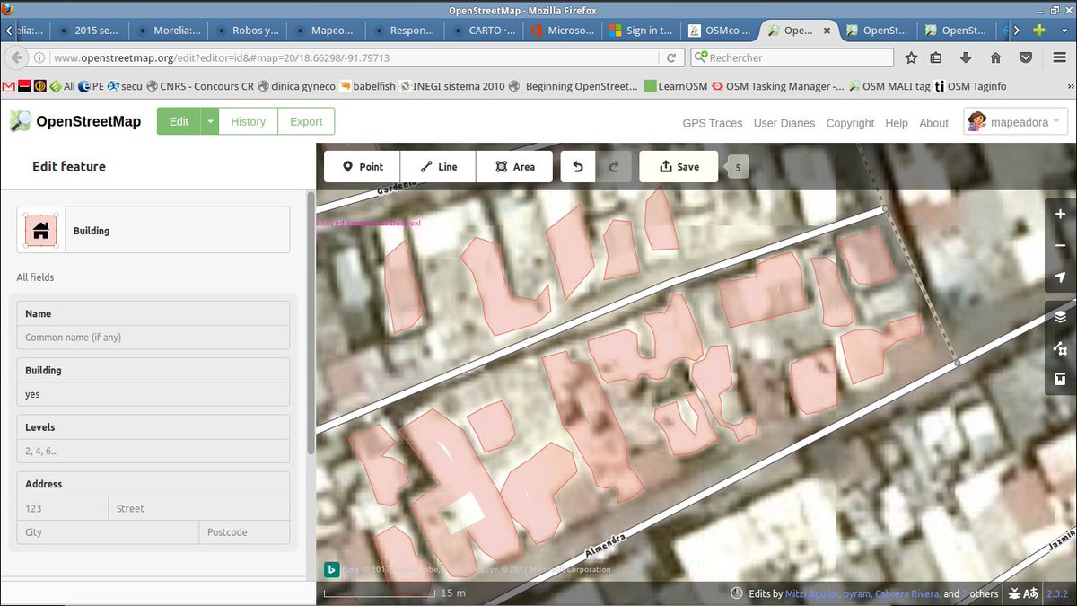
Photo 1. Routes contained in the API of the MapatonCDMX in the first delivery

In the Mapaton API, which was the method for public consultation and download of routes in GTFS format in the first delivery, 2893 routes were available, of which only 501 were valid for GTFS format, representing only 20% usable in navigation and network analysis technologies.

Alt text Photo 2. Routes contained in the GTFS in the first delivery

The routes contained in the GTFS, despite having a good topology, did not manage to be representative of the public transport offer in the CDMX. The state of the information requires a validation process and a correction of the routes contained in the API that could not be integrated into the GTFS because of the serious topological errors.

The data were submitted to a second cleaning session with the support of the Mario Molina Center in October and November 2016. These data were made available in December. In this second stage, the API presents 4019 routes, of which 29 do not contain geographical information, the 3990 remaining routes can be classified as follows:

  • Valid: 2162
  • Invalid: 1122
  • Invalid, out of time travel: 529
  • Invalid, data with error: 177

Of these routes, 501 were finally added in the GTFS format, which represents 23.17% of the total of API’s valid routes. For these 501 routes, georeferencing is good and is attached to the road network, but some of the attributes are missing and do not allow to validate the format and give it a possible use: service schedule, stops, time of arrival at stops. When this information can not be reliably robust (such as in the case of informal or unstructured transport systems mapping), the construction of a GTFS format relies on estimations, but information can not be dispensed with.

A visual summary of the information contained in the GTFS is presented:

Alt text Photo 3. Routes total Alt text Photo 4. Valid routes Alt text Photo 5. Invalid routes Alt text Photo 6. Invalid routes, short travels Alt text Photo 7. Invalid routes, travels out of time

As a synthesis

The current MapatonCDMX data has a very low part of valid routes and the absence of complementary attributes for many of them doesn’t allow its use as a GTFS. For this purpose, this data may still go through an in-depth​ process of validation and correction, which could be done with some technological tool or with a crowdsourcing methodology, which should be submitted to a cost-benefit evaluation. Another strategy could be to re-collect part of the data (but the number of routes needed is high) or establish a permanent mechanism for contributing to the create new data over a long period, to progressively replace non-functional information.

Because of its scope of work, the MapatonCDMX can be seen as an experiment of institutional cooperation for a crowdsourcing exercise, and a test for a large-scale participatory method. We invite you to read soon about the methods and results of other non-structured​ transport mapping operations carried out in other cities around the world. We will inform about the upcoming evaluations in this blog and networks of OpenStreetMap México.

(Update 2021: look at the DATUM initiative )

** The General Transit Feed Specification (GTFS) was created in 2005 by Trimet and Google so that transit agencies could share open information in a simple way, boost the technology development ecosystem and facilitate the development of applications that use this information.

Additional resources for data visualization:

Mapaton Viewer

GTFS Viewer

Read more about the first delivery of MapatonCDMX data

By @imleodc & @mapeadora

Location: 06800, Mexico

Building a Women's work group in Openstreetmap Latin America, or How to Make Community

Posted by mapeadora on 11 December 2016 in English. Last updated on 19 December 2016.

The gender gap in technologies and information’s world is a commonplace, so assumed that few solutions are sought. This reflection appeared through an internal debate in the regional chat of OpenStreetMap Latam, allowing that the concerns of several people could concretize in a work line within the community. This text could also be a reflection on how to build community.

Why and how did the need to build a forum on the gender gap in OpenStreetMap appear

The OpenStreetMap community has various channels for relating, communicating information, giving directions, debating opinions: mailing lists, wikis and chats, country or region based, working group based. In the ConDatos 2014 event in Mexico City, where several people from the continent meet each other, linking the Openstreetmap community of Latin America in a more integrated way was proposed, firstly creating a mailing list and a regional chat. Alt text

I wasn’t personally involved in these media until summer 2016 when I was invited to the chat. A chat of about 100 people can be a space where topics are drowned, but also a space where new perspectives, information and conversations emerge. In relation to the State of the Map Latam event in Sao Paolo, November 2016, where an extremely low participation of women was taking place, the issue of the gender gap in the community appeared as a problem to be addressed. The chat then had an active participation of no more than 5 women over then 80 registered. We began to talk about propositional actions to achieve greater participation in the SOTM. The ongoing debate was first about the need to have data about female participation in the mapping, but this data not exist since the profiles of OSM users are anonymous. We talked about some analyses presented previously in another SOTM event (Brussels 2016), which sought to interpret the mappers gender through the types of mapped objects. The analysis related a type of commerce and service with a specific gender: services considered male-oriented (car shops) appeared more frequently on the map than services considered typically women-oriented (hairdressers and services oriented to personal aesthetics). This analysis was considered inconsistent for the most of us, generated passion in the chat and raised to ask:

  1. How to obtain evidence of the relative participation of different genders
  2. What difference can there be in the perspective, the needs and the interests on the space, between the different genders
  3. Why it is so important to integrate this axis into our community actions and information management

What actions were proposed?

Certain countries, such as Argentina, had already a map of the location of their users, being a local community support. We all decided in the regional chat to replicate the map at the LatAm level asking each one to locate him/herself on the map, with gender information. Although it grows permanently, the map reflects the gap in the same proportion as estimated. It is proposed to frequently invite new OSM members to mark his or her location on the map. In addition to giving a visualization of the gender gap, the map is a nice product and a medium for identity group construction. Because it allows to clearly perceive the problem of the very low female participation, it gave the impulse to the formation of the internal group: #OSMchicas.

The discussions focused secondly in the need to develop an effort to summon more women to the SOTM event: from the local community of Brazil, from the region, and orienting the scholarships that are generally oriented to have a wide participation, towards women. In this way, the participation of women from the chat was greater, they could attend the event and meet personally. As a consequence, this group of women strengthened and had the possibility to propose specific actions to address this issue, in advance.

The plan for the event was:

  1. Participate individually with their individual work presentation, contributing to a better gender balance in the program
  2. Organize a women’s panel where the topic would be discussed from various perspectives: Why greater participation of women in the OSM mapping is important to build the map with information that represents society as a whole (it appears as a crucial point since the map is the basis for territorial planning and public policy); Telling about our projects related to gender, women, space, and mapping; What is our experience as women in the community and in the data and technology world; How we could remedy the gender gap in the community, and unit everybody into this debate and brainstorm.
  3. Begin to build a network of women among those present, involving less active or new women in this area.

Alt text

In addition, a pre-SOTM toast was proposed to get to know and strengthen ideas before the panel, being a pretext to summon more people not very connected with the community or the subject.

Alt text Alt text

What results did we obtain?

We can consider that, as a first step of linking, these actions with a gender perspective and female empowerment have had a triple success: raise awareness on this issue in the community; start a network of Latin American women broader than the starting nucleus; Through gender-based engagement, integrate isolated people into the OpenStreetMap community. The panel also gave rise to several agreements, in addition to identifying us and forming a new workgroup, with a parallel chat of 15 people.

We invite attendees and participants as well as social networks to brainstorm about the gender gap with the hashtag #OSMintegra. This action will be a permanent task of the OSMchicas group.

We also understood the need to link and make more visible the different works with a gender perspective that we are doing throughout the community, linked to the construction or use of the map, or technologies associated to OpenStreetMap, as well as training actions for women in any kind of context. It is about documenting and having a tendency to publish in all possible ways (and firstly in this OSM diary) to give space to the subject.

Reducing the gap also implies a constant effort to increase women’s participation in OSM, data and freeware events in general. Added to a representation gap, there is a clear problem of funding for traveling, and targeted call, which can be achieved through the work of network construction. A central task of OSMchicas will be the search for sponsorship of all kinds to finance:

  • Travel scholarships for women from the community or women who can contribute to the community, to attend the most important events
  • Support for the logistics of activities that target women participation

As a result of the link that naturally happens in a regional scale community event such as SOTM Latam, we have been interested in participate in an important upcoming event for a wider community: CubaConf 2017. Several dimensions today lead us to have a more committed attention to this event: the interest in the challenge of a free technology event in the context of Cuba, and a challenge for OSMchicas to promote in a first occasion the participation of women.

Our participation in the organization of CubaConf, with ideas and proposals, gives us a pretext to continue building our instruments of work and OSM women’s network. It also lead us, given the particular context of Cuba, to develop new strategies, projects, methodologies for local community participation.

To be continued

It seems to have a high relevance to continue analyzing participatory processes in a network like Openstreetmap, but not only. Explore the mechanisms that result in the building, growth and strengthening of a community; Identify how leaderships are built and how these leaderships can be as positive as inhibitors for certain parts of the community, based on a gender or any other difference. This analysis is nourished by our expression and debates, both in our differences and internally to a subgroup. In this sense, separating women in a reserved space is not a matter. They are given the opportunity to work in several groups and expand their opportunities to express, propose, take leadership. It was quite revealing how the construction of a separate chat for this new group led us to have new ideas and how it encouraged the participation of people who were already part of the regional community, but less visible.

Our participation in CubaConf can have a positive impact in boosting the participation of women in Cuba and in the region, by continuing to build networks, and to give greater scope to training. We will be seeking funding and having a participation of more institutions to achieve this.

We invite to join a general effort of documentation to the people who can contribute to this issue of cartography and the uses and perceptions of space by women, being a necessary link to have an integrative vision of the territory. People from the Openstreetmap community are invited to write on this topic in their OSM User Journal, with the hashtag #OSMintegra (in diaries and in social networks), that allows to link the contributions, to spread them more easily, and to continue to invite to be part of the debate. Finally, any link will be enriching to understand better this topic. The group of girls of OSM Latam was very enthusiastic following the meeting in SOTM Latam of Sao Paulo. Thanks to the organizers!

[Spanish version] (https://www.openstreetmap.org/user/mapeadora/diary/40027)   See also: Https://www.openstreetmap.org/user/Mapanauta/diary/40008 Http://www.openstreetmap.org/user/SeleneYang/diary/40014

@mapeadora #OSMintegra

Location: 06880, Cuauhtémoc, Mexico City, Mexico

La brecha de género en el mundo de las tecnologías y de la información es un lugar común, tan asumido que se buscan pocas soluciones. Este tema de reflexión apareció por un diálogo interno a un chat regional de Openstreetmap, permitiendo que se concretizarán las inquietudes de varias personas, en lo que es ahora un tema de trabajo dentro de la comunidad. Este texto podría ser una reflexión sobre cómo construir comunidad.

Sobre la necesidad de hablar de la brecha de género en Openstreetmap

La comunidad Openstreetmap tiene diversos canales para relacionarse, comunicar información, dar orientaciones, debatir opiniones: las listas de difusión, wikis y chats, en cada país, cada grupo de trabajo, y también regiones. A partir del evento ConDatos 2014 en México, a donde acudieron varias personas del continente, se planteo el interés de relacionar la comunidad Openstreetmap de Latinoamérica de manera más integrada, creando primero una lista de mail y más adelante un chat regional.

Alt text

No estuve personalmente muy involucrada en estos medios de comunicación hasta hace pocos meses al ser invitada al chat Latam. Un chat de cerca de 100 personas puede ser un espacio donde se ahogan los temas, pero también un espacio donde se descubren nuevas perspectivas, informaciones, y emergen conversaciones. En relación con el evento State of the Map Latam entonces en preparación en Sao Paolo, donde se perfilaba una participación extremadamente baja de mujeres, apareció el tema de la brecha de género en la comunidad como un problema que atender. El chat tenía entonces una participación activa de no más de 5 mujeres sobre entonces 80 inscritos. Se empezo a hablar de acciones propositivas para lograr una mayor participación en el SOTM. El debate continuo sobre la necesidad de tener datos sobre la participación femenina en el mapeo, dato que no existe puesto que los perfiles de los usuarios de OSM son anónimos. Se habló de algunos análisis presentados anteriormente en otro evento SOTM (Bruselas 2016), que buscaba interpretar el género de los mapeadores a través de las temáticas y tipos de objetos mapeados, análisis que resulta poco robusto y generó más debate aún. El analisis relacionaba un tipo de comercio y servicio con un género: servicios considerados orientados al sexo masculino (tiendas de automóviles) aparecian con mayor frecuencia en el mapa que servicios considerados típicamente de interés para las mujeres (peluquerías y servicios orientados a la estética personal). Esta perspectiva generó cierta pasión en el chat y planteó la necesidad de preguntarnos:

  1. Cómo obtener evidencias de la participación relativa de los diferentes género

  2. Qué diferencia puede haber entre la mirada, la necesidad y el interés sobre el espacio, de los distintos géneros

  3. Porqué es importante integrar este eje en nuestras acciones comunitarias y en la gestión de la información

¿Qué acciones surgieron?

Ciertos países como Argentina tenían un mapa de localización de sus usuarios en UMAP, como soporte de comunidad local. Se decidió en el chat replicar el mapa a nivel regional, pidiendo al grupo localizarse en el mapa, con información adicional de género. Aunque evolutivo, el mapa refleja la brecha en una misma proporción que la que se estimaba. Se propone invitar con frecuencia a los nuevos integrantes a representarse en el mapa. Además de darnos una visualización de la brecha de género, el mapa es un bonito producto y medio que hace sentir parte de un grupo, él de Openstreetmap Latam, y, viendo y percibiendo el problema de la baja participación femenina, él de un grupo interno de mujeres OSM.

Las discusiones internas al chat que se desarrollaban en paralelo caminaron a tratar de convocar a más mujeres al SOTM, mujeres de la comunidad local de Brasil, y mujeres de la región, orientando las becas que se buscan generalmente para ayudar a tener una amplia participación, hacia mapeadoras. De esta manera, fue mayor el numero de mujeres ya en relación en el chat que pudieron acudir y conocerse personalmente en el evento. Como consecuencia este grupo de mujeres tuvo la posibilidad y el interés de plantear acciones concretas para atender este tema, de manera anticipada.

El plan fue:

  1. Participar de manera individual con ponencias sobre sus temas de trabajo, aportando un poco más de equilibrio en la convocatoria
  2. Organizar un panel de mujeres donde se discutiría del tema desde varias perspectivas: porqué una mayor participación de mujeres es importante para tener en el mapa una información que representa el conjunto de la sociedad, punto bastante crucial dado que el mapa es la base de la planeación territorial y de políticas públicas; cuáles son nuestros proyectos relacionados con género, mujeres, espacio, y mapeo; cuál es nuestra experiencia como mujeres en la comunidad; cómo podríamos remediar a la brecha de género, invitando el público a debatir y aportar ideas.
  3. Empezar a construir una red de mujeres entre las presentes, involucrar a mujeres menos activas o nuevas en este tema.

Alt text

De manera adicional, se propuso un brindis pre-SOTM para conocernos y fortalecer ideas antes del panel, siendo un pretexto para convocar a más personas no muy conectadas con la comunidad ni con el tema.

Alt text Alt text

Balance y resultados

Podemos considerar que, como primera etapa de vinculación, estas acciones con perspectiva de género y de empoderamiento femenino han tenido un triple éxito: él de lograr concientizar parte de la comunidad en este tema; él de formar una red de mujeres latinoamericanas más amplio que el núcleo de inicio; a través del involucramiento con tinte de género, integrar más personas a la comunidad Openstreetmap.

El panel dio tambien lugar a varios acuerdos, además de identificarnos y formar un nuevo grupo, con un chat paralelo de 15 personas. Invitamos a los asistentes y participantes, así como en las redes sociales, a tener una lluvia de idea sobre la brecha de género, con el hashtag #OSMintegra. Esta acción será una tarea permanente del grupo de chicas OSM Latam.

Entendimos la necesidad también de vincular y visibilizar los trabajos sobre género o con perspectiva de género que estamos realizando toda la comunidad, que se vinculan con la construcción o el uso del mapa, o de tecnologías asociadas a Openstreetmap, así como acciones de capacitación a niñas y mujeres en cualquier tipo de contexto, a nivel internacional. Se trata de documentar y tener una tendencia a la publicación en todos los medios posibles para dar espacio al tema de datos, cartografía y género.

Reducir la brecha implica también concretamente tener un esfuerzo constante para aumentar la participación femenina en los eventos de OSM, de datos y software libres en general. El esfuerzo que realizar aparece claramente como un problema de fondeo y de convocatoria dirigida, lo cual se logra gracias al trabajo de construcción de red. Una tarea central del grupo de mujeres será entonces la búsqueda de patrocinios de todo tipo para financiar:

  • Becas de viajes para mujeres de la comunidad o mujeres que puedan aportar a la comunidad, a los eventos más importantes
  • Apoyo para la logística de actividades específicamente orientadas a mujeres y niñas

Como resultado de la vinculacion que sucede naturalmente en un evento comunitario de escala regional como el SOTM Latam, nos hemos interesado en un próximo evento de importancia para una comunidad más amplia, donde puede converger la participación de OSM: el CubaConf 2017. Varias dimensiones nos llevan hoy a tener una atención más comprometida con este evento: el interés por el reto que representa un evento de tecnologías libres en Cuba; la fecha próxima; así como el sentimiento de grupo que ha generado el panel y la red naciente de mujeres, con una misión que nos es más clara hoy día, de impulsar la participación femenina en la mayoría de los eventos posibles.

Nuestra participación en la organización de CubaConf con ideas, propuestas y cuestiones logísticas nos da el pretexto para construir, dar continuidad y fortalecer nuestros instrumentos de trabajo y de red de mujeres. La continuidad en fecha, después del SOTM es particularmente oportuna para canalizar y fortalecer nuestro interés, así como para motivar personas aún poco activas. También nos permite, dado el contexto particular de Cuba, desarrollar nuevas estrategias, proyectos, metodologías de participación con la comunidad local.

Muchas cosas por venir

Parece tener una alta relevancia el seguir analizando los procesos participativos en una red como la de Openstreetmap, pero no solamente. Explorar los mecanismos que resultan en la construcción, el crecimiento y el fortalecimiento de una comunidad; identificar cómo se construyen los liderazgos y cómo estos liderazgos pueden ser tan positivos como inhibidores para ciertas partes de la comunidad, basadas en una diferencia de género pero también en cualquier otra diferencia. Este análisis se nutre de nuestra expresión y debates, tanto en nuestras diferencias como de manera interna a un subgrupo, en este caso de mujeres. En este sentido no se trata de separar las mujeres en un espacio aparte, pero darles la oportunidad de desenvolverse en ambos grupos y ampliar sus oportunidades de expresarse y proponer. Fue bastante revelador como la construcción del grupo y de un chat separado nos ha llevado a tener ideas y como impulsó la participación de personas que ya eran parte, pero más invisibles, de la comunidad regional.

Nuestra participación en CubaConf puede tener un impacto positivo al impulsar la participación de las mujeres en Cuba y en la región, al seguir construyendo redes, y dar un mayor alcance a las capacitaciones. Estaremos buscando financiamiento y la participación de más instituciones para lograrlo.

Invitamos a sumarse a un esfuerzo general de documentación a las personas que puedan aportar a este tema de la cartografía y del uso y percepción del espacio por mujeres, siendo un eslabón necesario para tener una visión integradora del territorio. Las personas de la comunidad Openstreetmap están invitadas a escribir sobre este tema en su Diario de usuario OSM, con el hashtag #OSMintegra, para poder centralizar los textos, difundirlos más fácilmente, y seguir invitando al debate. Invitamos a usar este mismo hashtag en redes para cualquier motivo que aporte al tema y a la red de mujeres. Finalmente, cualquier vínculo será enriquecedor para entender más del tema. El grupo de chicas de OSM Latam quedó muy entusiasto a raíz del encuentro en SOTM Latam de Sao Paulo. Agradecemos profundamente a los organizadores!

Version en ingles

Ver también: https://www.openstreetmap.org/user/Mapanauta/diary/40008 http://www.openstreetmap.org/user/SeleneYang/diary/40014

@mapeadora #OSMintegra

Location: 06850, Cuauhtémoc, Ciudad de México, México