
New updates to "Latest Changes"
Posted by rene78 on 5 July 2022 in English. Last updated on 10 January 2023.“Latest changes” (https://rene78.github.io/latest-changes/) got a few improvements:
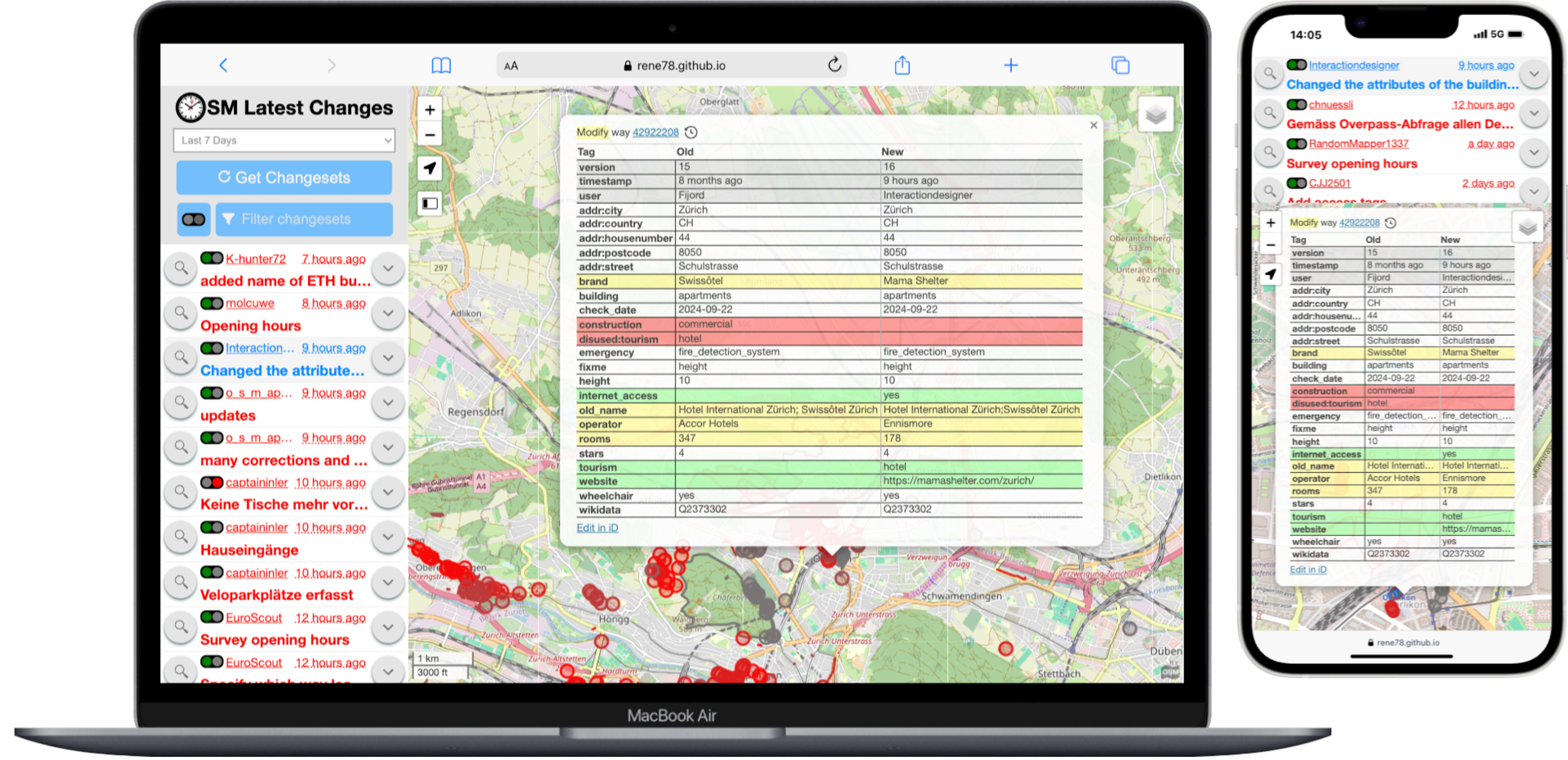
Tag comparison table
A table opens when clicking on any element. Updated key-value-pairs are highlighted in different colors (Green: Newly created, Yellow: Modified or Red: deleted). (similar to achavi).

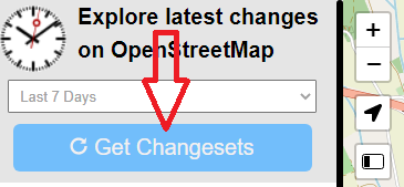
Download button
Button to download changesets instead of automatic download on pan and zoom. The long waiting times and frequent timeouts when querying overpass led to a bad experience. With a button it is much better in my opinion.
Vandalism Checker
Simple sanity checker for all the downloaded changesets. It adds up all elements and tags which have been added or deleted in the changeset. If the sum is below a certain treshold (currently -3) then a traffic light changes to red to alert the users of latest-changes about this changeset. Ideas on how to make this checker more powerful are welcome.

Examples
- A user adds one new supermarket and deletes two roads: The sum would be -1. Vandalism checker stays green.
- A user adds three key-value-pairs to a restaurant but deletes seven of a library. The sum would be -4. Vandalism checker turns red.
Small changes
A few other minor changes regarding the UI/UX. Check the GitHub pull request if you are interested
How to use
In a previous blog post I explained what this tool is about and how to use it. Please allow me to repost it here:
The purpose is to check recent OSM changes within a certain cartographic boundary, for example your home town. It is very simple and powerful:
- Open the Latest-Changes web app.
- Zoom to the area of interest
- Check and validate the changesets of the last 7 days (1 day, 3 days, 1 month).
- Bookmark the URL to regularly come back and monitor your area of interest.
Notes
The link on top leads to my version of the app. The original one can be found under https://tyrasd.github.io/latest-changes/

