I’ve been a Wikimedian since 2002 and an OSM mapper since 2007. While there are certainly a lot of differences between the two projects, I believe that there is much more in common between Wikimedia and OSM especially since OSM was directly inspired by Wikipedia (people usually introduce OSM as the “Wikipedia of maps”) and because they both came out of the free knowledge and open data movement (Wikipedia is licensed under Creative Commons and OSM was originally licensed under CC too before switching to ODbL). I therefore support and contribute to efforts for the two communities to understand each other and collaborate with each other. And I am not alone: there are a lot of Wikimedian/OSM contributors like me.
Over the past decade, I’ve given a lot of presentations, talks, trainings, and workshops on how to contribute to and make use of Wikimedia projects (like Wikipedia) and OSM but it was during Wikimania 2014 that I was first able to give a half-hour presentation about both projects and showing how the Wikimedia and OSM communities benefit from and collaborate with each other. (See the session page and my presentation slides.) Since then, I’ve given several talks about essentially the same topic in various Wikimedia and OSM events and you can see an overview of them on the Wikimedia Meta site.
State of the Map 2019 and WikidataCon 2019
 Edward and I discussing OSM with an audience member after our presentation at WikidataCon 2019. (Photo by Mohammad Hijjawi / CC BY-SA 4.0)
2019, however, was the first time that I gave such a talk together with another passionate OSM mapper and Wikipedian. State of the Map 2019 was held in Heidelberg back in September and WikidataCon 2019 was held in Berlin in October and I submitted proposals to talk about Wikidata+OSM at both conferences. Fortunately, both of my proposals were accepted. However, the WikidataCon conference program organizer contacted me and Edward Betts to suggest that we combine both of our talks because we essentially submitted the same topic! Edward and I readily agreed with the suggestion and when I learned that he was also going to SotM, I offered to let him be a co-presenter at my accepted Wikidata workshop.
So Edward and I discussed and worked on our sessions together. This needed some more preparation and adjustment on my part because I usually tend to cram finishing my presentations right before the event. 😝 Edward had created this super excellent OSM tool that generates a list of candidate matches between OSM objects and Wikidata items within a specified a place or region, which are then reviewed by the mapper and saved to OSM as wikidata=* tags on those OSM objects. Edward has presented his tool a few times before, most recently at Wikimania 2019 in Stockholm. We then both decided that in both conferences, I would give a quick introduction of Wikidata (at SotM) or OSM (at WikidataCon) and talk about the benefits of linking both projects then Edward will introduce and demonstrate his tool and touch on the problems of and limitations on linking OSM with Wikidata (including the fact that there can never be a one-to-one correspondence between OSM objects and Wikidata items).
If you are interested to learn more about our sessions, here are the details:

“OpenStreetMap and Wikidata: Awesome Together”
(55-minute workshop at State of the Map 2019)
session page, slides (part 1), slides (part 2)

“OpenStreetMap and Wikidata”
(25-minute talk at WikidataCon 2019)
session page, slides, video recording
Why link OSM and Wikidata together?
Within the Wikidata community, linking databases with each other is a no-brainer—Wikidata has thousands of properties (which are basically like OSM’s keys) that one can use to specify the ID of a record in a third-party database that corresponds to a Wikidata item. And Wikidata encourages linking back in return. For instance, earlier this year, the U.S. Library of Congress started linking back to Wikidata. (See the LOC’s Name Authority File page for OpenStreetMap where there is a link to the Wikidata item for OSM.) This linking practice is all part of Tim Berners-Lee’s (you know, the guy that invented the World Wide Web) grand concept of Linked Data.
On the other hand in OSM, there is a vocal segment of the community that expresses skepticism against adding wikidata=* tags (and similar secondary tags like brand:wikidata=*, artist:wikidata=*, and architect:wikidata=*) to OSM objects, preferring to stick to human-readable wikipedia=* tags instead. While that is a valid concern (after all, the tag wikipedia=en:New York City is obviously more comprehensible than the equivalent but opaque-looking wikidata=Q60 tag), this is really more a matter of tooling, and iD already has features that makes adding Wikidata tags easier. Ultimately—and if you already believe that linking OSM to Wikipedia/Wikidata is a good thing—linking to Wikidata, instead of or in addition to Wikipedia, is better in the long run because Wikidata has a more relaxed “notability” policy compared to Wikipedia. This means that there will be a lot more geographical items in Wikidata that do not have corresponding Wikipedia articles.
For example, one of the things I do in Wikidata is to add items on official historical markers (i.e., commemorative plaques) that are installed by my country’s historical government agency. (Example: the “Molino Dam” historical marker has this Wikidata item and that OSM node tagged with historic=memorial + memorial=plaque.) These markers will never have their own Wikipedia articles but I can tag their OSM nodes with wikidata=* and the corresponding Wikidata items contain a lot of information, including images stored on Wikimedia Commons, the marker’s inscription (which are often longer than 255 characters and therefore cannot be added as inscription=* tags in OSM), and links to one or more relevant Wikipedia articles about the subject that the marker commemorates.
So how does the OSM ecosystem benefit from linking to Wikidata? I discussed this extensively during our workshop at State of the Map (see slides above) but I will highlight a couple of examples. First, Wikidata often provides more multilingual labels (aka names) than OSM. For example, the Japanese city of Kobe only has 19 and 8 multilingual name:*=* tags for its OSM place node and administrative boundary relation respectively. In Wikidata, the corresponding item has much more: 108 labels. This wealth of labels in Wikidata is used by third-party map service providers such as Mapbox and MapTiler to provide better coverage for their multilingual maps. While OSM can of course add more name:*=* tags so that OSM data users do not have to rely on Wikidata, there is a strong opinion against adding pure transliterations or unattested/rarely-used translations of toponyms into OSM.
Second, Wikidata tags are now being used by Nominatim to provide better search results, thanks to a Google Summer of Code project by tchaddad. Before this project, Nominatim already uses Wikipedia tags as one of its inputs for its ranking/relevance algorithm. Now with the integration of Wikidata support, the geocoder now has easy access to even more data that it can use.

 A visualization of the mapping activity from thousands of mappers all over the world before, during, and after Typhoon Haiyan hit the Philippines.
 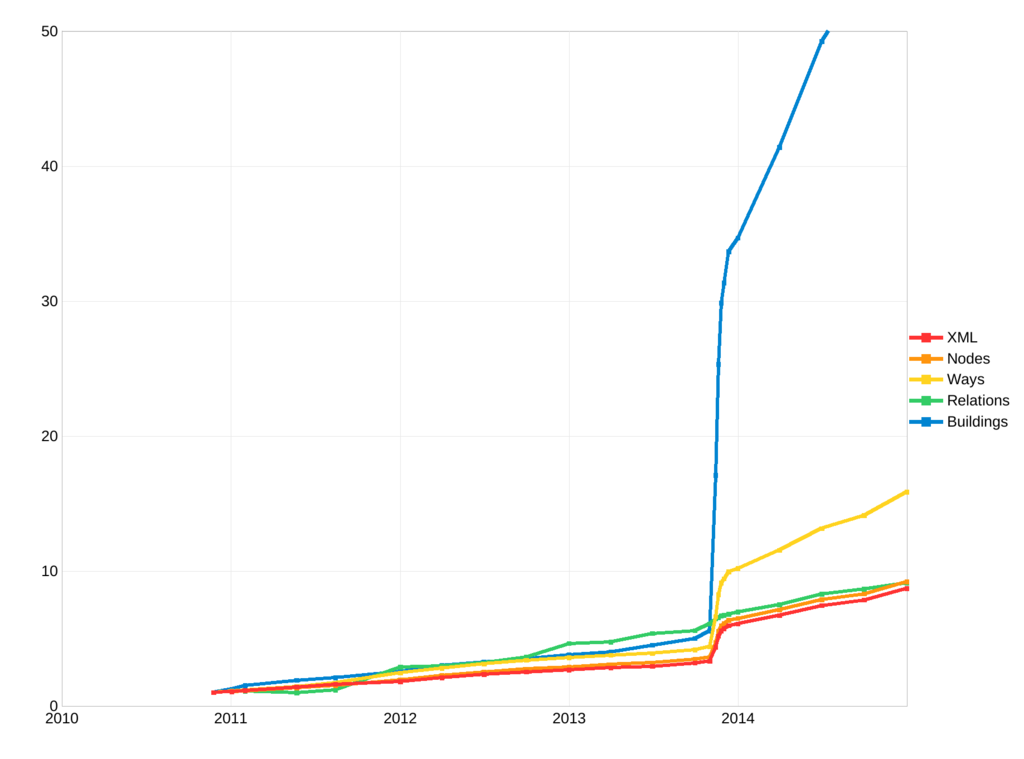 A line graph showing the extreme spike in the growth of OSM data for the Philippines as a result of mapping for Typhoon Haiyan.
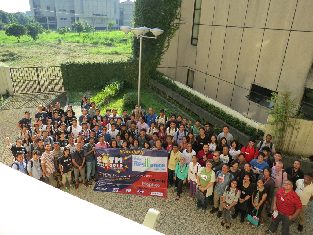 SotM Asia 2016 group photo

