
Originally posted on https://blog.georeactor.com
I had the idea to go bike touring on the western tip of Lake Superior. There’s a lot to say, but I wanted to have an OpenStreetMap mapper + bike travelogue perspective first.
The Route
I started in Duluth, Minnesota and crossed the bridge into Wisconsin. The next day I started biking along the Tri-County Trail, through a forested area, toward Ashland, Wisconsin.
The Twin Ports
Duluth, MN and Superior, WI (combined population: 113k) are a center for rail and Great Lakes shipping. They were built up during lumber and copper booms around 1900. I arrived on the weekend of their biggest summer event (Grandma’s Marathon).
The Duluth Airport is served by a regional transit bus. On weekdays it’s Route 1 to a transit center, but on the weekend it was Route 5 to a more southwestern neighborhood. I updated the bus stop and surrounding waiting area on OSM.
Duluth has a couple of bike shops - major props to Ski Hut for their help :)
A good stretch of Superior Street has a protected bi-directional bike lane:
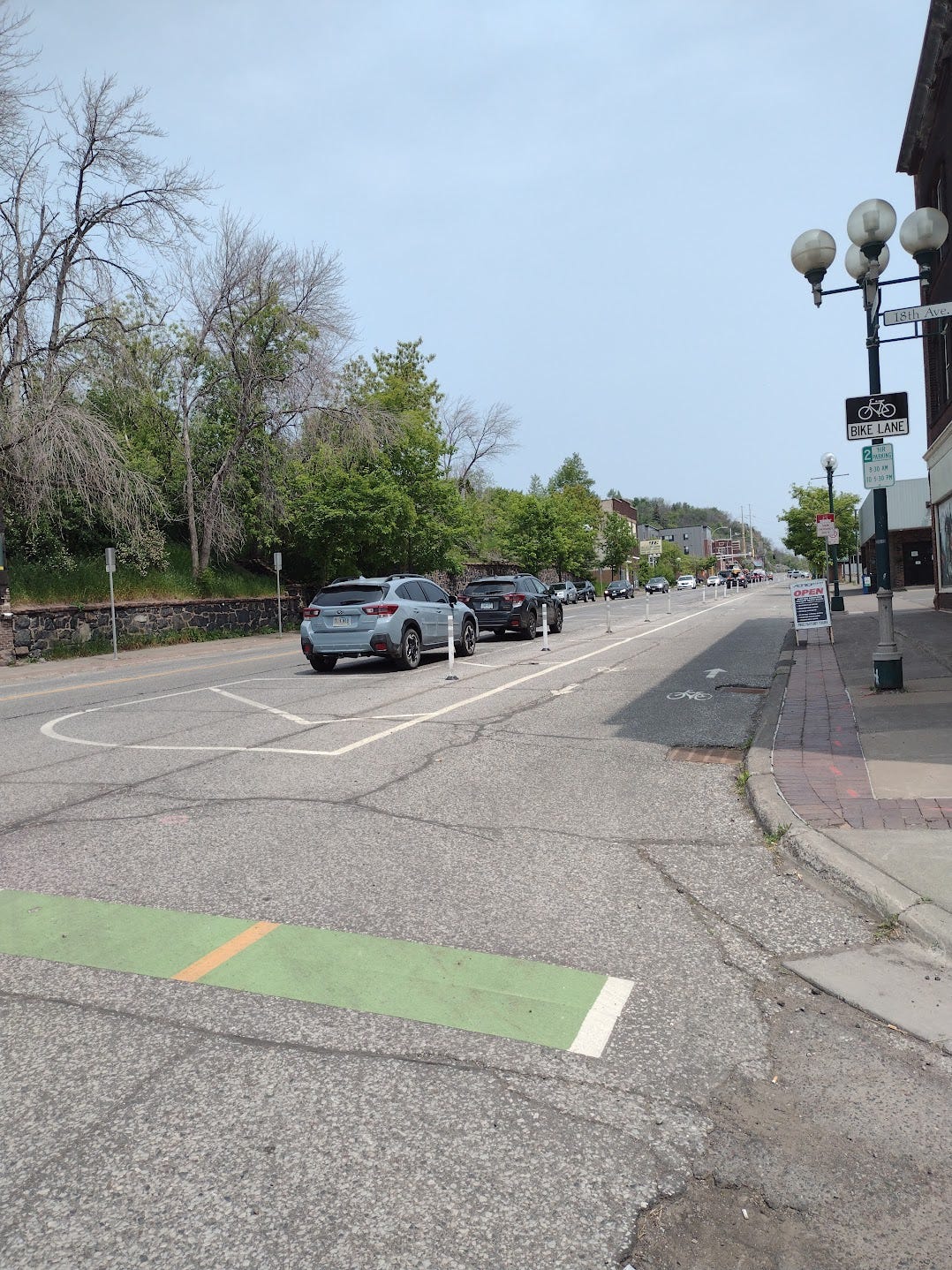
Part of the city is on a steep hill, so it could be difficult to navigate just by pedaling. Probably the nicest bike routes would be Minnesota Point and the Lakewalk going northeast. I was unable to explore during the marathon.
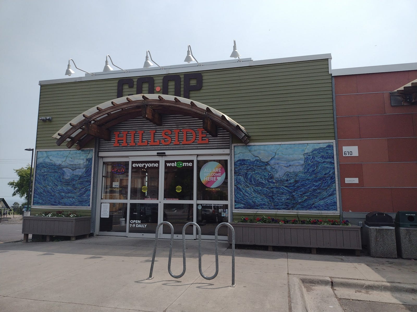
A grocery co-op named Whole Foods and a Kwik Trip had bike racks out front, but these are not so common. Whenever I see a bike rack, I try to mark them on MapsME and remember to fully add them later.
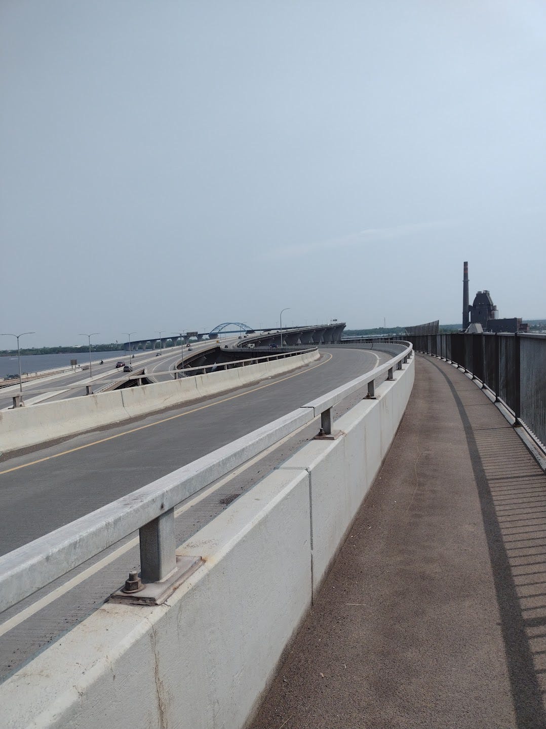
You can cross to Superior, WI over the 2.5 mile Richard I. Bong Memorial Bridge. There is a chute with its own onramp. Though this was Saturday of a busy holiday weekend, I didn’t see other bikers or walkers (there was maybe one guy in Superior).
In Superior there were a few ring-shaped bike racks installed on the sidewalk on Tower Ave (sort of the major commercial drive). Houses often had bikes out in their front or side yard. One annoying thing is biking over so many train tracks.
Barker’s Island was a quiet waterfront spot to park my bike (racks at the beach and U. Wisconsin building). They also had a former Zagster bike-share dock (should this be removed or renamed on OSM?)
The hotels, Veterans Center, Dollar Tree, etc. in this area did not have bike parking.
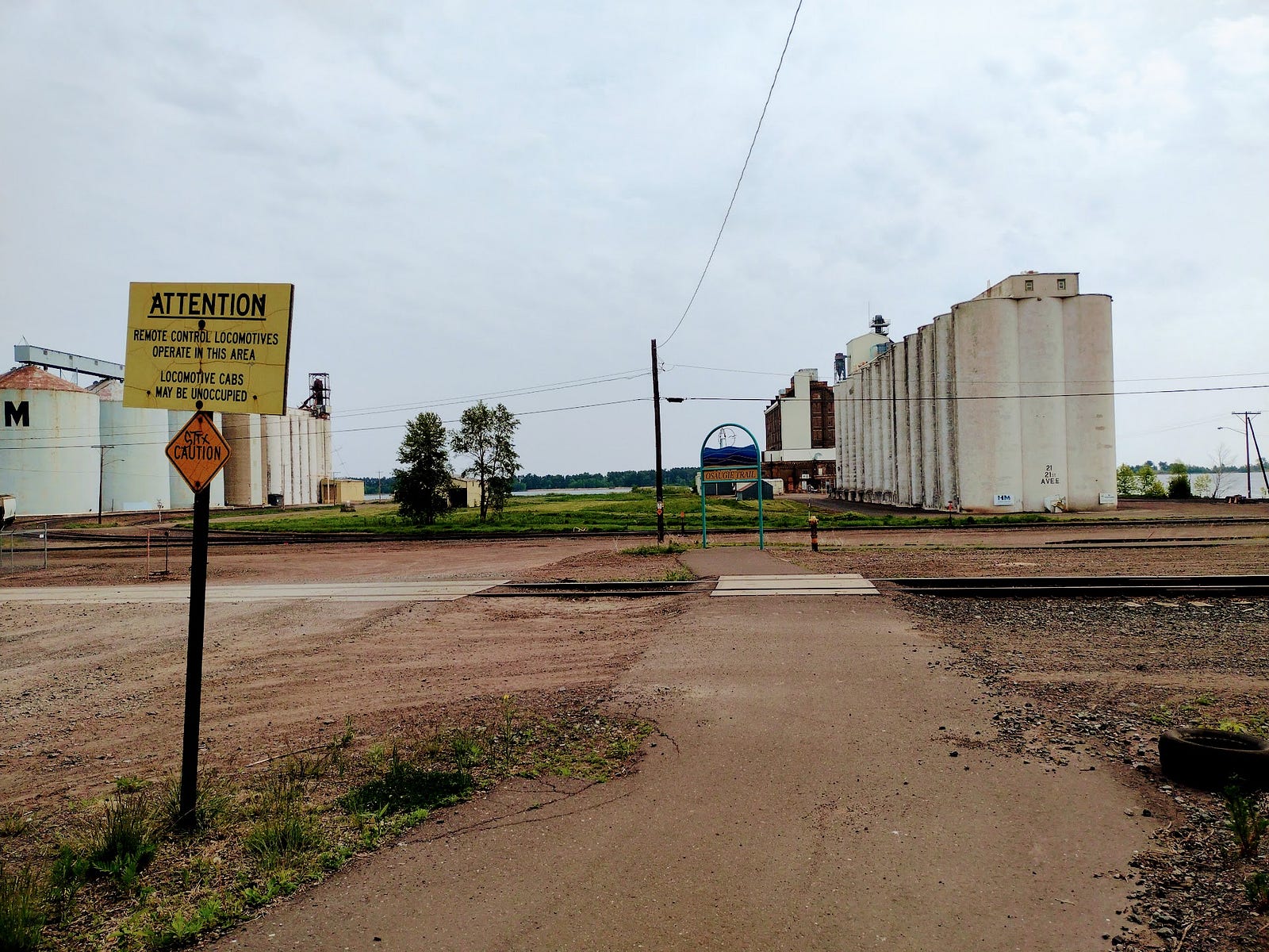
Superior has the 5-mile Osaugie Trail. A great part of this was beautiful waterfront or forest, but in the middle as you leave town, you get directed between two unsignaled railroad tracks. This looked kinda wild (look for the “Osaugie Trail” arch here).
Tri-County Corridor
The Tri-County Corridor is a 62-mile rail trail roughly following US Highway 2 from Superior to Ashland. It’s typically used by ATVs in summer and snowmobiles in winter. Despite researching this a bit, I only found a few reviews, warnings about gravel or puddles, and a recent embezzlement case.
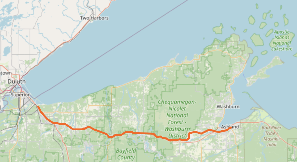
CC-BY OpenStreetMap contributors; Relation on OSM
The paved Osaugie trail quickly became stretches of packed sand and loose sand. Even though it was Sunday of a holiday weekend, I saw maybe three ATVs and one hiker with walking sticks (he asked me if cars were allowed).
On a mountain bike, there were several sections where I was slipping in sand before reaching Amnicon Falls State Park (13 miles in) and I was alternating between riding on ATV tracks or walking the bike, swarmed by mosquitos. Maybe I approached this with the wrong tire pressure / weight distribution / posture etc. If you cycle this trail, please post, because there is no info online. I decided to abandon the trail about 20 miles in, at Maple.
I rejoined the trail two days later from Ino to Ashland. This section was gravel and lightly downhill. Maybe this part would be an enjoyable day / weekend trip from Ashland. There were a few sand traps around Moquah though, and I didn’t notice another bike track until I was almost entering Ashland.
tl;dr It’s cool that the counties maintain this rail trail, but they only seriously consider use by ATVs and snowmobiles. When I did a bike tour before in Hokkaido, it was easy to stop at a convenience store for water and snacks. Here you’re never far from the highway, but you can’t expect to find a bathroom, store, restaurant, or hotel room around the corner.
Amnicon Falls State Park was a refreshing place to stop, but they had no bike rack and warned me not to take a bike on the trail system there (they suggested Brule).
County Roads
When I left the Tri-County Trail, I was on County Road “F”. Compared to busy US Highway 2, these county roads are less-traveled roads, often straight north/south or east/west, with one lane each way. There isn’t much of a shoulder, so I stuck close to the white line while the occasional car passed by. In state forests it felt like there were no cars at all.
Google Maps would suggest even smaller roads which looked more direct, but they often are gravel or sand. MapsME was generally better on routing and accurately long travel time.
There are risks to traveling on isolated roads and roads with limited space. I was also really lucky re: weather / visibility.
I followed these 20 miles down to Solon Springs for a last-minute hotel room. If I were re-doing the route, I would stick to county roads north of the trail until Iron River / Ino.
Preview
I’m planning a Part 2 about Ashland, Washburn, and potentially other bike experiences.
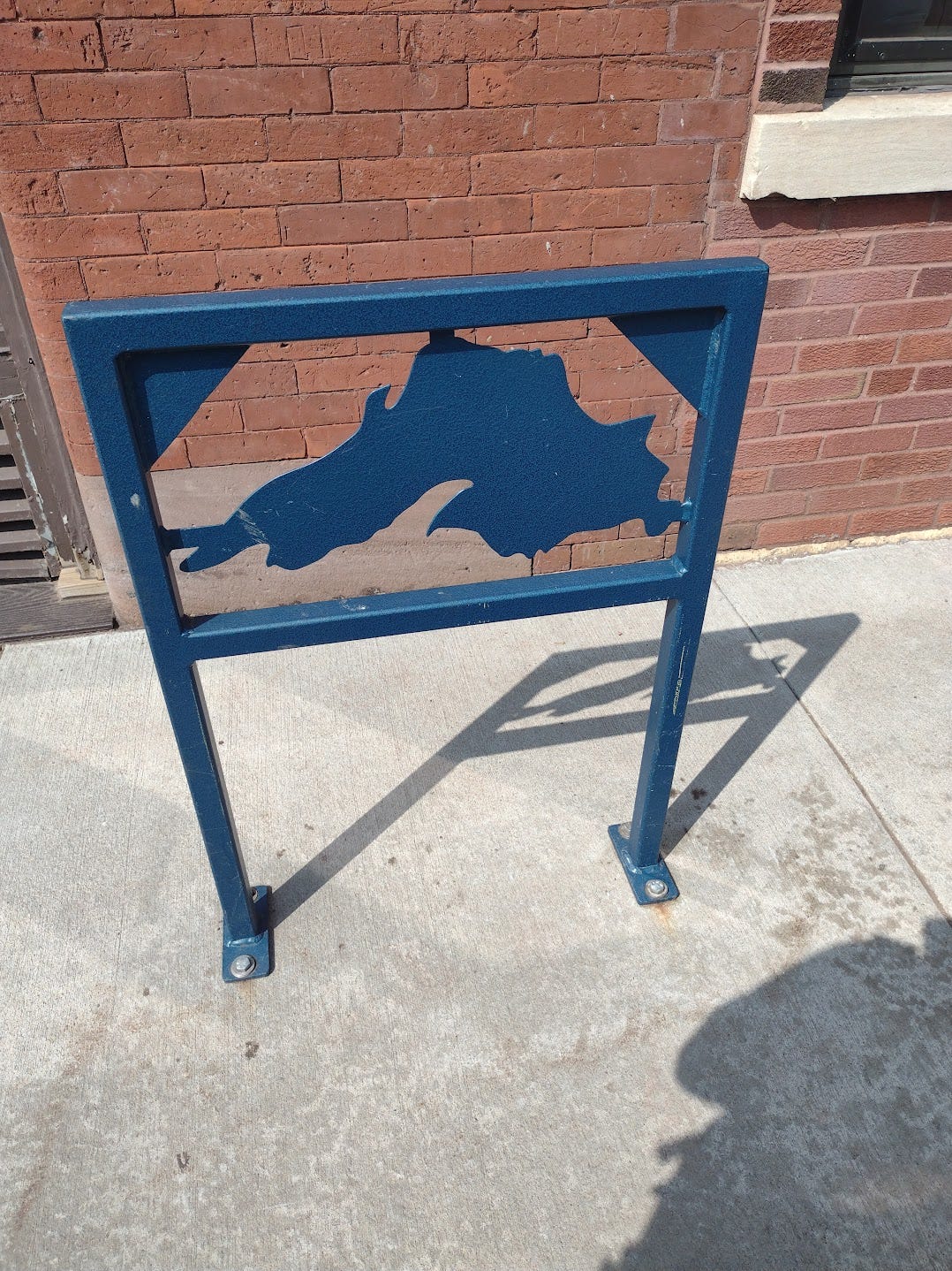
Ending with a fun Lake Superior-themed bike rack on Ashland’s Main Street (please add more on the new bike trails! And at laundromats!)
Discussion